⏰ The universal rule: leave the trailhead by 6:00 AM.
In summer: beat monsoon thunderstorms — you must be below treeline before noon. In spring/fall: reach the summit before afternoon wind and temperature drop. Year-round: the parking lot fills by 7:30 AM on weekends. A 6 AM start addresses all three constraints simultaneously.
We cover the actual weather window math for the 12,633-ft summit (most guides cite the 9,300-ft Snowbowl base elevation by mistake, when the trailhead itself sits at 9,340 ft) and the specific gear that fails above treeline at 11,500 ft — microspikes, wind layers, and the cotton problem that turns manageable into dangerous.
Methodology
How we built this guide:
- What was sampled: The Humphreys Peak Trail from the Arizona Snowbowl trailhead (9,340 ft) to the summit (12,633 ft) via the standard route, plus the Weatherford Trail junction and above-treeline ridge section.
- Visit cadence: One summit in August 2025 (monsoon season, 5:45am start), supplemented by trail condition reports from AllTrails and Coconino National Forest for the shoulder seasons.
- How we assess difficulty: Altitude-adjusted pace (not sea-level equivalents), gear failure points by elevation band, and specific go/no-go weather thresholds — not generic "strenuous" ratings.
- What we excluded: Winter ascents (require mountaineering skills beyond trail-guide scope); Weatherford Trail as a primary route (adds 4 miles, appropriate for backpacking not day hikes); guided group hikes (we cover self-guided only).
- What we do NOT verify: Current trail conditions above the saddle — these change weekly with snowpack, blowdowns, and monsoon erosion. Check AZ Snowbowl ranger reports and recent AllTrails reviews day-of.
- Refresh cycle: Quarterly, or after the next on-the-ground visit, whichever is sooner.
Humphreys Peak is the highest point in Arizona at 12,633 feet, and the trail to get there is one of the most rewarding day hikes in the American Southwest. Starting from the Arizona Snowbowl ski area at 9,340 feet, you'll climb through dense spruce-fir forest, break out above treeline into alpine tundra, and traverse a rocky ridge to the summit with 360-degree views stretching from the Grand Canyon to the Painted Desert and beyond.
This is not a casual walk. The combination of about 3,420 feet of elevation gain over 5 miles and the thin air above 11,000 feet makes this a genuinely demanding hike. But if you're reasonably fit, properly prepared, and pick the right weather window, it's absolutely doable as a day hike — and the summit views make every step worth it.
For an overview of all hiking options in the area, see our complete guide to hiking near Flagstaff. If you're still planning your trip, check out things to do in Flagstaff and where to stay.
Extend Your Adventure with an Audio Tour
GPS-guided audio tours that play automatically as you explore. Pair your hike with history — Route 66 stops, dark sky science, and Flagstaff's mountain town story. First 3 stops free.
Getting to the Trailhead
The Humphreys Peak Trail starts at the Arizona Snowbowl ski area, 14 miles northwest of downtown Flagstaff. Take US-180 north for 7 miles, then turn right onto Snowbowl Road (Forest Road 516) and follow it 7 miles up to the ski area parking lot. The road is paved the entire way and passenger cars handle it fine.
The trailhead is at the far end of the lower parking lot, near the Agassiz Lodge. There's a large sign marking the start of the trail. Parking is free, but the lot fills fast on summer weekends — arrive by 6:30–7:00 AM on Saturday or Sunday between June and September to guarantee a spot. By 7:30–8:00 AM the lot is typically full. There is no overflow parking: Snowbowl Road is private and rangers actively ticket roadside vehicles. On weekdays, the lot rarely fills before 9:00 AM. There are restrooms at the lodge area.
GPS Coordinates: 35.3297, -111.7104 (trailhead parking)
Trail Description: Section by Section
Miles 0–2: Through the Forest
The trail begins in dense mixed-conifer forest at 9,340 feet. The first two miles climb steadily through spruce, fir, and aspen trees on well-maintained switchbacks. The grade is moderate — steep enough to feel like work, but not punishing. During late September and early October, the aspen groves along this section put on a spectacular fall color show with golden-yellow leaves against dark green conifers.
You'll gain about 1,500 feet in this section. The trail is well-marked with clear signage at trail junctions. At roughly 1.5 miles, you'll pass a trail junction with the Weatherford Trail — stay right to continue on the Humphreys Peak Trail.
Miles 2–3.5: Approaching Treeline
The forest gradually thins as you climb above 10,800 feet. The trees get shorter and more twisted — these are Engelmann spruce and bristlecone pine adapted to the harsh conditions. The switchbacks continue but the trail becomes rockier. You'll start getting views through gaps in the trees, and on clear days you can see the red rock country around Sedona to the south.
At roughly 11,500 feet, you break above treeline entirely. This is the boundary of the Kachina Peaks Wilderness alpine tundra zone, where a standing Forest Service order requires hikers to stay on the marked trail. The vegetation shifts to low tundra grasses and wildflowers — fragile plants that take decades to grow in this harsh environment. Stay on the trail to protect them.
Miles 3.5–5: The Ridge to the Summit
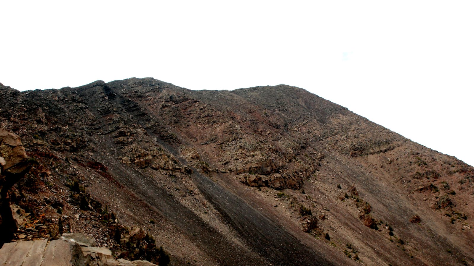
Above treeline, the trail follows a rocky saddle and ridge to the summit. This is the most exposed section — there's no shelter from wind, sun, or lightning up here. The "trail" becomes a series of rock cairns marking the route across a boulder field. The footing is loose in places and requires careful stepping.
The final push to the summit gains about 800 feet over 1.5 miles. It's not technical, but the altitude makes it feel much harder than it would at sea level. Take your time, breathe deeply, and rest whenever you need to. The summit is marked by a USGS benchmark and a register where hikers sign their names.
From the top: the Grand Canyon's North Rim is visible 70 miles to the north. The Painted Desert stretches east. Sedona's red rocks glow to the south. On exceptionally clear days, you can see mountains in New Mexico and Utah. It's one of the most expansive views in the state.
Guided Hiking Adventures in Flagstaff
Not comfortable tackling Humphreys Peak solo? Local guided hikes pair you with experienced guides who know the mountain, manage the pacing, and handle the logistics.
Browse Guided HikesWe earn a small commission if you book — at no extra cost to you.
When to Hike Humphreys Peak
The hiking season runs roughly mid-June through early October, but conditions vary year to year based on snowpack and monsoon patterns.
June
The trail usually opens mid-to-late June once snowpack melts from the upper ridge. Some years, patches of snow linger on north-facing slopes into early July. Check recent trail reports before going — if there's still consolidated snow on the ridge, you'll need microspikes and possibly an ice axe. Days are long, weather tends to be dry, and the crowds are manageable.
July – August (Monsoon Season)
The monsoon brings afternoon thunderstorms almost daily from early July through mid-September. These storms roll in fast and bring dangerous lightning to the exposed ridge above treeline. The rule is simple: start early, summit by 11 a.m., and be below treeline by noon. This means hitting the trailhead by 5:30–6:00 a.m. Mornings are typically clear and calm. The wildflowers above treeline peak during monsoon season, and the fresh afternoon rain keeps the air crystal clear.
September – Early October
This is the sweet spot. Monsoon storms taper off, temperatures are cool but not cold, and the aspen groves below treeline turn brilliant gold. Late September weekends draw bigger crowds for the fall color, but midweek hikes are uncrowded. First snow can arrive as early as late October.
November – May
The trail is snow-covered and becomes a backcountry winter route. Winter ascents of Humphreys Peak are serious undertakings requiring mountaineering skills, avalanche awareness, snowshoes or skis, and full winter gear. This is not a trail-running-with-microspikes situation — deep snow, whiteout conditions, and extreme wind chill are common. Don't attempt it without proper experience.
Honest Difficulty Assessment
Humphreys Peak is rated strenuous, and the rating is accurate. Here's what makes it genuinely hard, beyond just the mileage:
- Altitude: The trailhead starts at 9,340 feet — already higher than most people live. The summit is at 12,633 feet, where there's about 60% of the oxygen available at sea level. If you're visiting from a low-elevation city, you will feel this. Headaches, nausea, and extreme fatigue are common above 11,000 feet for unacclimatized hikers.
- Sustained climbing: There's no flat section on the way up. You climb steadily for 5 miles straight. The average grade is about 13%, which is relentless.
- Exposure above treeline: The last 1.5 miles have no shade, no wind shelter, and no easy escape route if weather rolls in. In summer, the sun at 12,000 feet is intense. In any wind, the chill factor drops fast.
- Rocky footing: The summit ridge is loose volcanic rock. It's not technical, but it requires attention to every step. Twisted ankles are the most common injury on this trail.
Who should do this hike: Anyone in reasonable cardiovascular fitness who regularly hikes 8–10 miles with significant elevation gain. Ideally, spend at least one night in Flagstaff (7,000 feet) before attempting the summit to start acclimatizing.
Who should skip it: If you don't hike regularly, if you're arriving the same day from sea level, or if you have any respiratory or cardiac conditions that worsen at altitude, choose one of the many excellent lower-elevation Flagstaff trails instead.
Should You Hike Humphreys Peak? A Go / No-Go Framework
Use this framework to make a clear decision before you drive to the trailhead.
| Condition | Go | No-Go |
|---|---|---|
| Fitness baseline | Regularly hike 8+ miles with 2,000+ ft gain | Hike occasionally; last hike was <6 mi flat |
| Acclimatization | Slept 1+ nights at Flagstaff (7,000 ft) | Arriving same morning from Phoenix or sea level |
| Departure time | At trailhead by 6:00 AM or earlier | Starting after 7:30 AM in summer |
| Weather forecast | Clear morning, <20% afternoon storm chance | Any afternoon storm in forecast above 30% |
| Snow/ice present | Have microspikes and know how to use them | Snow above 11,000 ft with no traction gear |
| Water carried | 3+ liters (4 in summer heat) | Less than 2 liters for the full day |
If any No-Go condition applies, consider the easy trails near Flagstaff or wait for better conditions. The mountain will be there next year.
What to Bring
This is a full-day hike at high altitude with highly variable conditions. Pack accordingly:
- Water: Minimum 3 liters. There is no water on the trail. In hot weather or if you're not acclimatized, bring 4 liters. A hydration bladder is easier to drink from while moving.
- Food: Lunch plus snacks for 6–9 hours. High-calorie, easy-to-eat items — trail mix, energy bars, sandwiches. Your appetite may decrease at altitude, but you still need the calories.
- Layers: The temperature difference between the trailhead and summit can be 20–30 degrees Fahrenheit. Bring a warm mid-layer (fleece or puffy) and a wind-resistant shell even in summer. Above treeline, wind chill can make 50 degrees feel like 30.
- Rain gear: A lightweight waterproof jacket, especially during monsoon season (July–September). Hypothermia is a real risk if you get caught in rain above treeline.
- Sun protection: Sunscreen (SPF 50+), sunglasses, and a hat. UV exposure increases meaningfully with elevation, so sun protection matters more here than it would at a comparable sea-level hike.
- Trekking poles: Strongly recommended. They save your knees on the 3,400-foot descent and improve stability on the rocky summit ridge.
- Sturdy footwear: Ankle-supporting hiking boots with good tread. Trail runners work if you're experienced, but the rocky ridge section punishes thin-soled shoes.
- First aid kit: Basic supplies plus blister care and ibuprofen (helps with altitude headaches).
- Headlamp: If you're starting before dawn or might take longer than expected.
Seasonal Gear: What Changes by Month
Microspikes — Required, Not Optional (Late May / Early June / October)
Microspikes are not "nice to have" on the shoulder-season openings — they are required equipment. At the transition between seasons, consolidated snow and ice patches persist on north-facing slopes above 11,000 feet even when the lower trail is clear. Every year, unprepared hikers turn around or self-rescue near the ridge because they're postholing through knee-deep snow without traction. Check recent reports on AllTrails and the Coconino National Forest website before assuming the trail is snow-free in June.
Rules of thumb:
- If any trail report from the past 5 days mentions snow above 11,000 feet: bring microspikes.
- If you see snow patches in the parking lot: bring microspikes.
- If you hike in October after the first snowfall: bring microspikes.
Microspikes (not crampons) are sufficient for all non-technical shoulder-season conditions. They weigh about 1 lb and fit in a daypack.
July – August: Monsoon Protocol
The monsoon thunderstorm window runs approximately 1:00–5:00 PM daily from early July through mid-September. Lightning on an exposed 12,000-foot ridge is genuinely life-threatening. The protocol is non-negotiable: summit by 11:00 AM at the absolute latest. This means hitting the trailhead at 5:30–6:00 AM. If you start at 7:30 AM or later on a monsoon day, turn around at treeline if storms are building, regardless of how close the summit looks.
October – November: Snow Can Arrive Overnight
The first autumn snowfall often happens in October with little warning. A trail that was clear on Thursday can have 6 inches of snow by Saturday. Check forecasts specifically for the summit area (Weather.gov grid point for Humphreys Peak, not just Flagstaff city). Snow above treeline is compacted by wind into hard slab — microspikes are essential, ice axe is optional but wise for early-season snowfall.
Explore More Flagstaff Outdoor Adventures
From scenic jeep tours to guided nature walks, Flagstaff offers outdoor experiences for every fitness level.
Browse ToursWe earn a small commission if you book — at no extra cost to you.
Common Mistakes to Avoid
- Starting too late: The number-one mistake. During monsoon season, thunderstorms build by early afternoon. If you're still above treeline at 1 p.m. with clouds building, you're in a dangerous spot. Start by 6 a.m. at the latest.
- Not enough water: Altitude and exertion increase fluid needs dramatically. Two bottles is not enough for this hike. Bring at least 3 liters.
- Ignoring acclimatization: Flying into Phoenix (1,100 feet) and driving up to hike Humphreys Peak the same day is a recipe for misery. Spend at least one night at Flagstaff's elevation first.
- Cotton clothing: Cotton kills at altitude. It holds moisture, loses insulation when wet, and dries slowly. Wear synthetic or merino wool layers.
- No wind layer: Even on a warm summer day at the trailhead, the summit can be bitterly windy. A packable wind jacket weighs nothing and can be the difference between a pleasant summit experience and a survival situation.
- Going off trail above treeline: The alpine tundra is extremely fragile and can take decades to recover from foot traffic. Stay on the marked route and walk on rock rather than vegetation.
Alternative Route: Weatherford Trail
If you want a longer, more gradual approach to the summit area, the Weatherford Trail offers an alternative. Starting from the Schultz Pass Trailhead on the east side of the peaks, the Weatherford Trail (Trail No. 102) is an old road grade that climbs through aspen forests and meadows with a gentler gradient than the standard route.
The Weatherford Trail meets the Humphreys Peak Trail at roughly 11,000 feet. From the junction, you can continue to the summit via the same ridge route. Total round-trip distance and elevation gain via this route are longer than the standard Humphreys Peak Trail — sources vary on the exact figures, so check current mileage with Coconino National Forest before you go. The longer approach means a very long day or an option for a backpacking trip with a camp below treeline.
The Weatherford Trail is typically less crowded than the main Humphreys Peak Trail and offers more solitude, but the extra mileage makes it a bigger commitment.
Above-Treeline Safety
Lightning Safety
The summit ridge of Humphreys Peak is the highest point for miles in every direction. During monsoon season, lightning strikes on and near the summit are common. If you hear thunder or see dark clouds building, descend immediately — do not wait to see if the storm passes. Get below treeline as fast as safely possible. If caught above treeline, descend to the lowest point you can reach, crouch on the balls of your feet (don't lie flat), and stay away from isolated trees or metal objects.
Wind: Sustained winds of 30–50 mph are common on the summit ridge, even on otherwise calm days. Gusts can knock you off balance on the rocky terrain. If winds are making it difficult to stand, turn back.
Altitude sickness: Symptoms include headache, nausea, dizziness, and fatigue. Mild symptoms are normal above 11,000 feet and usually manageable with rest, hydration, and slow pacing. If symptoms become severe — confusion, loss of coordination, vomiting — descend immediately. Altitude sickness resolves quickly with descent.
Navigation: Above treeline, the trail is marked by rock cairns. In fog or whiteout conditions (rare in summer but possible), these can be hard to spot. If you lose the cairns, don't push forward — backtrack to the last cairn you saw and reassess.
Top-Rated Tours & Activities
Looking for something less strenuous? Browse guided tours, scenic drives, and cultural experiences around Flagstaff.
Browse ToursWe earn a small commission if you book — at no extra cost to you.
Related Guides
- Hiking Near Flagstaff — all trails by difficulty
- Mountain Biking in Flagstaff — singletrack and trail systems
- Arizona Snowbowl — skiing on the same mountain in winter
- Things to Do in Flagstaff — the full activity list
- Where to Stay in Flagstaff — hotels near the trailheads
After 10 miles and 3,400 ft of gain you're done driving for the day. Take the 90-minute Historic Downtown audio tour for low-effort post-hike sightseeing — it covers the Hotel Monte Vista, the Babbitt Brothers Building, and the railroad-era history of the mountain town you just climbed above.
Frequently Asked Questions
How long does it take to hike Humphreys Peak?
Most hikers complete the round trip in 6 to 9 hours. Strong hikers who are acclimatized can finish in 5 to 6 hours, while those new to high elevation should plan for 8 to 9 hours. Start by 6 a.m. to allow plenty of time and avoid afternoon thunderstorms.
Is Humphreys Peak hard to hike?
Yes, it's strenuous. The 10-mile round trip gains about 3,420 feet and tops out at 12,633 feet where the air is thin. The trail isn't technical — no scrambling or exposure — but the combination of distance, elevation gain, and altitude makes it genuinely challenging. If you can comfortably hike 10 miles with 3,000 feet of gain at lower elevations, add about 30–50% more time for this trail.
When is the best time to hike Humphreys Peak?
Mid-June through early October. September and early October often have the most stable weather and gorgeous fall color in the aspen groves. July and August bring afternoon monsoon storms — start early and be below treeline by noon. The trail is snow-covered November through May.
Do I need a permit to hike Humphreys Peak?
No permit is required, and the trailhead is free. Above 11,500 feet, a standing Coconino National Forest order protects the fragile alpine tundra: hikers must stay on the marked trail, and camping and pack/saddle animals are prohibited in that zone. Staying on the Humphreys Peak Trail satisfies the rule — check current Forest Service alerts before you go.
Can beginners hike Humphreys Peak?
It's not recommended for beginners. Build up with shorter Flagstaff trails first — try Fatman's Loop or the Kachina Trail to gauge how you handle the altitude. You should be comfortable with 8–10 mile hikes with significant elevation gain before attempting the summit.