How Big South Mountain Park Is
At more than 16,000 acres, South Mountain Park/Preserve is, in the City of Phoenix's own words, one of the largest municipally managed parks in the nation. Unlike a single-peak destination such as Camelback Mountain, it spans three separate mountain ranges -- the Ma Ha Tauk, Gila, and Guadalupe -- with more than 100 miles of trails for hiking, horseback riding, and mountain biking. That scale changes how you should think about a visit: this is less a single trailhead you check off and more a large area with several distinct entrances and trail systems.
Because the park is so large, different entrances lead to noticeably different experiences, from quiet flat walks near some access points to longer, more remote ridgeline routes elsewhere. It's worth deciding what kind of outing you want before you pick which entrance to use. The South Mountain Visitor Center is open Thursday through Sunday, 9 a.m. to 3 p.m., and the park ranger office can be reached at 602-262-7393.
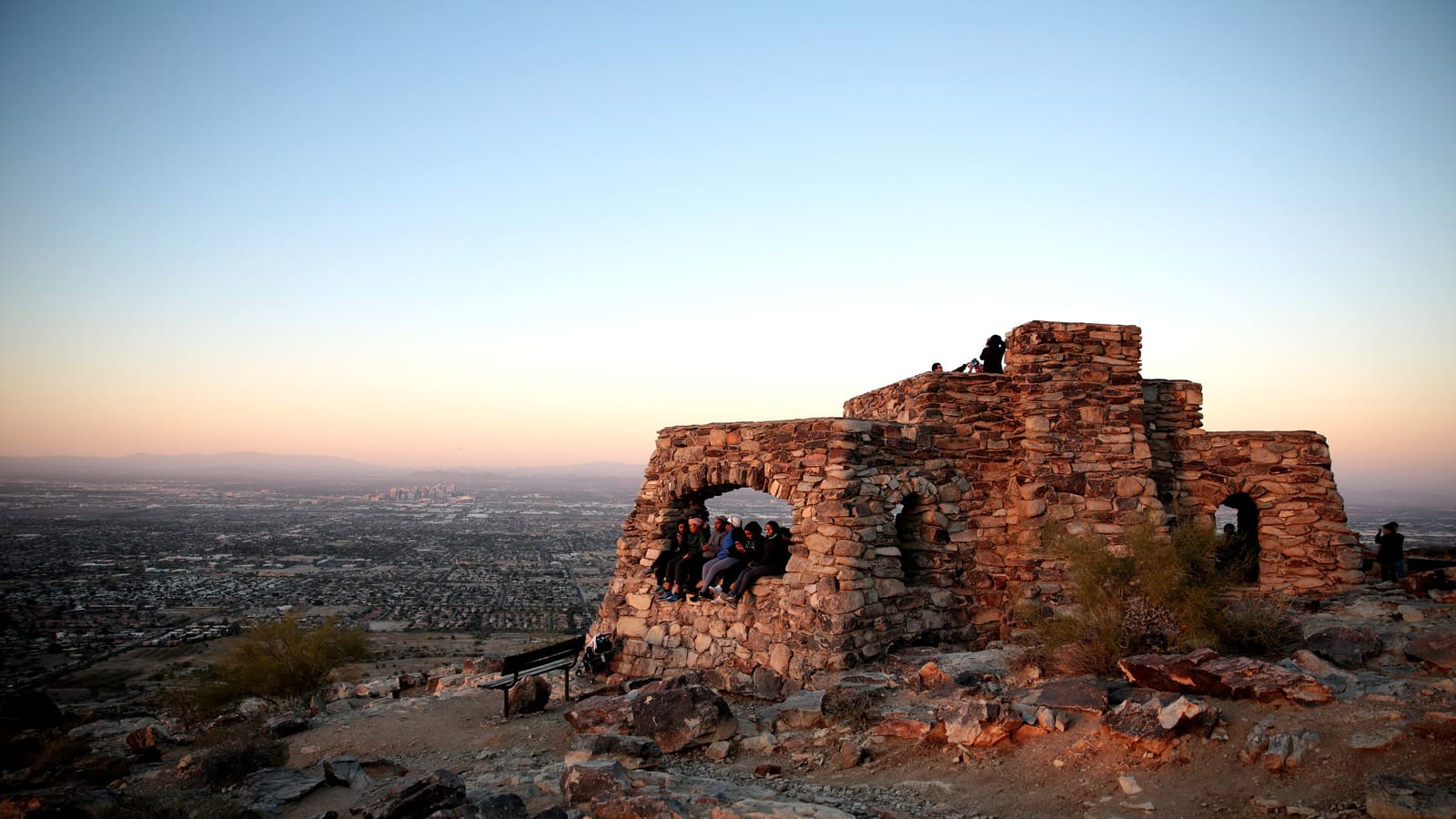
Dobbins Lookout
Dobbins Lookout, at 2,330 feet, is the highest point in the park open to the public, and what makes it distinctive among Valley viewpoints is that it can be reached by Summit Road as well as on foot -- you don't have to hike to get the view. That makes it accessible to people who want the scenery without committing to a trail.
Check the day before you count on driving up. Summit Road closes to motor vehicles every Sunday for the park's Silent Sunday program. On the fourth Sunday of the month the closure runs all day, 5 a.m. to 7 p.m., and every vehicle must park at the Activity Complex; on the first, second, third, and fifth Sundays a shortened closure runs 5 a.m. to 10 a.m., with the road gated at the 1.0-mile marker. Outside those windows the drive is open, and the lookout is a popular sunset stop, so expect company at peak times.
One caution the city makes explicitly: the park's scenic roadways are shared by motor vehicles, cyclists, and hikers, and with many blind corners, narrow sections, and steep drop-offs, extreme caution and strict adherence to the speed limit are required -- whether you're the one driving or the one walking the shoulder.
Hiking Trails and Difficulty Range
Because South Mountain covers so much terrain, its trails span the full difficulty spectrum rather than centering on one signature climb. Some routes near the entrances are short and relatively flat, suitable for casual walkers, while others climb into longer ridgeline hikes with real elevation gain and more exposure, comparable in effort to the tougher trails elsewhere in the Valley.
This range is part of what makes the park useful -- it can serve a family looking for a short walk and a serious hiker looking for distance on the same day, at different trailheads. It also means picking the wrong trail by accident is easier here than at a smaller park, so check a current trail map rather than assuming any given path is short.
Mountain Biking and Multi-Use Trails
South Mountain has a significant mountain biking community, with trails designated for shared use among hikers, cyclists, and, in some areas, equestrians. The scale of the park supports longer rides than most Valley trail systems, and it's a regular destination for local riders as well as visitors looking for desert singletrack.
Because trails are shared-use, hikers should stay alert for bikes, particularly on narrower or blind sections. The City of Phoenix sets the yielding order explicitly in its Parks and Recreation Code of Conduct: hikers and bicyclists yield to horses, bicyclists yield to hikers, and downhill traffic yields to uphill traffic. The same code bans playing music through speakers on trails. If you're planning a ride specifically, check current trail designations, since not every path in the park is open to bikes.
Getting There and Trailheads
South Mountain Park has multiple entrances feeding into different parts of the trail network, and which one makes sense depends on where you're starting from in the Valley and which trail or viewpoint you're aiming for. Central and south Phoenix are the most direct approach for most visitors, though the park's edges reach toward other parts of the metro area as well.
Because the entrances lead to genuinely different parts of the park, it's worth confirming which trailhead corresponds to the specific trail or lookout you want before you drive over, rather than assuming any entrance gets you to the same place.
When to Go and Heat Safety
Roughly November through March offers the most comfortable conditions for hiking or biking in South Mountain Park, in line with the rest of the Valley's outdoor trails. Spring and fall shoulder months still work well with an early start, and Dobbins Lookout is a reasonable option nearly any time of year given that it doesn't require a hike.
Summer is not a comfort problem here, it is a safety one. The City of Phoenix reports that more than 200 hikers a year are rescued from its desert parks and mountain preserves, and in 2024 the city recorded 121 days at or above 105°F.
Which South Mountain trails close in extreme heat
Under the city's Trail Heat Safety Program, on any day the National Weather Service issues an Extreme Heat Warning, four South Mountain access points are restricted from 8 a.m. to 5 p.m.: the Holbert Trail (2.56 miles), the Mormon Trail (1.35 miles), the Hau'pal Loop Trail (2.8 miles), and access to the National Trail from the Pima Canyon Trailhead. The National Trail stays open from other trailheads, and all other trails at Pima Canyon stay open -- in total, fewer than 7 of the park's 100-plus trail miles are restricted. The Parks Board last revised this list in March 2025, so confirm the current version on the Phoenix Trail Heat Safety Program page the morning you go.
Dogs: the Phoenix Parks and Recreation Code of Conduct prohibits endangering dogs on difficult trails or in adverse weather conditions, such as temperatures over 100°F, in any desert park or mountain preserve. In practice, that means leaving the dog at home on a hot day.
Water, heat illness, and snakes
The city's hiking checklist is the right baseline: hydrate before you go, carry more water than you think you need, and turn around and head back to the trailhead before you drink all of your water. Hike when it's cool, wear proper shoes, clothing, a hat, and sunscreen, carry a phone, and if you're hiking solo tell someone your start and end times and your location. South Mountain's size makes that last point matter more here than at a small trailhead.
Learn the difference between the two heat emergencies, because they are treated in opposite ways. Per the National Weather Service, heat exhaustion brings heavy sweating and cool, pale, clammy skin, with weakness, cramps, headache, dizziness or nausea -- move the person somewhere cool, remove excess clothing, apply cool wet cloths, and give small sips of water, but get medical attention if they vomit, if symptoms worsen, or if symptoms last more than an hour. Heat stroke brings confusion, slurred speech, hot red dry or damp skin, and a body temperature above 103°F -- call 911 immediately, move them somewhere cooler, cool them with wet cloths, and do not give fluids.
Venomous rattlesnakes live throughout these preserves. Keep your distance and never try to move or handle one. If someone is bitten, the Arizona Poison and Drug Information Center says to stay calm, move as little as possible, remove tight clothing or jewelry from the bitten limb, and go to the nearest medical facility immediately -- and to avoid ice, constricting bands or tourniquets, suction extractors, cutting the wound, or alcohol and medication. Do not wait to see whether symptoms appear.
Finally, the NWS monsoon season runs June 15 through September 30. Afternoon storms build fast, which on an exposed South Mountain ridgeline means lightning and in the washes means flash flooding. Never drive around a barricade into a flooded roadway: under A.R.S. § 28-910, Arizona's “Stupid Motorist Law,” a driver who does and then needs rescuing is liable for the emergency-response cost, up to $2,000 per incident.