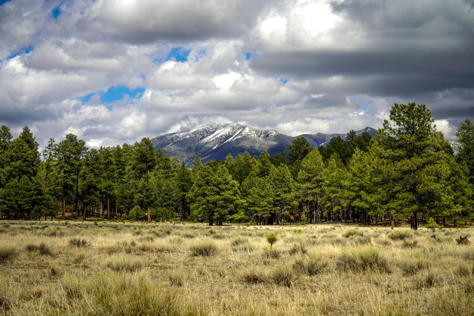
This is not a drive you point-and-shoot through in three hours like a flat interstate. The scenic centerpiece — the Salt River Canyon on US-60 — is also the slow part: tight switchbacks down to the river and back up the far wall, no services in the canyon bottom, and steep grades that punish ridden brakes. The thing that makes this route beautiful is the same thing that makes it slow, and pretending otherwise gets people into trouble. Plan three and a half hours, not three; fuel in Globe; drive the canyon in daylight; and in winter check road conditions before you commit. Do that and the drive itself becomes the best part of the trip, the moment you watch the Sonoran desert visibly turn into ponderosa pine and, in season, snow.
The White Mountains are the alpine, anti-desert half of Arizona — ~7,000 ft pine high country anchored by three towns: Show Low (the hub), Pinetop-Lakeside (the cabin heart), and Greer (the tiny 8,300 ft alpine village). From Phoenix it is roughly 190 miles and about three and a half hours northeast on US-60, and the route is a genuine two-season destination: a cool-summer escape when the Valley is unbearable, and a ski-and-snow drive in winter to Sunrise Park, the largest ski area in the state.
The summer case is the simplest one in Arizona travel: when Phoenix is running 105 to 115°F in July and August, Show Low, Pinetop-Lakeside, and Greer typically sit in the high 70s to low 80s by day and drop into the 40s and 50s at night. That 20-to-30-degree delta is the single biggest reason Valley residents make the drive, and it is why the summer weekend exodus from Phoenix and Tucson points straight at this high country. The winter case is the surprising one — people forget Arizona has a ski resort because the brand of the state is saguaro and red rock — and the fall-color case, the aspens around Greer and Mount Baldy turning gold in late September and October, is the quiet third reason.
Below is the stop-by-stop drive, an at-a-glance schedule table, and a two-day plan that uses Show Low or Pinetop as a base and day-trips out to Greer, Sunrise Park, and the high lakes. The whole trip is built around the truth of the road: take the canyon slowly, base in the cluster, and treat the three towns as one alpine identity rather than three separate stops.
Methodology
How this route was built and what the numbers rest on, so you can judge whether our calls fit your trip:
- The route: the waypoints follow the real US-60 corridor northeast from Phoenix — through Globe, down and up the Salt River Canyon, onto the high plateau at Show Low, then the SR-260 cluster to Pinetop-Lakeside, with Greer, Sunrise Park, and the high lakes as the day-trip spokes. This is the road Valley residents actually drive; the alternate northern approach via SR-260 over the Mogollon Rim from Flagstaff is noted, not mapped, because most of this hub's traffic comes up from Phoenix.
- Distances and times: the ~190 miles and ~3.5 hours to Show Low are approximate driving figures, given as honest round numbers. The 3.5-hour figure deliberately runs longer than the mileage implies because the Salt River Canyon stretch is slow by design — switchbacks and grades, not a number you can shave. Treat every figure as "about," and budget extra for the canyon overlooks you will want to stop at.
- Dual-season weighting: we treat this as a genuine two-season destination rather than picking one. The summer cool-escape delta (roughly 20 to 30 degrees below the Valley) and the winter ski season at Sunrise Park are both load-bearing, and we flag the shoulder honestly — muddy windy springs with snow lingering into May, and monsoon afternoon storms in July and August that argue for morning canyon driving.
- Cultural ground-truth: the high country is the homeland of the White Mountain Apache Tribe, and we mark it. Sunrise Park is tribe-operated; the true summit of Mount Baldy is sacred and closed to non-members. We route hikers to the open Mount Baldy Wilderness trails up to the boundary and explicitly do not send anyone toward the closed summit. Tribal-land access and permit rules can change; verify before relying on them.
- What we name vs. what we don't: we name durable, confirmed places — the towns, Sunrise Park Resort, the named lakes, the Salt River Canyon, the Coronado Trail. For services we point to the category (fuel and food at Globe) rather than vouch for a specific operator. Refresh cycle: seasonal sections and ski dates re-checked before each winter; canyon road conditions and tribal-access notes re-verified seasonally. Last verified: 2026-06-10.
At a Glance: The US-60 Route, Stop by Stop
| Stop | Place | ~Drive from Phoenix | Time There | Why This Stop |
|---|---|---|---|---|
| Day 1 — The Drive Up, ~190 mi / ~3.5 hrs (US-60) | ||||
| 1 | Phoenix departure (the Valley) | 0 mi — start | — | Leave with a full tank, heading east then northeast onto US-60. The summer payoff: leaving 110°F behind for a 20–30° cooler high country. |
| 2 | Globe (gateway town) | ~90 mi / ~1.5 hrs | 20–40 min | Historic copper town at the foot of the climb. Last full-service stop — fuel, food, restrooms — before the canyon. Top off here. |
| 3 | Salt River Canyon (scenic centerpiece) | ~125 mi / ~2.25 hrs | 20–30 min at overlook | Arizona's "mini Grand Canyon." Switchback down to the river, across, and up. Slow, daylight-only. Stop at the overlook near the crossing. |
| 4 | Show Low (the hub) | ~190 mi / ~3.5 hrs | Base / 1st night | The commercial hub on the plateau. Services, hotels, and the in-town Show Low Lake and Fool Hollow Lake for an easy first evening. |
| Day 2 — The Cluster: Pinetop, Greer & the High Country | ||||
| 5 | Pinetop-Lakeside (cabin base) | ~15 min SE of Show Low | Base / day | The cabin-and-forest heart and the White Mountains Trail System trailhead. The cozier base; the day-two anchor. |
| 6 | Greer + Little Colorado headwaters | ~50 min E | Half day | The 8,300 ft alpine village, meadow and aspen. The fall-color and quiet destination, close to Sunrise and Mount Baldy. |
| 7 | Sunrise Park Resort | ~1 hr E, near Greer | Half/full day | Tribe-operated, the largest ski area in Arizona. Winter skiing/snow play; summer lifts. Mount Baldy's true summit is closed sacred land. |
| 8 | Big Lake + the high Rim lakes (optional) | ~1.25 hrs SE | Optional add-on | The high-plateau trout lakes above 9,000 ft. The fishing-and-camping anchor for a longer summer stay. |
The Drive in Detail: Valley Floor to Alpine Plateau
Stop 1 — Leaving Phoenix
The trip starts with a full tank and an eastbound heading. From central Phoenix you work out to US-60 and point northeast, climbing gradually out of the Valley through the eastern suburbs and into the desert hills beyond. In summer the psychology of the drive is its own reward: every mile and every thousand feet of elevation gain is a few degrees off the thermometer, and you can feel the trip working before you ever see a pine tree.
The early stretch is high Sonoran desert — saguaro giving way to scrub and rock as the road climbs. There is little reason to stop until Globe, so settle in and let the elevation do its work.
Stop 2 — Globe (the gateway)
Globe is a historic copper-mining town at the foot of the real climb, about an hour and a half out of Phoenix, and it is the practical hinge of the whole drive. This is the last full-service town — fuel, food, restrooms, a place to stretch — before the Salt River Canyon, where there are no services at all in the bottom. Top off the tank here whether or not you think you need to, and use the stop to caffeinate before the curves.
Globe rewards a little curiosity if you have time — there is genuine mining and frontier history in the old downtown — but for this route its job is clean and important: it is where you prepare for the canyon.
Stop 3 — The Salt River Canyon (the centerpiece)
This is the moment the drive earns its reputation. North of Globe, US-60 reaches the rim of the Salt River Canyon and begins a tight switchbacking descent to the river at the bottom — a drop dramatic enough that the canyon is routinely called Arizona's "mini Grand Canyon." You cross the Salt River on the canyon floor, then climb the far wall in the same switchbacking fashion up onto the high country. There is a pullout and overlook area near the river crossing; stop there. It is the single best photo of the trip and the clearest place to watch the landscape change.
Drive it carefully and honestly. The grades are steep both directions — gear down on the descent rather than riding the brakes, which can overheat on a long downhill — and the curves are tight. There are no services in the canyon, so this is not the place to discover you are low on fuel. Drive it in daylight; the views are the point and the curves are safer when you can see them. In monsoon season (July–August) aim to be through the canyon in the morning, before the afternoon thunderstorms build. This 35-mile stretch is slow, and that slowness is exactly why the 3.5-hour estimate runs longer than the mileage suggests.
Stop 4 — Arrival: Show Low (the hub)
Climb out of the canyon and the world has changed: you are on the ~6,300–7,000 ft high-country plateau, in ponderosa pine, with the air noticeably cooler and thinner. Show Low, sitting around 6,300 feet, is the first town and the commercial hub of the White Mountains — the largest of the three cluster towns, sitting at the junction of US-60 and SR-260, with the chain hotels, the hospital, and the practical services. It is the easiest base for a first trip because everything is here, and the in-town lakes — Show Low Lake and the Fool Hollow Lake Recreation Area — make an easy first-evening stop to put your feet in mountain water after the drive.
If your trip is a quick overnight, Show Low is your base for the night. If you have two nights and want the cabin-and-forest feel, push fifteen minutes further to Pinetop-Lakeside.
Stop 5 — Pinetop-Lakeside (the cabin heart)
A short hop southeast on SR-260 brings you into Pinetop-Lakeside, the resort and cabin heart of the cluster. The forest is denser here, the feel is woodsier and quieter than hub-town Show Low, and this is the country of cabin rentals, mountain golf, and the trailheads for the White Mountains Trail System — a well-built network of forest loops good for hiking, mountain biking, and, in winter, cross-country skiing and snowshoeing. For travelers who came up specifically to be in the pines rather than near the services, Pinetop is the better base, and it is the natural anchor for a second day exploring the cluster.
Stop 6 — Greer and the Little Colorado headwaters
The day trip that defines the alpine character of the trip is Greer. About fifty minutes east of the Pinetop–Show Low base, Greer is a tiny village at 8,300 feet, tucked into meadow and aspen at the headwaters of the Little Colorado River. It is the smallest and most alpine of the cluster towns, and people go there specifically for two things: fall color, when the aspens around the village and on Mount Baldy turn gold in late September and October, and quiet. The Little Colorado headwaters add cold-stream fishing to the lake fishing the rest of the region is known for. Greer is also the staging point for the highest country — Sunrise Park and the Mount Baldy wilderness are right here.
Stop 7 — Sunrise Park and the Mount Baldy country
Near Greer sits Sunrise Park Resort, operated by the White Mountain Apache Tribe and the largest ski and snowboard area in Arizona, spread across three peaks with downhill runs, Nordic trails, and snow play. In winter this is the reason the drive exists for skiers; in summer the resort runs lift rides and trails and the high meadows are at their greenest. People forget Arizona has a ski resort at all, and standing at the base in February is the most direct way to understand the "anti-desert" identity of this whole high country.
One important note, marked clearly because it matters: the true summit of Mount Baldy is on the White Mountain Apache Tribe's land and is sacred to the tribe — the final summit push is closed to non-tribal members, and that closure must be respected. The Mount Baldy Wilderness trails on the national-forest side climb high through spectacular alpine meadow and spruce-fir forest to a point near, but not on, the closed summit, and they are open to everyone. Hike the wilderness trail to the boundary, take in the views, and turn around there. These are exposed, above-treeline meadow trails, and the Mogollon Rim/White Mountains high country sees some of the highest lightning-strike frequency in Arizona during monsoon season (roughly June through September) — start early, watch the sky, and be back below treeline before afternoon storms build. Tribal-land and permit rules can change; verify current access before you rely on it.
Stop 8 — Big Lake and the high Rim lakes (optional)
If you have a longer stay and it is the warm season, the high lakes are the payoff for going deep. Big Lake and Crescent Lake sit on the high plateau above 9,000 feet, ringed by spruce-fir forest and stocked with trout — this is some of the best mountain-lake fishing in the Southwest, and the region as a whole is dotted with Rim reservoirs from Show Low Lake and Fool Hollow near town to Woods Canyon and Willow Springs out along the Mogollon Rim. It is a scenic drive south of Greer and a genuine destination for anglers and campers rather than a quick stop. Save it for a trip where fishing and forest camping are the point.
Onward from the White Mountains: The Coronado Trail to New Mexico
The White Mountains are not the end of the road east — they are the doorway to one of the great drives in the Southwest. If you are building a longer loop rather than an out-and-back from the Valley, the high country keeps going.
From Springerville and Eagar on the eastern edge of the cluster, US-180 and US-191 run concurrently south to the mountain town of Alpine, Arizona, in the far-eastern high country. There the two roads split: US-191 — the Coronado Trail — continues south through the Blue Range toward Clifton and Morenci, a famously twisting, remote, high-elevation route with very few services that stays entirely inside Arizona. US-180 continues east from Alpine into New Mexico — it's the road that actually carries on toward the Silver City and Gila country of southwestern New Mexico — mountain country with its own deep history. Both routes are best in summer and early fall and are often closed or hazardous in winter snow, so time your trip with the season.
We mention these places because they are the geographically honest next move from this exact corner of Arizona — where the White Mountains hand off to New Mexico's mountains. Dedicated Lowdown Guide coverage of the New Mexico high country is on the roadmap, not live yet, so there is nothing to click through to here; treat this as orientation for where the road goes next, not a link.
Practical Notes: The Canyon, the Seasons, and What to Pack
Driving the canyon
The Salt River Canyon is the part of this route to respect. Fuel in Globe; there are no services in the canyon bottom. Gear down on the steep descent rather than riding your brakes the whole way, which can overheat them. Take the curves at the posted speeds — this is a road where slower is genuinely better — and drive it in daylight so you get both the safety and the views. In monsoon season, be through the canyon before the afternoon storms.
The seasons, honestly
Summer (June–August) is the marquee cool-escape: 20 to 30 degrees below the Valley, with full lakes, trails, and cabins, plus monsoon afternoon storms to plan around. Late September into mid-October is fall color and thinner crowds. Winter (December–March) is ski and snow-play season at Sunrise Park — and real snow on the roads, so a winter drive may need chains or all-wheel drive and a road-conditions check before you go. Spring is the weakest window: muddy, windy, with snow possible into May. Pick your season on purpose; there is no bad one, but they are genuinely different trips.
Respecting tribal land
Much of this high country, including Sunrise Park and the Mount Baldy summit, is connected to the White Mountain Apache Tribe. Sunrise is tribe-operated and welcomes visitors. The true summit of Mount Baldy is sacred and closed to non-tribal members, who are not issued climbing permits for it — hike the open wilderness trails on the national-forest side to the reservation boundary and no further. If your plans take you onto the Fort Apache Indian Reservation itself — to fish, picnic, or camp, as opposed to the national-forest and state land this itinerary names (Big Lake, Crescent Lake, Show Low Lake, Fool Hollow, the Greer headwaters) — a tribal recreation permit is required, purchased through White Mountain Apache Game & Fish or at Hon-Dah. Check wmatoutdoor.org for current access and permit rules before counting on any specific trail or area; they can change season to season.
What to pack
- Layers, always: even in summer the high country drops into the 40s and 50s at night. A real jacket, not just a Valley hoodie.
- Rain shell in monsoon season: July–August afternoon storms are dramatic and quick.
- Winter gear: chains or AWD, warm clothing, and a road-conditions check for a December–March drive.
- Full tank out of the Valley and again at Globe — no fuel in the Salt River Canyon.
- Fishing license if the lakes are the plan; the trout fishing is a core reason families return.
Book Things to Do in the White Mountains
Guided high-country activities, seasonal experiences, and tours around the White Mountains and the wider Arizona high country can be browsed and booked in advance on Viator. Advance booking matters most in the summer cool-escape weekends and the winter ski season, when the cluster fills with Valley visitors.
High-Country Activities
Browse Arizona high-country tours and seasonal activities — bookable in advance for a summer cool-escape weekend or a winter snow trip.
Browse Arizona Tours on ViatorPlan the Trip Itself
New to the cluster? Start with the full White Mountains hub for the three-town breakdown, the seasons, the lakes, and Sunrise Park before you drive.
Read the Full White Mountains Guide