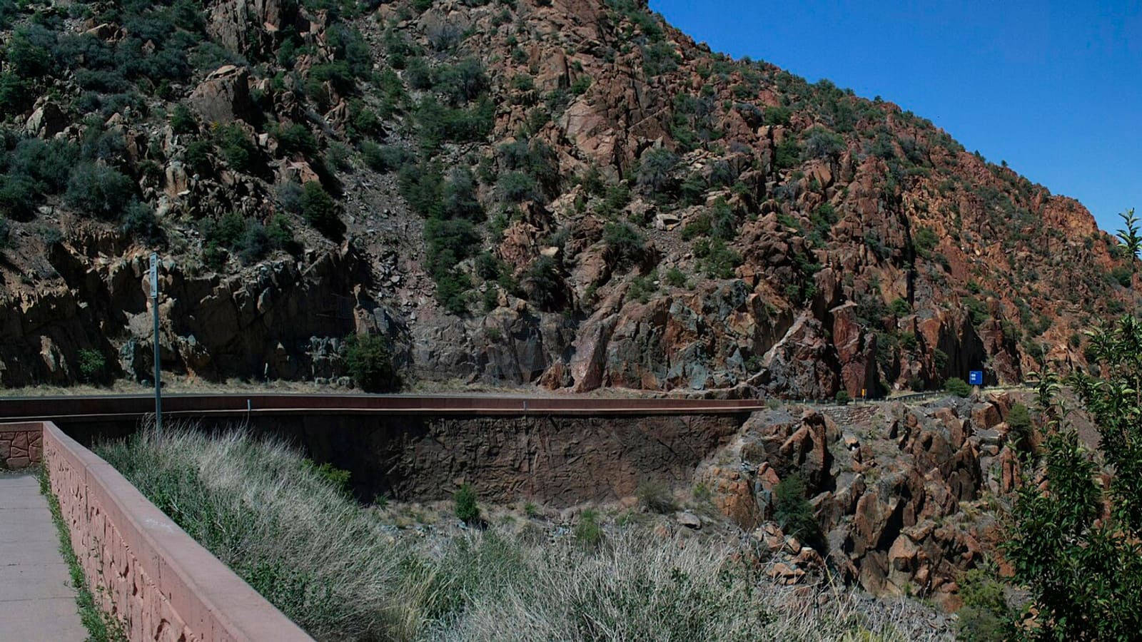
Every week, someone posts in a travel forum: "I really want to visit Jerome but I read the switchbacks are terrifying. Should I skip it?" The answers are all over the map — some say it's fine, some say it's harrowing, and most don't bother to distinguish between the two completely different approaches to Jerome that have completely different difficulty levels.
This guide fixes that. We separate the Cottonwood approach (manageable for most drivers) from the Mingus Mountain approach (genuinely technical, RV-restricted, and the one that generates all the forum posts). We give you exact numbers — switchback counts, elevation gains, road grades, and vehicle restrictions — so you can make a real decision instead of a Reddit-fear decision. Jerome is worth visiting. Here's how to get there confidently.
The AZ-89A Route: Two Approaches, Two Very Different Roads
Arizona State Route 89A runs from Sedona in the east to Prescott in the west, passing directly through Jerome at its midpoint. Jerome sits at the literal center of this route — which means there are two distinct approaches, and they are not equivalent:
The 158 total turns figure refers to the complete AZ-89A corridor from Sedona through Jerome to Prescott — a scenic mountain highway with constant curves across its entire 70+ mile length. Not all of these are hairpin switchbacks; the majority are sweeping curves on a road built for steady mountain travel. The headline switchback counts that matter for planning are the 11 on the Cottonwood side and 32 on the Mingus Mountain/Prescott side.
Approach 1: Cottonwood Side (AZ-89A from Sedona/Cottonwood)
This is the standard approach for visitors coming from Phoenix, Scottsdale, Sedona, or the I-17 corridor. It is the approach you should use if you have any anxiety about mountain driving.
Cottonwood Approach Stats
The Cottonwood approach climbs steadily from 3,314 feet through 11 switchbacks over 8 miles — an average grade of just over 4%, with sections reaching 5–6% on the steeper switchback curves. The road is two lanes wide throughout, with dedicated guardrails at the most exposed cliff-side sections. The surface is well-maintained state highway asphalt. Lane-keeping at moderate speeds (25–35 mph on the turns) is not challenging.
What you will notice on the Cottonwood approach: the turns come one after another without long straight recovery sections between them. If you are prone to motion sickness as a passenger, this matters more than the fear of heights does. As a driver, you have complete control — the road is wide, the guardrails are present at the scariest moments, and the 25 mph advisory speed on the steepest turns is the actual comfortable speed, not a suggestion to ignore.
Approach 2: Mingus Mountain Side (AZ-89A from Prescott)
This is the route between Jerome and Prescott, crossing the Mingus Mountain summit at roughly 7,815 feet. This is the approach generating most of the forum fear posts. The fear is partially warranted.
Mingus Mountain Approach Stats
The Mingus Mountain section is categorically different from the Cottonwood approach. The 32 switchbacks include several genuine hairpin turns — tight enough that larger vehicles must use the full width of the road to complete the turn. The maximum 6–7% grade means sustained downhill braking pressure on the descent into Jerome: this is the section that stresses transmissions and brakes on heavy vehicles. Large vehicles and long RV or tow-vehicle rigs are strongly discouraged on the Mingus grade — check ADOT (az511.gov) for any posted length restrictions before towing or driving an oversized vehicle over the mountain.
For private passenger cars and SUVs with no trailer: the Mingus Mountain section is drivable by any reasonably experienced driver in good road conditions. The switchbacks are challenging but not dangerous at the 20–25 mph advisory speeds. The road is wide enough for two-way traffic except at the tightest hairpins, where one direction may need to yield briefly. Overlooks along the route provide both scenic reward and natural pace-setting pauses.
For nervous drivers: the Mingus Mountain section has genuine exposure — you will look over the edge of the mountain on multiple switchbacks, and the drop is real. If heights at speed trigger anxiety for you, use the Cottonwood approach and skip Prescott for this trip.
RV and Tow Vehicle Reality
This deserves its own clear section because misinformation circulates constantly. Here is the actual guidance by vehicle class:
Class B camper vans (20–24 ft): Both approaches are manageable. The Cottonwood side has no significant restrictions for a Class B in good conditions. Mingus Mountain is tighter but doable — the switchbacks are navigable for a van-length vehicle with careful line selection.
Class C motorhomes (25–35 ft): Cottonwood approach is your only practical option. Mingus Mountain is not recommended — the 32 tighter switchbacks require three-point turns for vehicles over approximately 30 feet at the tightest hairpins, and the 6–7% grade puts stress on transmissions not designed for sustained mountain grades with the mass of a Class C. Some experienced Class C drivers have navigated Mingus successfully, but it is not the recommended route.
Class A coaches (35–45 ft): Do not attempt either mountain approach. Jerome does not have suitable Class A parking, the streets inside town are narrow and steeply pitched, and the mountain roads on both sides are incompatible with a vehicle of this length and weight. If you are traveling in a Class A, base in Camp Verde or Cottonwood (both have RV parks with full hookups) and make the Jerome day trip in a tow vehicle or rental car.
Vehicles towing trailers or 5th wheels: Not recommended on either mountain approach. The Cottonwood side is marginally more manageable for a short trailer (under 20 ft combined), but long tow setups are strongly discouraged on the Mingus grade — check ADOT (az511.gov) for any posted length restrictions. Detach the trailer at your RV park or campsite before driving to Jerome.
Winter Driving and Road Closures
AZ-89A over Mingus Mountain is the primary closure risk. The summit sits at roughly 7,815 feet, and a significant portion of its winter precipitation falls as snow December through February. ADOT closes the Mingus Mountain section of AZ-89A when ice or snow accumulation makes the switchbacks impassable. Closure frequency and duration vary from year to year — always check az511.gov or call 5-1-1 before a winter drive rather than assuming the road is open.
How to check before you drive: AZ511.gov provides real-time road condition and closure data. You can also call 5-1-1 from any Arizona cell phone. The Yavapai County Sheriff typically posts Mingus Mountain closure notices on social media. Always check before a winter drive from Prescott to Jerome.
The Cottonwood approach sits at lower elevation (3,314 ft at the base) and is rarely closed, but can have icy patches after overnight freezes from late November through February. The switchback curves are the ice-collection points — even when the straight sections are clear, the shaded side-of-the-mountain turns can retain overnight ice into the 9–10 AM hour. Do not drive the switchbacks in the dark if there is any possibility of overnight freezing. Drive when the sun has been on the road for at least two hours.
Winter alternative route (Prescott to Jerome, Mingus closed): Take AZ-69 east from Prescott to Cordes Junction, then I-17 north to the AZ-260 exit (Exit 287) west into Cottonwood, and AZ-89A up to Jerome. This adds roughly an hour over the Mingus route but keeps you on fully maintained highway. Check az511.gov or a maps app for live routing and timing before you set out — this bypass avoids the Mingus Mountain closure zone entirely.
Motorcycle Notes
AZ-89A through Jerome and over Mingus Mountain is one of the most-ridden motorcycle routes in Arizona, and for good reasons: the road surface is clean and well-maintained, the switchback sections on Mingus provide genuine technical challenge for experienced riders, and the scenery is outstanding across the full route. The Spirit Room in Jerome at 166 Main St functions as an informal moto gathering spot on weekend afternoons — the parking along Hull Ave frequently has 20–40 bikes on spring and fall Saturdays.
Motorcycle-specific hazards on AZ-89A to Jerome:
- Gravel in switchback apexes: Loose gravel accumulates at the inside edge of sharp turns, particularly on the Mingus Mountain section. Especially after rain. Enter switchbacks at a speed that allows for mid-corner adjustment.
- Oncoming vehicles cutting corners: On the tighter Mingus hairpins, car drivers sometimes drift wide on the inside of their turn, encroaching on the opposite lane. Approach blind hairpins conservatively and position toward your lane's center line.
- Rider traffic density: On peak weekends (October especially), AZ-89A carries significant rider volume. Multi-bike groups moving at touring pace can bunch up on the switchbacks. Leave following distance appropriate to the terrain.
- Afternoon heat on the Verde Valley floor: The descent from Jerome (5,066 ft) to Cottonwood (3,314 ft) in summer afternoon drops you from 75°F into 95°F+ over 8 miles. Gear accordingly if you're riding down for a wine trail afternoon.
The Nervous Driver Verdict
Can you handle the drive? Honest assessment by driver type:
The Alternative: Flat Route via I-17 and AZ-260
If you've read this far and still feel the Mingus mountain road is not for you, there is a flatter alternative that avoids the Mingus Mountain crossing entirely. From Phoenix or the I-17 corridor: take I-17 north to Exit 287 (AZ-260), follow AZ-260 west into Cottonwood, and then take AZ-89A up to Jerome from the Cottonwood side.
Wait — the Cottonwood side still has 11 switchbacks. There is no completely flat route to Jerome. The town sits on a cliff at 5,066 feet; some mountain driving is inherent to reaching it. What the I-17 bypass does is eliminate the Mingus Mountain section entirely, and the Cottonwood side's 11 switchbacks are significantly less demanding. Most drivers who describe themselves as "terrified of mountain driving" find the Cottonwood approach completely manageable after the fact.
Book Jerome Accommodation Before the Drive
Jerome's limited in-town rooms (Jerome Grand Hotel, Connor Hotel, Ghost City Inn) book fast — especially if your trip date involves a weekend. Cottonwood has 300+ rooms at $85–140/night and puts you at the base of the Cottonwood approach, so you can drive up fresh in the morning rather than after a long arrival day. Compare both on Expedia before committing.
Search Jerome & Cottonwood Hotels on Expedia Affiliate link — we may earn a commission at no cost to you.Parking Once You Arrive in Jerome
Getting to Jerome is only half the road challenge. Jerome's in-town parking is notoriously scarce — approximately 200–300 spaces for 3,000+ daily peak-season visitors. On a fall Saturday between 10 AM and 4 PM, you may circle for 20–30 minutes. The full parking in Jerome guide covers the specific lots, street sections, and the overflow parking at the Jerome Grand Hotel (guests only) and at the bottom of town near the Sliding Jail. Arriving before 9:30 AM on weekends eliminates most of the parking stress.
More Jerome Travel Planning
Now that you know you can handle the drive, the next steps are planning what to do when you get there. The Jerome things to do guide covers the full slate — Jerome State Historic Park, Gold King Mine, Caduceus Cellars, the gallery strip, and the Spirit Room. For overnight stays, the where to stay near Jerome guide covers the in-town vs Cottonwood decision with pricing and booking lead times. If you plan to spend multiple days using Jerome as a base, the day trips from Jerome guide covers all 9 surrounding destinations with drive times and ranked recommendations.