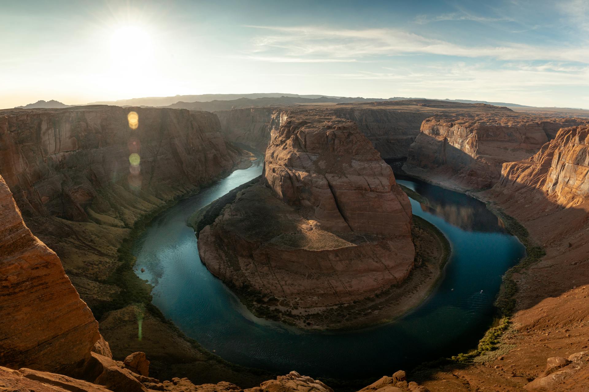
Horseshoe Bend is the one major Page sight you can see entirely on your own: no Navajo guide, no boat, no reservation. That makes it a good fit for a self-guided audio tour. This one follows the Horseshoe Bend Trail from the trailhead off US-89 out to the railed viewing platform above the Colorado River. Narration plays on its own as you reach each of seven stops. For parking, timing and the full safety rundown, read the Horseshoe Bend guide first.
GPS Audio Tour — Free
An intro plus seven stops, about ten minutes of narration in all. Open it on your phone at the trailhead and allow location access.
Start the TourRim safety. The only railing is at the viewing platform. Most of the rim is open rock above a drop of roughly 1,000 feet. Stay on the trail and behind the railing, keep children within reach, and never walk backward while taking a photo.
The Seven Stops
-
Stop 1: Horseshoe Bend Trailhead
Why the overlook and river are Glen Canyon National Recreation Area while the parking lot is City of Page land, which is why National Park Service passes do not cover the parking fee. Also: the last restrooms before the rim. (Narration: 1:19)
-
Stop 2: Around the Hill
The older trail climbed straight over the hill. The current trail, built by National Park Service crews as part of a project that began in late 2017, curves around it and was designed to meet federal accessibility standards. (Narration: 1:19)
-
Stop 3: First Shade Shelter
The Navajo Sandstone underfoot: wind-blown dunes from the Early Jurassic, roughly 190 million years ago, with cross-bedding you can still see in exposed rock. (Narration: 1:14)
-
Stop 4: Second Shade Shelter
The last shade on the route. Heat, water and pets, and a reminder that the trail loses elevation on the way out, so the return is a gentle climb. (Narration: 1:10)
-
Stop 5: Toward the Rim
How an entrenched meander forms: the Colorado Plateau rose around five million years ago and the looping river cut straight down instead of straightening out. (Narration: 1:12)
-
Stop 6: The Open Rim
The safety stop. Railings exist only at the viewing platform. Beyond it the rim is open rock above a drop of roughly 1,000 feet. (Narration: 1:14)
-
Stop 7: The Overlook Platform
The railed stone platform that opened in July 2018, the 270-degree bend, and why the river below runs green since Glen Canyon Dam began trapping sediment. (Narration: 1:13)
Before You Go
The parking lot is on City of Page land, and the City sets the parking fee, the hours and any shuttle rules on busy days. None of that is covered by a National Park Service pass. Check current details before you drive out. Carry more water than you think you need: there is little shade on the trail and none at the rim, and the return leg is uphill. Drones may not be flown from National Park Service lands and waters here.
Horseshoe Bend pairs well with a Navajo-guided Antelope Canyon tour or a visit to Glen Canyon Dam, which explains why the river below the overlook runs green. For more ideas, see things to do in Page.
Sources
National Park Service, Glen Canyon National Recreation Area: Horseshoe Bend pages (trail, railings, jurisdiction, parking and the geology of the meander); National Park Service, Zion National Park: Navajo Sandstone; USGS 10-meter elevation data for the trail profile; Lake Powell Chronicle (July 2018) and contemporary regional news reports on the 2017–2018 trail and platform project. Stop locations are taken from OpenStreetMap's mapped Horseshoe Bend Trail.
Frequently Asked Questions
Is the Horseshoe Bend audio tour free?
Yes. The audio tour costs nothing and needs no account. Horseshoe Bend itself has no entrance fee, but the City of Page charges for parking at the trailhead lot. National Park Service passes, including America the Beautiful, do not cover that parking fee. Rates and hours change, so check the current details posted at the lot or on the City of Page site before you go.
How long is the walk to the Horseshoe Bend overlook?
The National Park Service describes the trail as about 1.5 miles round trip on a hardened path, so roughly three-quarters of a mile each way. Allow about an hour with the seven audio stops and time at the rim. Elevation data shows the trail losing roughly a hundred feet on the way out, so the walk back to the lot is a gradual climb.
Is the Horseshoe Bend trail accessible?
The National Park Service says the trail was built to accessibility standards and describes it as wheelchair and stroller friendly. The railed viewing platform at the end is level. There are two shade structures along the way, no shade at the overlook, and no restrooms past the parking lot.
Is there a railing at Horseshoe Bend?
Only at the viewing platform. The National Park Service notes that there are railings at the edge of the platform but not along the trail, and that beyond the viewing deck the rim is rocky with no railing. The drop to the river is roughly 1,000 feet. Stay on the trail and behind the railing, and keep children within reach.
How does the GPS audio work?
Open the tour in your phone's browser and allow location access. Each stop has a small trigger zone along the trail, and its narration starts on its own when you walk into it. You can also play any stop by hand. The intro plays before you start, so listen to it at the trailhead.