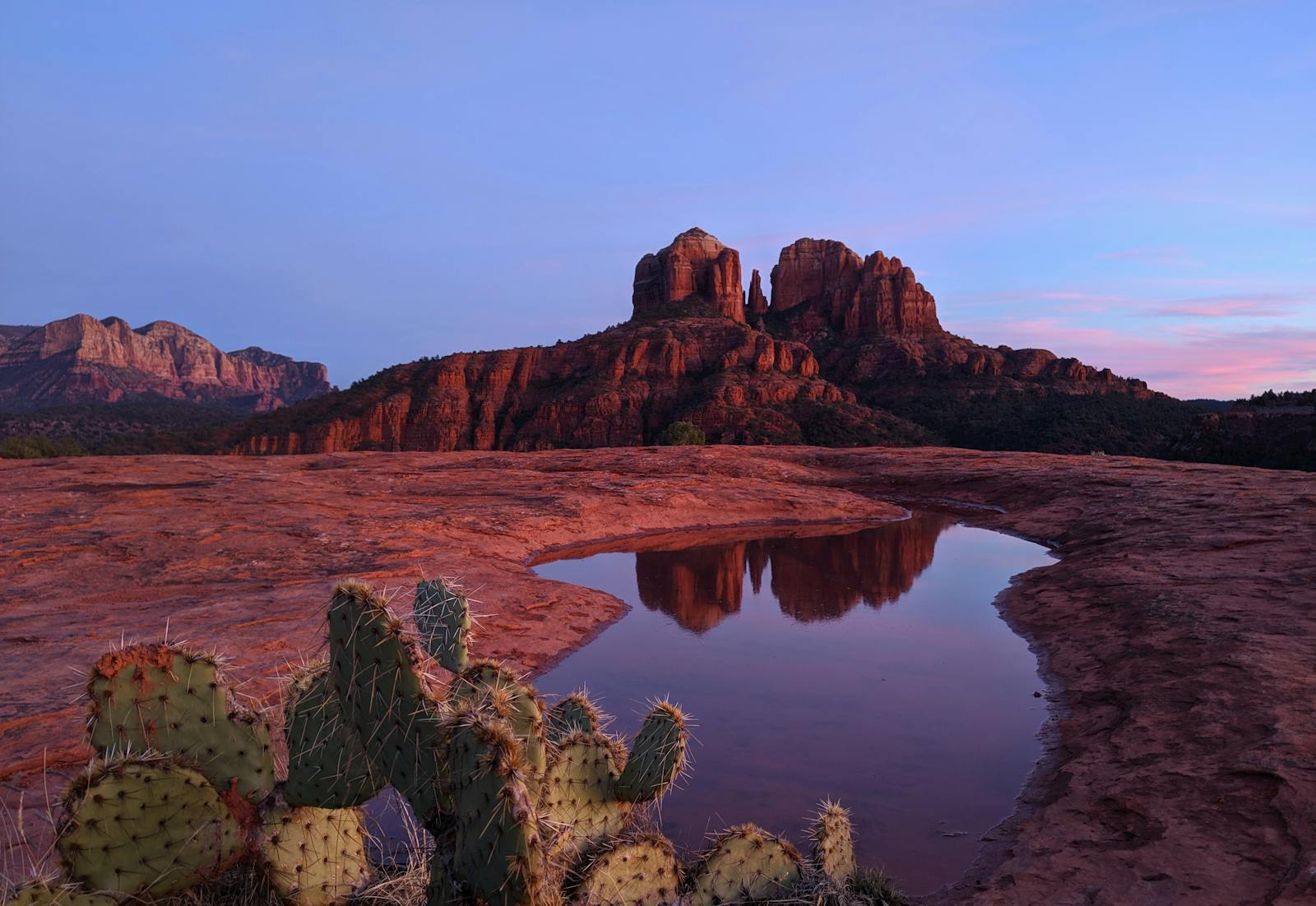
The beautiful way into Sedona is also the slow way. The final fifteen miles on State Route 179 — the Red Rock Scenic Byway, with Bell Rock and Courthouse Butte and Cathedral Rock unspooling on either side — is the entrance everyone wants and the one the postcards are shot from. It is also a two-lane road threaded with roundabouts through the Village of Oak Creek, and on a weekend or a holiday afternoon it backs up into a crawl that can turn the last few miles into the longest part of a two-hour drive. The drive is short and easy right up until it isn't, and the difference is almost entirely the day and hour you arrive. Leave Phoenix early, drive the byway on a weekday if you possibly can, and keep the SR-260 / Cottonwood backdoor in your pocket for the times SR-179 is jammed. Plan around that one fact and this is one of the best short drives in the state.
As a piece of driving, Phoenix to Sedona is gentle: about 115 to 120 miles and roughly two hours, almost all of it straight up Interstate 17 North before a short final run on SR-179. What makes it worth treating as a trip rather than a transfer is the climb and what punctuates it. You start in the Phoenix desert at around 1,100 feet and finish in the red rock country at roughly 4,500 — a 3,400-foot gain you feel the moment you open the car door into cooler, pine-tinged air. This guide sequences the whole thing: the two stops that turn a two-hour push into a relaxed half-day, and the arrival logic that keeps you out of the worst of the byway backup.
The corridor itself does the work of changing the scenery for you. I-17 leaves the saguaro flats, threads the Black Canyon, climbs through the high-desert grassland around the Verde Valley, and hands you off to SR-179 just as the first red formations come into view. Two stops sit naturally along the way — the Rock Springs pie tradition near Black Canyon City, early in the drive, and Montezuma Castle, a five-story Sinagua cliff dwelling a few minutes off exit 289 — and neither costs you a meaningful detour.
Below is the stop-by-stop, an at-a-glance schedule table, and the practical notes that matter most for this particular drive: the SR-179 versus SR-260 decision, the roundabouts in the Village of Oak Creek, and the real story on trailhead parking and the free Sedona shuttle once you arrive.
Methodology
How this route was driven and built, and what the numbers rest on, so you can judge whether our calls match your trip:
- The route: the waypoints follow the actual I-17 North / SR-179 corridor between Phoenix and Sedona in real geographic order — Phoenix, the Rock Springs / Black Canyon City pie stop, Montezuma Castle off exit 289 near Camp Verde, the Village of Oak Creek and Bell Rock trailhead where SR-179 enters the red rocks, then Sedona itself. This is the road everyone actually drives, sequenced for breaking the climb and for arriving before the byway backs up — not an invented scenic detour.
- Distances, times, and elevation: the ~115–120 miles and ~2 hours are approximate driving figures for the Phoenix-to-Sedona leg, given as honest round numbers rather than false-precise readings. The ~1,100-foot Phoenix start and ~4,500-foot Sedona arrival are standard elevations for the two cities, and the ~3,400-foot climb is the difference between them. Treat any single figure as "about," not to-the-minute — how long you linger at the stops and, above all, weekend SR-179 congestion both move the total.
- The congestion call is load-bearing: the weekend / holiday SR-179 backup is the honest tradeoff this whole guide is organized around. It comes from the road's real character — a two-lane scenic byway with roundabouts running through a small village into a destination town whose visitation routinely outstrips its parking. We weight the timing advice to "what day and hour are you arriving," because the same fifteen miles that are a joy on a Tuesday morning can be a crawl on a Saturday afternoon.
- What we name vs. what we don't: we name confirmed, durable places — Montezuma Castle National Monument, the Red Rock Scenic Byway (SR-179), the Bell Rock trailhead, the Village of Oak Creek, Sedona's red rock formations and trail network. For the roadside pie stop we point to the category (the Rock Springs Café / pie stop in the Black Canyon City area) rather than vouch for a specific operator's current hours, which change. Parking and shuttle specifics are described at the level that stays true — lots fill, several busy trailheads charge, and the city runs a free seasonal shuttle — with the advice to verify your exact trailhead before you drive to it.
- Refresh cycle: the seasonal congestion and shuttle guidance is re-checked each quarter; trailhead parking rules, shuttle routes, and monument and park hours are re-verified before each high season. Last verified: 2026-06-13.
At a Glance: The I-17 Route, Stop by Stop
| Stop | Place | ~Drive from Phoenix | Time There | Why This Stop |
|---|---|---|---|---|
| The Drive — I-17 North to SR-179, ~115 mi / ~2 hrs, +3,400 ft | ||||
| 1 | Phoenix departure (the Valley, ~1,100 ft) | 0 mi — start | — | Leave early, especially on a weekend. North on I-17. An early start is the single best move against the mid-morning SR-179 backup at the far end. |
| 2 | Rock Springs / Black Canyon City — the pie stop | ~40 mi / ~45 min | 20–30 min | The classic first break before the road climbs out of the low desert. The long-running Rock Springs Café and its famous pies — a genuine Arizona road-trip tradition. |
| 3 | Montezuma Castle National Monument (exit 289) | ~90 mi / ~1.5 hrs | 30–45 min | A five-story Sinagua cliff dwelling minutes off I-17. Short, flat, paved loop — substance for almost no detour, and the natural mid-drive break. |
| Into the Red Rocks — SR-179, the Scenic Byway | ||||
| 4 | Village of Oak Creek / Bell Rock trailhead | ~105 mi / ~1.75 hrs | 30–60 min | Where SR-179 enters the red rocks through the roundabouts. Bell Rock is a short, accessible first walk among the formations and a good stretch before town. |
| 5 | Sedona (arrival, ~4,500 ft) | ~115 mi / ~2 hrs | Rest of day | The payoff at the top of the climb. Cathedral Rock, the Chapel of the Holy Cross, uptown, the trails. Park early; lots fill and the free shuttle covers the busiest trailheads. |
The Drive in Detail: Phoenix Up to the Red Rocks
Stop 1 — Leaving Phoenix
The whole trip starts with one decision, and on this route it is about the clock rather than the tank: leave early. Phoenix to Sedona is short enough that the temptation is to dawdle out of the Valley after a leisurely breakfast, but the cost of that on a weekend lands at the very end, when SR-179 has filled with everyone who left at the same time. Pull north onto Interstate 17 in the morning and you are not just beating traffic on the way up — you are buying yourself the quiet version of the Red Rock Scenic Byway two hours from now.
The drive out of Phoenix changes character fast. You leave the saguaro-studded flats of the low desert, drop into and climb back out of the Black Canyon, and within an hour the vegetation and the air both shift as the road gains elevation. There is genuine pleasure in watching the desert give way to high-desert grassland and then to the first hint of red rock, and the two stops below give the climb its shape. This is not a drive to grind out in one push; it is a drive to break twice and arrive relaxed.
Stop 2 — Rock Springs and the pie
About 45 minutes north of Phoenix, in the Black Canyon City area, Rock Springs is the traditional first break on the drive north — and the Rock Springs Café is the reason. It is a long-running roadside institution known above all for its pies, the kind of place that has been a fixture of the I-17 run for generations of Arizona families heading to the high country. It comes early enough in the drive that you are still fresh, which makes it less a rest stop than a small ritual: a slice, a coffee, a stretch, and back on the road before the real climb begins.
This is the kind of stop that earns its place on a first-timer or family run more than on a solo dash, and we are pointing you to the category — the Rock Springs pie stop in the Black Canyon City area — rather than vouching for any single operator's current hours, which can shift. If pie at ten in the morning is not your idea of a road trip, it is an easy one to skip; if it is, it sets the tone for the whole day.
Stop 3 — Montezuma Castle
Further north, just off I-17 at exit 289 near Camp Verde, is one of the easiest worthwhile stops in the state. Montezuma Castle National Monument preserves a well-preserved five-story cliff dwelling built into a limestone alcove high above Beaver Creek by the Sinagua people roughly seven centuries ago. The name is a historical misnomer — it has nothing to do with the Aztec emperor, a mistaken attribution by early Anglo settlers — but the structure itself is the real thing: one of the best-preserved cliff dwellings in North America, viewed from a short, mostly flat paved loop along the creek.
What makes it perfect for this drive is the economics of the detour: the monument sits only a few minutes off the interstate, so a visit costs you almost nothing in distance. Thirty to forty-five minutes is plenty to walk the loop, read the interpretive signs, and look up at the dwelling. It breaks the climb at almost exactly the right point and adds genuine substance to a day that could otherwise be all driving and red rock — a reminder that people have been drawn to this stretch of Arizona for a very long time.
Stop 4 — Into the red rocks: SR-179 and the Village of Oak Creek
This is where the drive turns from a highway run into the thing you came for. Leave I-17 at exit 298 onto State Route 179 — the Red Rock Scenic Byway — and within minutes the first formations rise on either side. The Village of Oak Creek is the gateway community here, and SR-179 threads through it on a series of roundabouts that were built specifically to keep this two-lane road moving. Take them at the posted pace, watch for pedestrians and other drivers gawking at the scenery, and use the Bell Rock trailhead as your first real stop in the red rocks.
Bell Rock is one of Sedona's most accessible formations: a short, gentle walk from the trailhead puts you among the rocks without committing to a strenuous hike, which makes it an ideal first stretch after two hours in the car. It is also where the honest tradeoff from the top of this guide becomes concrete — on a busy weekend, the byway through here and on into Sedona can slow to a crawl. If you have hit it at a bad hour, this is the decision point: either settle in and enjoy the slow scenic crawl, or, if you are still on I-17 and see the weekend forming, consider staying on the interstate to the SR-260 exit and coming into Sedona from the Cottonwood side instead. The byway is prettier; the backdoor is faster when SR-179 is jammed.
Stop 5 — Arrival in Sedona
At the end of the byway you arrive in Sedona proper, at roughly 4,500 feet — a full 3,400 feet above where you started in Phoenix, and you will feel it in the cooler, cleaner air. From here the town opens into everything it is known for: Cathedral Rock and its iconic profile, the Chapel of the Holy Cross built into the red rock, the galleries and shops of uptown, and a dense network of trails radiating out in every direction. Most visitors arrive with a hike or a view in mind; the trick is matching that ambition to the parking reality.
Parking is the thing that catches first-timers. Sedona's most popular trailheads have small lots that fill early, several of them now charge for parking, and the city runs a free seasonal shuttle to the busiest of them — including parts of the Cathedral Rock and Soldier Pass areas — precisely because the lots cannot absorb the demand. The practical sequence is: arrive early, check before you drive whether your target trailhead is on the shuttle network or has its own lot, carry the relevant pass for Forest Service day-use parking, and keep a backup trail in mind for when your first choice is full. Do that and Sedona delivers; show up at noon on a Saturday expecting to park at the front of Cathedral Rock and it will not.
The deeper truth about Sedona is that it rewards staying the night. The light on the rocks at dawn and dusk is the best of it, the trailheads are quietest first thing in the morning, and an overnight lets you avoid driving SR-179 at the worst weekend hours in both directions. A day trip absolutely works — that is the next section — but if you can give Sedona a sunrise, it becomes a different and better trip.
Practical Notes: Timing, the Byway, and Parking
The SR-179 vs. SR-260 decision
This is the call that defines the end of the drive. State Route 179 — the Red Rock Scenic Byway, off I-17 at exit 298 — is the scenic and natural way in, with the formations on display the whole fifteen miles. It is also the road that backs up. The alternative is to stay on I-17 a little longer, exit at SR-260 toward Cottonwood, and approach Sedona from the west through the Verde Valley. Our default is the byway on a weekday or an early arrival, and the SR-260 backdoor reserved for the peak weekend and holiday hours when SR-179 is at a crawl. If you only drive it once, drive the byway — just drive it at the right time.
Timing is everything on this route
Unlike a heat-driven desert drive, the variable here is crowds, not climate, and it concentrates at the very end. Weekday mornings are the gold standard: the byway flows, the trailhead lots have spaces, and the town is calm. Weekends and holidays from late morning through mid-afternoon are the worst, both on the way in and on the way out. If a weekend is your only option, the move is the same as for the whole trip — leave Phoenix early, do the byway before the crowd forms, and either leave Sedona before the afternoon exodus or stay the night and skip it entirely.
Parking and the free shuttle
Sedona's trailhead parking is genuinely managed now. Many of the busiest trailheads charge for parking or fill early, and the city operates a free seasonal shuttle to several of the most crowded trails — including parts of the Cathedral Rock and Soldier Pass areas — because the small lots cannot keep up with demand. A Red Rock Pass or the relevant federal pass covers day-use parking at many Forest Service sites; the city shuttle is separate and free. Check whether your target trailhead is on the shuttle network before you drive to it, and always have a backup trail in mind.
What to pack
- Layers for the climb: Sedona at 4,500 feet runs noticeably cooler than Phoenix, and red rock evenings drop fast. A jacket even on a warm desert morning.
- Real shoes for the trails: Bell Rock and the easy formations are fine in sneakers; the slickrock on busier trails wants grip.
- Sun protection: the red rock country is high and exposed; hat, sunglasses, and SPF year-round.
- Water: the desert leg and the trailheads both warrant more than you think, especially in the warm months.
- The relevant parking pass for Forest Service trailheads, and a checked plan for the free city shuttle if you are targeting a crowded trail.
Extend Your Trip: Where Sedona Leads Next
Sedona is a hub, not a dead end. It sits at the center of a tight cluster of northern-Arizona destinations, each an easy onward leg from the red rocks — which is exactly what makes it a great first night on a longer loop rather than just a day's destination. Three same-region next stops, all of them live on The Lowdown Guide:
Jerome
The historic copper-mining town clinging to Cleopatra Hill above the Verde Valley — galleries, ghost-town history, and big views, a scenic 30-to-45-minute drive from Sedona.
< 1 hr awayFlagstaff
Up the SR-89A switchbacks through Oak Creek Canyon to the 7,000-foot mountain town — pines, dark skies, and the gateway to the Colorado Plateau.
~2 hrs awayGrand Canyon
The South Rim, roughly two hours north via Flagstaff — the headline of any northern-Arizona loop, with Sedona as the natural first night.
Each of these has its own full Lowdown Guide hub — follow a link above to plan the next leg.