Last updated: 2026-07-01
1. The two you will hear about: Cathedral Rock and Devil Bridge
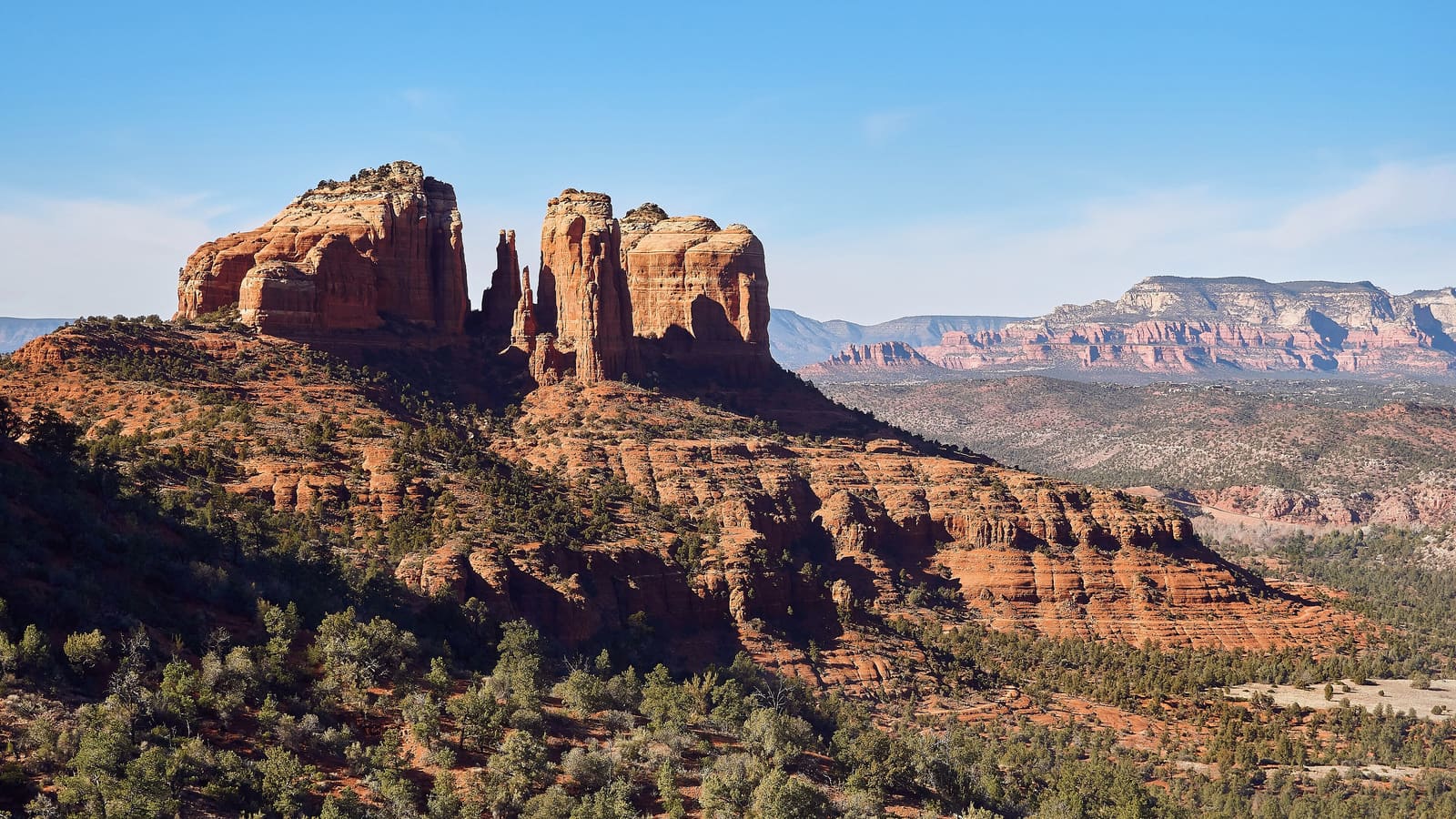
Cathedral Rock (about 1.1 miles round trip, 669 feet of elevation gain) is the most iconic and photographed hike in Sedona — short but steep, and rated strenuous by the Forest Service. The final approach to the saddle involves hands-on scrambling over sandstone slabs — not technical climbing, but you need comfort moving over uneven rock. The trail begins at the Back O Beyond trailhead on Back O Beyond Road off AZ-179. Devil Bridge is the most popular hike. From the high-clearance Devil's Bridge trailhead it is 1.6 miles round trip with 371 feet of gain; most visitors instead park on Dry Creek Road, which makes it roughly 4 miles round trip, ending at the largest natural sandstone arch in the Sedona area, wide enough to walk across. The trailhead is off Dry Creek Road in west Sedona.
Both require a Red Rock Pass for trailhead parking and have notoriously tight lots. Cathedral Rock and Devil Bridge trailheads fill by 8 AM on weekends from March through October — arrive before 7 AM or expect a long wait. For the full hiking overview for these and related trails, see our Sedona hiking guide.
2. Easy trails for beginners and families
Bell Rock Pathway (3.5 miles, almost entirely flat) is the most reliable beginner trail. Paved access, reliable parking in the Village of Oak Creek on AZ-179, and good views of Bell Rock and Courthouse Butte. Airport Mesa Loop (3.5 miles, about 535 feet of gain) gives panoramic views of Sedona from the west side without technical sections. The trailhead is off Airport Road. Crescent Moon Picnic Area (short flat walk along Oak Creek, swimming possible in summer) charges a day-use fee — verify current rates with the USFS before visiting.
For families with young children, Bell Rock Pathway is the correct starting point. See our Sedona with kids guide for family-specific notes on these three trails.
3. Moderate trails worth the effort
Doe Mountain (about 2 miles round trip with the rim loop, 542 feet of gain) delivers 360-degree plateau views with a short, steep approach. Margs Draw (about 4 miles round trip, rolling terrain) rewards with canyon scenery without the technical scrambling of Cathedral Rock. Soldier Pass (about 4 miles round trip, arches and sinkholes) has a very small trailhead lot — roughly 14 spaces and no hiking permit required; the free Sedona Shuttle serves it. Verify current requirements with the Coconino National Forest before planning your visit. All three are in the Dry Creek or west Sedona corridor, accessible from AZ-89A.
Cross-reference with our things to do guide for how to combine these with afternoon activities.
4. Challenging trails for experienced hikers
Bear Mountain (4.6 miles round trip, 2,289 feet of gain) is one of the most strenuous day hikes in the Sedona area — a sustained rocky climb to a high mesa with views across Oak Creek Canyon. Wilson Mountain (about 11 miles round trip, 2,400 feet of gain) is the longest single-day trail option. Both require solid footwear, early starts (before 8 AM in summer), and substantially more water than you think you need.
Devil Bridge appears in the moderate category for most hikers, but the spur trail to the arch is exposed with drop-offs on both sides. It is not strenuous, but it is not suitable for people uncomfortable with heights. Carry at least one liter of water per hour of hiking in warm weather.
5. What you need to know before you go
Red Rock Pass: roughly $5 per day or $15 per week per vehicle, available at trailheads via iron ranger or covered by the America the Beautiful annual interagency pass. Parking fills fast: Cathedral Rock, Devil Bridge, and Bell Rock lots fill by 8 AM on weekends from March through October. The Village Connector shuttle (verify current schedule with the Coconino National Forest before your visit) serves several popular trailheads and can reduce parking pressure. Water: carry at least 2 liters for any trail over 3 miles in warm weather.
Current trail conditions, permit requirements, and fee information are managed by the Coconino National Forest. Verify current requirements at the official National Forest site before your visit — trail closures and permit requirements change seasonally.
6. Seasonal hiking calendar
Spring (March to May): best overall window — mild temperatures, wildflowers in April, and good trail conditions on all difficulty levels. Summer (June to August): early starts are essential. Start before 7 AM for any moderate or strenuous hike. Dangerous midday heat. The official Arizona monsoon season runs June 15 through September 30 (storms are most frequent mid-July through August); thunderstorms typically build in the afternoon and can bring lightning and flash flooding — check the forecast before any canyon hike. Fall (September to November): excellent conditions with lower crowds after Labor Day. October is the standout month. Winter (December to February): cold mornings, occasional ice on shaded sections, short daylight. Low crowds.
For the full seasonal breakdown with weather data and crowd patterns, see our best time to visit Sedona guide.
Book a Guided Sedona Experience
Viator runs Pink Jeep-style jeep tours, Red Rock helicopter flights, and guided hiking experiences in Sedona. Browse current availability and compare tour operators.
Browse Sedona Tours on Viator →Affiliate link — we earn a small commission at no cost to you.