By The Lowdown Guide Editorial Team — Updated April 30, 2026
Monsoon Sedona is the highest-risk and highest-reward window on the entire calendar.
If you hike at sunrise and clear the trails by 11 AM, you avoid the lightning. Slot canyons — Antelope, Secret Canyon — close when any upstream rain is forecast, and that is non-negotiable regardless of what the sky looks like at your trailhead. Photographers who plan around the 2 PM rule get the iconic Cathedral Rock storm shots and double rainbows that simply do not exist any other season. The flash flood deaths in Arizona’s canyon drainages during monsoon season are real — and entirely avoidable with one rule: never camp in or near a creek bed during monsoon, and never enter slot canyons when the forecast shows ANY upstream rain, even a 10% chance. The canyon walls funnel water from storms you cannot see from inside them.
Most monsoon guides tell you it rains in the afternoon and to carry a poncho. They do not tell you that a flash flood can hit West Fork of Oak Creek from a storm 30 miles upstream that you never saw, or that a dewpoint reading of 55°F means the afternoon storm window is almost certain. This guide does.
TL;DR — Should You Visit Sedona in Monsoon Season?
Yes, If You Hike at Sunrise and Plan Around 2 PM
Trailhead at 5:30 AM. Summit by 8 AM. Car by 10:30 AM. Afternoons are for restaurants, galleries, and watching the storm show from a covered patio. This is a genuinely excellent trip if you execute the schedule.
No, If You’re Set on Slot Canyon Hiking (Antelope Closes)
Antelope Canyon (Page) shuts for any rain probability; Secret Canyon closes intermittently. If slot canyons are the primary reason for your trip, go in April–May or October instead.
Maybe, If You’re a Photographer (This Is Your Season)
The double rainbow over Cathedral Rock from Airport Mesa is a real and frequent occurrence. The post-storm “Sedona Glow” produces the deepest red sandstone color of the year. No other season offers this.
What “Monsoon Season” Actually Means in Sedona
The official calendar: June 15–September 30
The National Weather Service defines Arizona’s monsoon season as June 15 through September 30. In practice, meaningful storm activity rarely begins before mid-July. The peak window is mid-July through early September — roughly seven weeks during which afternoon storms occur 3–5 days per week. By late September, storms become less frequent and the mornings start to cool toward fall conditions.
Why it hits Sedona harder than Phoenix
Sedona sits at 4,350 feet elevation. Phoenix sits at 1,086 feet. The elevation difference means moisture-laden air from the Gulf of Mexico and Gulf of California gets forced upslope as it moves north, cooling and condensing into thunderstorms earlier and more reliably than it does in the Valley. The red rock formations themselves create thermal updrafts — columns of rising hot air — that accelerate convective development. A storm that fizzles over Scottsdale can explode into a severe cell over the Mogollon Rim above Sedona.
How to read the forecast: the dewpoint threshold
Open Weather Underground or the NWS Flagstaff forecast discussion. If the morning dewpoint reading hits 55°F or above, monsoon is “active” and afternoon storms are highly probable. Below 50°F, the atmosphere is drier and afternoon convection is unlikely. The dewpoint threshold is more predictive than storm probability percentages on consumer weather apps, which average large geographic areas. A 30% storm chance for “Sedona” on the app can mean a near-certain storm in Oak Creek Canyon and dry skies over Bell Rock simultaneously.
The 2 PM Rule — Live By It
80% of monsoon storms hit between 2–6 PM:
The reason is thermal-driven convection. The sun heats the desert floor from morning onward, building unstable air columns. By early afternoon, enough instability has accumulated that any moisture trigger — an approaching upper-level disturbance, a collision of sea-breeze boundaries — ignites rapid thunderstorm development. In Sedona specifically, storms typically form over the Mogollon Rim to the north first, then move south-southwest over the red rock country between 2:00 and 4:00 PM. By 6:00–7:00 PM, many storms have passed or dissipated. Evening conditions are often clear.
Sunrise hike strategy
Trailhead by 5:30 AM. If you’re hiking West Fork of Oak Creek (currently closed as of this writing following the 2026 Pocket Fire — check status before planning around it) or any other trail near a drainage, by 5:30 AM in July you’ll have approximately 4.5 hours of unambiguous window. Summit or turnaround point by 8:00 AM. Back to the car by 10:30 AM. From 10:30 AM onward, watch the sky north and northwest toward the Rim every 20 minutes. A clear morning can build a full anvil cloud in 40 minutes over the Rim at Sedona elevation.
When to bail immediately
Any time you see an anvil-shaped cumulonimbus cloud building over the Mogollon Rim to the north, descend immediately regardless of how much time you’re “supposed to” have. The anvil top (the flat, spreading top of a thunderstorm) means the storm is mature and producing lightning. At Sedona’s elevation, lightning can arrive 15–20 minutes after you first see the anvil. You do not have time to finish the summit and get down. Turn around.
Flash Flood Safety — The Conversation Most Articles Skip
Oak Creek Canyon: flash floods are a real, recurring danger
In July 2017, a flash flood at the Cold Springs swimming hole on Ellison Creek near Payson — the same Arizona monsoon flash-flood pattern that threatens Oak Creek Canyon — killed 10 members of one family. The storm that generated the flood originated roughly 8 miles upstream from where the victims were, and the sky was clear at the swimming hole when the flood arrived. This is not an anomaly — it is exactly how flash floods in narrow canyon drainages work. The flood travels faster than the storm that caused it. By the time you hear the roaring of the water, you have less than 60 seconds to get to high ground.
Slide Rock State Park in monsoon
Slide Rock State Park closes intermittently throughout monsoon season after significant upstream rain events, and as of this writing the Oak Creek swim area is already closed until October 1 following the 2026 Pocket Fire (vehicle access to the park remains open). Before you drive the 7 miles north on AZ-89A to the park, call ahead: (928) 282-3034. The park staff checks conditions and will tell you whether the slide section is open. Driving to find it closed is a common frustration; calling takes 2 minutes.
West Fork of Oak Creek: avoid on any day with >20% storm chance
West Fork Trail #108 is closed as of this writing under a Coconino National Forest closure order following the 2026 Pocket Fire — recently burned watersheds are especially vulnerable to flash flooding and debris flows, which is exactly the monsoon risk this section describes. The monsoon guidance below applies once the trail reopens. West Fork is a narrow slot-style canyon. The walls are 60–80 feet high in sections with no exits. Even a moderate storm 10–15 miles upstream can send a wall of water down the canyon with no warning. Avoid West Fork entirely on any monsoon day with storm probability above 20%. If the morning is clear and the dewpoint is below 50°F, it is a reasonable hike with early start. If dewpoint is 55°F+, skip it.
The 30-mile rule
A flash flood from rain you cannot see can reach Oak Creek 60–90 minutes after the storm that caused it, from as far as 30 miles upstream. The rule is simple: never camp in or near a creek bed during monsoon season. Never sleep in a tent near any running water between June 15 and September 30 in the Sedona area. Elevation above the drainage is the only protection; a hill 20 feet above the waterline is enough. A campsite inside the drainage is not.
Lightning Risk on Vortex Hikes
Cathedral Rock + Bell Rock = worst lightning magnets in Sedona
Both formations are exposed sandstone with no tree cover above the saddle. Cathedral Rock’s upper saddle sits at approximately 5,100 feet with 360-degree exposure to the sky. Bell Rock’s upper ledges are similar — open, elevated, and visible from miles away to a storm cell looking for a strike path. During active monsoon season, these two sites become lightning rods in the literal sense. Airport Mesa and Boynton Canyon involve lower exposed elevations and more tree cover near the vortex energy sites, making them safer afternoon choices in marginal conditions.
The below-treeline rule
Get below the exposed rim before noon on any day when the morning dewpoint exceeds 50°F. The treeline on Cathedral Rock sits roughly at the base of the upper trail section, about 20 minutes below the saddle. That is your safety threshold. On the way down, do not stop at exposed points to take photos — get below the treeline first, then photograph the incoming storm from there.
If you are caught above the saddle
Descend immediately along the established trail. Move quickly but do not run on wet sandstone — it is slicker than it looks. Get into low spots on the terrain if you cannot descend fast enough; spread out from your group to minimize the chance of a single strike hitting multiple people. NEVER shelter under an isolated tree; a lone tree on an exposed ridge is the most dangerous possible position during a lightning storm. Crouch with feet together if caught in the open, hands over ears, and wait for the storm to pass.
What Closes During Monsoon Season
| Location / Activity | Closure Trigger | What to Do |
|---|---|---|
| Antelope Canyon (Page) | Any rain probability upstream | Rebook for April–May; non-negotiable |
| Secret Canyon (Sedona area) | Intermittent; active storm watch | Check morning conditions with outfitter |
| Slide Rock State Park | After significant upstream rain | Call (928) 282-3034 before driving |
| Soldier Pass wash section | Post-flash flood; trail reassessment | Check hiking page for status |
| Diamondback Gulch Jeep tours | Occasionally pauses during heavy monsoon | Broken Arrow tour generally runs; confirm morning of |
The Photography Upside
Cloud drama + Cathedral Rock: the image that doesn’t exist any other season
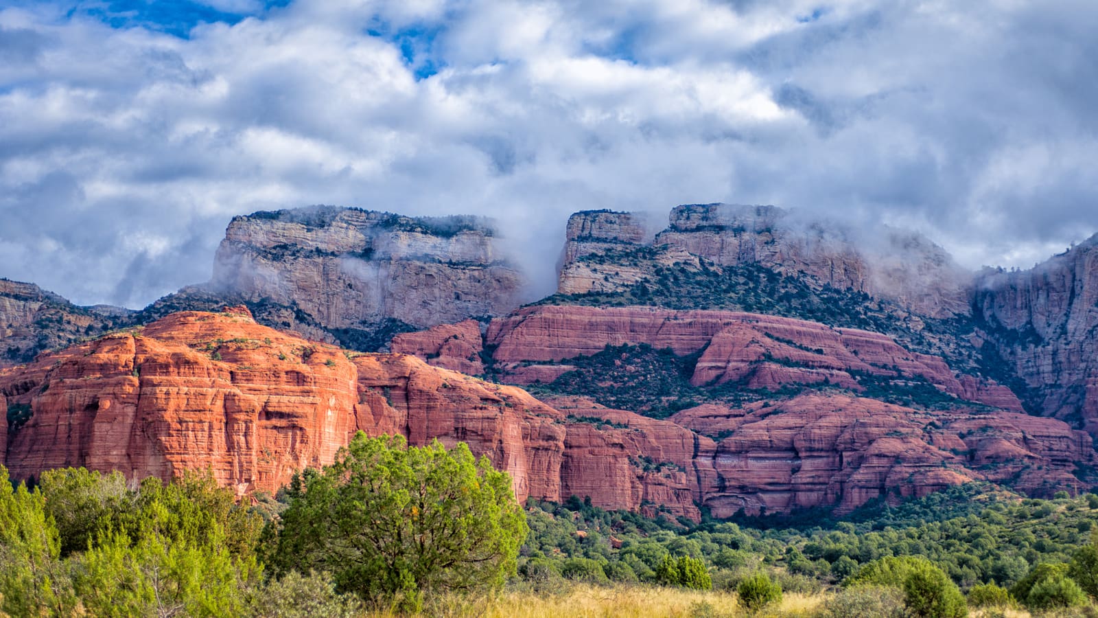
The iconic Sedona photograph — Cathedral Rock silhouetted against a tower of monsoon clouds with orange-purple light — requires monsoon conditions. It does not exist in spring. It does not exist in fall. The thunderheads that build over the Rim in July and August create a sky that no other season can replicate, and the red sandstone’s color deepens in the pre-storm diffused light in a way that direct summer sun cannot produce. Photographers from the Pacific Northwest and the UK fly into Phoenix specifically to shoot Sedona in monsoon.
Double rainbows: real, frequent, photographable
Position yourself at Airport Mesa overlook 30–45 minutes after a storm clears to the east. With the setting sun behind you and the residual moisture in the air ahead, double rainbows form over the Cathedral Rock – Bell Rock formation band on a near-weekly basis during peak monsoon. The primary rainbow arc sits at approximately 42 degrees above the horizon from the overlook; the secondary arc sits at 51 degrees. A 24–35mm lens captures both arcs in a single frame from the Airport Mesa north pullout.
Post-storm “Sedona Glow”
The 20-minute golden hour after a clearing monsoon storm produces the deepest red sandstone color of the entire year. The dust has been washed out of the air by rain, reducing haze. The residual cloud cover acts as a giant reflector, bouncing warm light onto the rock faces from multiple angles simultaneously. This is the moment that separates monsoon photography from every other season. Best vantage points:
Airport Mesa (panorama)
Cathedral Rock in the frame with storm sky. Double rainbows visible here. 30-spot north pullout. Arrive before storm clears.
Schnebly Hill Road
Requires 4WD or a Pink Jeep tour. Highest overlook in Sedona. Post-storm panoramic shots are extraordinary from here.
Bell Rock Pathway (eye-level)
0.4 miles southeast on the pathway for the formation’s best angle. Storm clouds stack above the dome. Safe during passing storms.
Red Rock Scenic Drive Audio Tour
Trapped indoors by a 3 PM storm? Do the scenic drive from your car. GPS-triggered narration at every major formation overlook — Airport Mesa, Cathedral Rock viewpoint, Bell Rock pullout — with zero lightning exposure.
See the Scenic Drive Tour →Find Sedona Monsoon Tours on Viator
Guided Jeep tours, photography workshops, and sunset vortex experiences that are designed around the monsoon schedule and know when to head back.
Browse Monsoon Tours on Viator →Where to Stay If Storms Trap You Indoors
In monsoon season, your hotel is not just a place to sleep — it is a storm bunker. A two-day rain event in August is not hypothetical; it happens. The properties below have genuine indoor amenities that make a 48-hour indoor day survivable. July–August rates are 30–40% below peak spring pricing at all three.
L’Auberge de Sedona
Creekside but situated well above the Oak Creek flood zone. Indoor spa pool. Restaurant with covered creek-view terrace. The most romantic indoor storm experience in Sedona.
Check Rates on Expedia →Enchantment Resort
Set in Boynton Canyon with genuine four-seasons indoor amenities: full Mii Amo spa, indoor pool, multiple restaurants, and a canyon location that produces some of the most spectacular storm views of any Sedona property.
Check Rates on Expedia →Amara Resort & Spa
Central Uptown location. Indoor pool. Dog-friendly. Walking distance to Tlaquepaque and restaurants. If a storm hits and you need to stay walkable to indoor activity, Amara’s location is the best of the three for that situation.
Check Rates on Expedia →Skip: any “courtyard motel” property in Sedona that has no real indoor common area. During a 2-day monsoon event, you will be in your room staring at the wall. The budget saved on the room is not worth the 48-hour confinement penalty.
Indoor & Rain-Friendly Activities
See the full guide at Sedona Rainy Day Activities. Three specific options that work especially well during monsoon afternoon storms:
Mariposa Latin-Inspired Grill
Book a 1:30 PM lunch reservation. The cliff patio has partial cover over the dining terrace. Order something that takes time. Watch the storm build over the Rim from one of the best views in the entire Verde Valley. Plan for a 2-hour lunch.
Sedona Heritage Museum
Small museum with excellent coverage of Sedona’s pre-tourism history — apple orchards, homesteaders, the Hollywood era when Westerns were filmed here. Budget 60–90 minutes; they take walk-ins.
Tlaquepaque Arts Village
Covered Mexican colonial courtyards, 30+ galleries, and the sycamore canopy keeps the main plazas dry. Storm rain creates a genuinely atmospheric browsing environment. Galleries close at 6 PM; property gates close at 6:30 PM.
Day Trips That Work Better in Monsoon
If Sedona’s afternoon storm pattern has you pinned indoors 3 out of 5 afternoons, these day trips offer genuine relief without canceling your Sedona trip entirely:
90 minutes from Sedona. Sits at 5,000 feet on a completely different formation band than Sedona. Less prone to the specific afternoon storm pattern that hits Sedona’s red rock elevation band. Historic mining town with galleries, bars, and cliff-edge views.
Flagstaff
30 minutes north, 7,000 feet elevation. Mountain cool. Indoor brewery crawl (Mother Road, Lumberyard, Wanderlust). The Museum of Northern Arizona is excellent. Sedona’s monsoon storms and Flagstaff’s weather pattern are often completely different on the same day.
Climate-controlled train cars. 4-hour round-trip through the Verde Canyon — a route inaccessible by any road. Schedules Wed–Sun, departs 1 PM from Clarkdale (35 min from Sedona). Perfect storm-day activity because you’re enclosed and moving.
Driving Safety in Monsoon Sedona
AZ-89A Oak Creek Canyon switchbacks
The AZ-89A descent into Oak Creek Canyon from the Rim is one of the more treacherous roads in Arizona under normal conditions. During a monsoon storm it becomes actively dangerous: water sheets across the road in multiple places on the switchbacks, visibility drops to near-zero in heavy rain, and Sedona locals who know the road drive it at 50 mph regardless of conditions. If you are in a rental car with unfamiliar brakes, pull over before entering the switchback section if heavy rain begins and wait for the storm to pass — most storms clear in 30–60 minutes.
The dust storm (haboob) protocol
If you encounter a haboob (dust storm wall) on the highway in the Verde Valley or driving toward Phoenix: pull completely off the road, turn your lights OFF (not just hazards — lights off entirely), and keep your foot off the brake pedal. The reason lights-off is the rule: drivers in zero-visibility dust storms follow tail lights, assuming the vehicle ahead is moving. If you are stopped with lights on, they will drive into you at highway speed. Foot off the brake eliminates the red brake light signal. Wait until visibility exceeds 300 feet before re-entering the roadway.
When to pull over: zero hesitation threshold
If you cannot see 2 car lengths ahead, pull over immediately. This applies to rain, dust, or any combination. Arizona has a disproportionate number of multi-car highway pile-ups relative to its driving population — almost all of them happen when drivers try to continue through zero-visibility conditions rather than stopping. The inconvenience of a 20-minute roadside stop is significantly less than the alternative.
Frequently Asked Questions
Should I cancel my July or August trip to Sedona? +
Is hiking safe in Sedona during monsoon season? +
Can I still visit the vortex sites in monsoon season? +
Do hotel rates drop in Sedona during monsoon season? +
What is the week-to-week rain pattern in Sedona during monsoon? +
More Sedona Planning
Sedona in Summer →
Full seasonal guide with heat strategies
Best Time to Visit Sedona →
Month-by-month comparison with crowds and pricing
West Fork of Oak Creek →
Trail guide with monsoon safety conditions
Slide Rock State Park →
Current conditions and closure schedule
One-Day Sedona Itinerary →
Hour-by-hour plan adaptable to monsoon timing
Sedona Trip Mistakes →
Common planning errors and how to avoid them
Rainy Day Activities →
Full indoor activities guide for storm days
Travel Planning Hub →
Itineraries, packing lists, and logistics