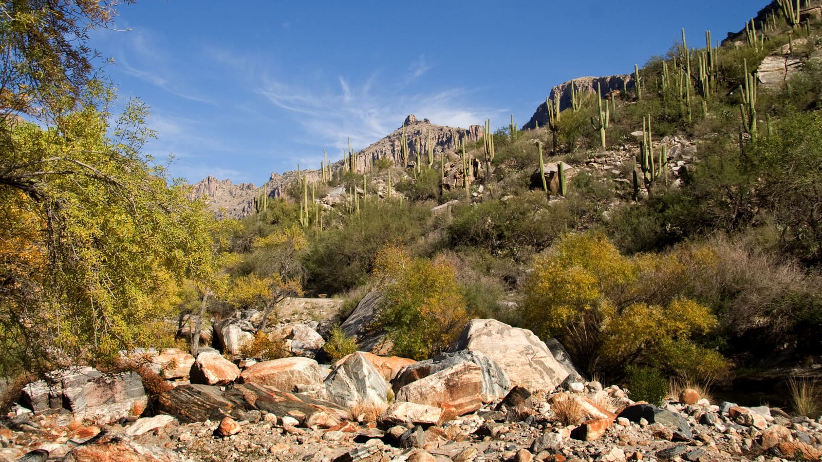
Sabino Canyon Recreation Area
Sabino Canyon is one of the most popular natural areas in southern Arizona and one of the few desert canyon experiences accessible by a public tram. Private vehicles are not permitted into the canyon -- the entry parking lot is at the main trailhead and visitor area on Sunrise Drive on the northeast side of Tucson. From there you either walk or ride the Sabino Canyon Crawler, the emission-free electric shuttle that replaced the old diesel tram and is run by the Forest Service's concessioner (sabinocanyoncrawler.com). The Sabino route is a one-hour round trip with nine stops, running about 3.7 miles up the paved road, and passengers can get off, explore, and catch a later shuttle back. A separate Bear Canyon route with three stops serves the Seven Falls trailhead.
The Bear Canyon Trail to 7 Falls is the signature hike in Sabino Canyon, and its distance is the single most commonly understated fact about it. The Forest Service figure is approximately 8.5 miles round trip from the Sabino Canyon Visitor Center; riding the Bear Canyon shuttle to the last stop cuts roughly 4 miles off that, leaving about 4.5 miles round trip on foot. Plan water and turnaround time against the 8.5-mile number unless you have a shuttle ticket in hand -- the Bear Canyon shuttle runs daily through the winter but only on weekends in summer. The route follows a drainage through the desert canyon, crossing the stream multiple times; the Forest Service puts it plainly -- when the water is running, your feet will get wet. 7 Falls is a series of tiered waterfalls in a canyon pocket -- the amount of water flowing depends on recent precipitation. Winter and spring after rainfall produce the best flow; late summer monsoon season can make the crossings high enough to require wading.
Two separate charges apply. The Coronado National Forest day-use fee for the parking area is $8 per vehicle per day or $10 per vehicle per week, and an Interagency (America the Beautiful) pass or a $40 Coronado National Forest annual pass covers it. Shuttle fares are charged separately by the concessioner and are not included in the recreation fee -- get current fares and departure times from sabinocanyoncrawler.com, and current trail and creek conditions from the Coronado National Forest. The canyon is managed by the Coronado National Forest and is open year-round; the visitor center runs 8:00 AM to 4:30 PM. In summer, start as early as possible -- the canyon walls provide less shade than you might expect once the sun is above the ridgeline.
Saguaro National Park East: Cactus Forest and Tanque Verde Ridge
The Rincon Mountain District (East) of Saguaro National Park has the most route variety at both easy and difficult ends of the spectrum. The Cactus Forest Loop Drive -- about 8 paved miles passable by bicycle -- has multiple short connecting trails that let visitors walk into the saguaro forest and return without gaining significant elevation. The Desert Ecology Trail, off the Cactus Forest Loop Drive, is a 0.25-mile paved loop built to ADA standards with benches -- one of only two such trails in Saguaro East, and suitable for all fitness levels. For moderate hiking, the Loma Verde and Pink Hill loop combination gives a few miles of saguaro-forest walking with minor elevation change through dense, photogenic stands of giant cactus.
Tanque Verde Ridge is the major elevation route from the East unit. The approach from the Javelina Picnic Area parking lot ascends the ridge and can be extended through the backcountry toward Mica Mountain, the high point of the Rincon Mountains at 8,666 feet. The NPS describes the trail as workable in stages -- roughly 0.75 miles to a second overlook at the short end, up to about 8.7 miles with as much as 4,000 feet of gain at the long end. The full ridge-to-summit objective is a multi-day backcountry trip, and the camping permits for it are reserved through Recreation.gov, not obtained at the visitor center -- $8 per site per night at six designated wilderness campgrounds. Even the shorter day-hike portion involves significant elevation gain and exposed terrain that is serious in warm weather. The NPS standard is one quart of water per hour of hiking on a hot summer day, avoiding 10 AM to 4 PM entirely; verify trail conditions and water source status with the Rincon Mountain Visitor Center (520-733-5153) before any attempt on the upper ridge.
The Rincon Mountain Visitor Center staff are the authoritative source for current trail conditions in the East unit. Distances stated in any guide are approximate; use the official park map for trip planning. Trailhead parking at the East unit is free with valid park entry; the entry fee applies at the gate on Old Spanish Trail.
Saguaro National Park West: Wasson Peak and the Desert Loop
The Tucson Mountain District (West) has a consolidated trail network with most routes originating from trailheads on Kinney Road and the Bajada Loop Drive. Wasson Peak is the high point of the Tucson Mountains at 4,687 feet. The shortest route the NPS names is the King Canyon Trail -- 3.5 miles one way to the summit, about 7 miles round trip -- from the King Canyon Trailhead, which sits in Pima County's Tucson Mountain Park just outside the national park boundary. The Hugh Norris Trail climbs the ridgeline from a trailhead off Bajada Loop Drive and is the longer option; take its mileage from the official park map rather than any guide, since posted distances differ by source. Sendero Esperanza is a third approach, which the NPS lists at 3.4 to 8 miles depending on how far you go. All of them involve consistent elevation gain and exposed ridgeline. The summit views extend across the Tucson valley and into multiple mountain ranges. In cooler months it's a rewarding full half-day; in summer it's a serious heat risk and requires a very early start.
The Valley View Overlook Trail is the better option when time is limited -- roughly 0.8 miles round trip from the Bajada Loop Drive, with a mild climb to a viewpoint above the cactus forest and Avra Valley. It works for most fitness levels and is one of the better short hikes in the West unit for seeing the saguaro landscape from above. The King Canyon Trailhead sits across Kinney Road from the Arizona-Sonora Desert Museum, inside Pima County's Tucson Mountain Park, which makes it the natural pairing if you want to combine a summit hike with a Desert Museum visit. The adjoining Gould Mine Trail runs 0.8 miles one way and meets the Sendero Esperanza Trail inside the national park.
No water sources exist on any West unit trail. Carry everything you need before leaving the parking area. The Red Hills Visitor Center on Kinney Road near the Desert Museum can provide current trail conditions and is worth a stop for park maps and updated information before heading into the backcountry. The Bajada Loop Drive is unpaved; verify road conditions with the visitor center before driving after rain.
Mount Lemmon and the Catalina Highway Hikes
Mt. Lemmon and the Catalina Highway add a completely different category to Tucson hiking: sky-island hikes in ponderosa pine and mixed-conifer forest starting above 7,000 feet, all accessible by a public road. The highway climbs about 27 miles from its base on the north side of Tucson to the Summerhaven area, and multiple trailheads occur along the way at different elevations and habitat zones. The vegetation transition from saguaro desert to pine forest happens within a single drive, which is the whole point of the sky-island designation.
Marshall Gulch is a well-known starting point in the upper Catalinas, at the Marshall Gulch Picnic Area past Summerhaven. The classic loop combines the Aspen Trail #93 and Marshall Gulch Trail #3 through mixed forest with aspen, oak and pine that looks entirely unlike the desert below; the Forest Service calls it one of the most heavily used upper-elevation routes into the Pusch Ridge Wilderness. The Wilderness of Rock is the granite maze above it -- reached by the Wilderness of Rock Trail #44, and note that it is an area within the 56,933-acre Pusch Ridge Wilderness rather than a separately designated wilderness of its own. Two rules catch people out up here: dogs are prohibited in the Bighorn Sheep Management Area portion of the Pusch Ridge Wilderness year-round, and from January 1 to April 30 traveling more than 400 feet off a Forest Service system trail is prohibited for bighorn lambing season. Verify distances and current conditions with the Coronado National Forest (fs.usda.gov/coronado) or at trailhead signage before committing to an objective.
There is no county highway toll on the Catalina Highway. What applies is a Coronado National Forest day-use recreation fee at the developed sites along it -- $8 per vehicle per day, $10 per vehicle per week -- and it is covered by an Interagency (America the Beautiful) pass, including the Annual, Senior, Access and Military versions, or by a $40 Coronado National Forest annual pass. Display proof of payment on the driver's-side dashboard. The Forest Service also observes nine fee-waiver days a year. For current road conditions, the Forest Service points drivers to the Pima County Sheriff's road-condition hotline at (520) 351-3351 -- Mount Lemmon is in Pima County, not Pinal. In summer, Mt. Lemmon is Tucson's practical heat escape: the Catalinas run from 2,724 feet in Sabino Canyon to 9,157 feet at the summit, and that 6,400 feet of relief is what makes midday hiking in the pine forest comfortable while the desert floor sits near 100.
Gates Pass
Gates Pass is a low mountain pass through the Tucson Mountains, about 8 miles west of downtown Tucson via Speedway Boulevard and Gates Pass Road. It's a popular sunset viewpoint and the natural corridor to the west side of the city. A short trail from the main parking area climbs the ridge above the pass for broader views -- less than a mile round trip and accessible without specialized footwear. The viewpoint looks east toward the Catalinas and the Rincons, and west toward the Tucson Mountains and the distant desert ranges beyond.
The parking area at Gates Pass is free and managed by Pima County, inside Tucson Mountain Park -- about 20,000 acres established in April 1929 and one of the largest natural-resource areas owned by a local government anywhere in the US. The paved staging area holds 50 vehicles and can fill during popular sunset periods, particularly on weekends in winter. Arriving 30 to 45 minutes before sunset helps secure a spot. Two things to know before you plan a sunset around it: the gates open at 6 a.m. and close at 8 p.m., so check the closing time against the sunset time for your date, and dogs are not permitted on the trails here. The pass road is also the entry route to the Arizona-Sonora Desert Museum and Saguaro National Park West, so the road sees regular through traffic throughout the day. The pass road itself is narrow and winding in sections -- drive cautiously and allow space for oncoming vehicles on the single-lane sections.
Gates Pass works well as an add-on to a Saguaro National Park West visit -- it's on the same road corridor and adds minimal time to the trip. The sunset light at Gates Pass in October and November, with the saguaro silhouettes below and the Catalinas glowing in the east, is one of the better easily accessible photography subjects in the Tucson area. No fees at the pass viewpoint itself, though the Saguaro West entry fee applies if you continue to the national park.
Heat, Water, and Safety Reality
Heat management is the central planning fact for Tucson hiking from approximately mid-May through September. National Weather Service normals put Tucson's average high at 101 degrees Fahrenheit in June, 100 in July and 99 in August, with an all-time record of 117 set on June 26, 1990. NWS states flatly that extreme heat is "by far the number-one, weather-related killer in Arizona." Desert hiking terrain -- exposed ridgelines, open washes, south-facing slopes -- amplifies heat exposure, and there is no meaningful shade on most saguaro-forest trails. Heat illness progresses faster in Tucson summer conditions than most visitors from temperate climates expect. The combination of dry air, direct sun, and moderate physical exertion depletes hydration before most people feel thirsty.
The practical rules for summer hiking come straight from the National Park Service's own hiking-safety guidance for Saguaro, and they are more specific than most visitors expect. Drink one quart of water per hour of hiking on a hot, dry summer day; in winter carry at least two quarts for the day. Avoid 10 AM to 4 PM outright -- the NPS names that window as the hottest part of the day -- and start early in the morning or close to sunset instead. Carry electrolyte replacement, sports drinks or salty snacks, because water alone is not enough; the NPS notes this can be lifesaving in heat exhaustion. Drink before you feel thirsty, since the humidity is low enough that you dehydrate without the usual warning signs. Leave your itinerary with a friend or relative and avoid hiking without letting someone know your detailed plans. Turn around before you feel depleted, not after.
The exposed, popular day hikes are the ones that catch people out -- the 7 Falls route in Sabino Canyon, Tanque Verde Ridge, and the ridgeline routes in both Saguaro districts are day hikes rather than extreme backcountry, which is exactly why unprepared visitors get into trouble on them. We are not able to cite a public agency tally of Tucson-area trail heat incidents by trail, so treat the pattern as a reason for caution rather than a statistic: the sourced fact is the NWS one, that extreme heat is Arizona's leading weather-related killer. And October through April is milder, not risk-free -- NWS normal highs are 86 in October and 83 in April, so shoulder-season hikes still need an early start and a full water carry. If you are planning a summer trip and want to hike, the sky-island routes on Mt. Lemmon are the correct choice for midday activity.
The monsoon is the second hazard and it starts earlier than most itineraries assume: the National Weather Service defines the Arizona monsoon as June 15 through September 30. The NPS instruction for this terrain is to avoid hiking in canyons and washes -- dry riverbeds -- whenever thunderstorms are occurring anywhere nearby, which directly affects the Bear Canyon crossings and every wash route on the desert floor. Do not cross a flooded stream; wait until the flow subsides. Driving matters as much as walking: NWS Tucson's guidance is "never ever drive into a flooded roadway," never drive around barricades, and note that it takes only about one to two feet of water to float most vehicles, including SUVs. Turn around, don't drown.
Lightning is the paired monsoon risk, and it is the specific reason to be off Tanque Verde Ridge, Wasson Peak and the Catalina high country by early afternoon in summer. NWS notes lightning may strike up to 10 miles from the parent storm, so if you can hear thunder you are close enough to be hit. There is no safe place outdoors -- the NWS stopped recommending the old "lightning crouch" back in 2008 because it "doesn't provide a significant level of protection." The only real shelter is a substantial building or a hard-topped vehicle, reached before the storm arrives, and you should wait 30 minutes after the last thunder before going back out. On a ridge, that means planning to turn around early rather than improvising in the storm.
Three wildlife hazards are worth knowing, all per NPS guidance for these trails. Rattlesnakes: never place hands or feet in a spot you cannot see, and if bitten, stay calm, restrain movement and get medical help immediately. Africanized honey bees are established across southern Arizona -- if a colony attacks, run, and keep running, since bees typically break off a quarter to a half mile from the hive. Mountain lions: do not hike or jog alone, keep children close and within sight, and if you encounter one, do not run -- stand and face it, make eye contact, and make yourself look as large as possible. Pima County has documented mountain lion use of Tucson Mountain Park through DNA study, so this is resident wildlife, not a remote possibility. Cell coverage is unreliable on much of this terrain; do not treat a phone as the safety plan. Emergencies: 911.