East District vs West District: The Key Differences
The two Saguaro districts are separated by the city of Tucson -- you can't drive from one to the other without passing through town. That geographic split means they function independently, and they feel quite different once you're inside. Choosing between them is one of the first practical decisions any Saguaro visit requires.
The West unit, formally the Tucson Mountain District, sits on the far west side of the city, just past the Arizona-Sonora Desert Museum. It's smaller than the East unit but generally considered the more striking experience for first-time visitors. The saguaro density is higher here, the cactus tends to be older and larger with more arms, and the Bajada Loop Drive -- a one-way dirt road through the heart of the cactus forest -- delivers the kind of saguaro-at-golden-hour scenery that defines the Tucson image. The Signal Hill petroglyph site is a short walk from a parking area on the loop's north section.
The East unit, the Rincon Mountain District, is larger, more remote-feeling, and starts at the Rincon Mountain Visitor Center off Old Spanish Trail on the city's east side. The terrain is different: the Rincon Mountains rise behind the desert floor, and the trail network extends considerably farther into backcountry. Tanque Verde Ridge is one of the main routes into the high country. For visitors who want serious hiking or more solitude, the East unit is the better choice. The saguaro forest is still the dominant feature -- this is saguaro habitat throughout -- but the experience here skews toward hiking over scenic drives.
Best Trails in the East District
The Cactus Forest Loop Drive is the paved scenic road that anchors the East unit. It runs about 8 miles and can be driven, biked, or walked. The road gives broad access to the saguaro forest without requiring any hiking. Several short loop trails branch from it. Freeman Homestead Trail is a short walk to the remains of an old homestead site within the cactus forest -- roughly 1 mile round trip by most estimates, though verify current signage and mileage with the visitor center, as trail conditions and posted distances can change.
For longer hikes, the network off the Cactus Forest Trailhead includes the Loma Verde and Pink Hill loops -- moderate routes through dense saguaro forest with more elevation change than the flat drive gives. Tanque Verde Ridge is the major climbing route in the East unit. The National Park Service describes it as a trail you can take in stages -- roughly 0.75 miles to a second overlook at the short end, up to about 8.7 miles with as much as 4,000 feet of elevation gain at the long end -- and it runs 11 miles from the trailhead to the Cow Head Saddle Trail junction, from which the backcountry route continues to Mica Mountain, the high point of the Rincons at 8,666 feet. That full route requires a wilderness permit and significant advance planning. Even the day-hike portion involves serious elevation gain on exposed terrain. The NPS hiking-safety guidance is specific: on a hot, dry summer day you should be drinking one quart of water per hour of hiking, and you should avoid being out between 10 AM and 4 PM, the hottest part of the day. Verify current trail conditions and water source status with the Rincon Mountain Visitor Center (520-733-5153) before any attempt on the upper ridge.
Distances stated in any guide are approximate. The official park map and the Rincon Mountain Visitor Center staff are the authoritative source for current trail lengths, conditions, and what is or isn't accessible. The NPS trail information at nps.gov/sagu has current conditions updates during periods of maintenance or weather impact.
Best Trails and Drives in the West District
The Bajada Loop Drive is a 6-mile unpaved, graded dirt road on the north section of the West unit and is the most-visited route in the district. The NPS notes high-clearance and four-wheel drive are not required, so it is suitable for passenger vehicles in dry conditions -- follow the posted direction-of-travel signs, and verify road conditions with the Red Hills Visitor Center before driving after rain, as the dirt surface can become impassable when wet. The Golden Gate Road extension adds additional mileage to reach the south parking area. This drive through dense saguaro forest is the one most travelers photograph, especially in early morning light when long shadows stretch across the desert floor.
Signal Hill is a short walk off the Bajada Loop Drive, up a stepped path to a boulder field carrying more than 200 petroglyphs. The NPS attributes them to the Hohokam, who lived in southern and south-central Arizona from roughly 450 to 1450 A.D., and dates the images to between about 550 and 1,550 years ago. It is the largest petroglyph site in the Tucson Mountain District. The petroglyphs sit directly on open rock, not behind barriers, and the walk up is not ADA accessible. The NPS rule is explicit and worth honoring: do not touch the rock art, because the oils in your skin damage it. Take nothing but photographs. Valley View Overlook Trail runs roughly 0.8 miles round trip from the Bajada Loop Drive to a viewpoint above the Avra Valley and the cactus forest, with a mild elevation gain. It's one of the better short hikes in the West unit for a view from above the desert floor.
Wasson Peak is the high point of the Tucson Mountains at 4,687 feet. Several routes reach the summit; the shortest the NPS names is the King Canyon Trail, 3.5 miles one way to the peak (about 7 miles round trip) from the King Canyon Trailhead, which sits in Pima County's Tucson Mountain Park just outside the national park boundary. The longer Hugh Norris Trail climbs the ridgeline from a trailhead off Bajada Loop Drive; get its current mileage from the official park map rather than a guide, since posted distances vary by source. Any of these is a full half-day or longer, on exposed ridgeline that is genuinely serious in warm weather. There is no water on any West unit trail. Verify conditions and plan your water carry with the Red Hills Visitor Center (520-733-5158) on Kinney Road near the Desert Museum before attempting the summit.
Saguaro Facts Visitors Ask About
The saguaro cactus (Carnegiea gigantea) is the defining plant of the Sonoran Desert. It is the largest cactus in the United States, commonly reaching 40 feet in height; the tallest ever recorded in the park stood 78 feet before it fell in 1986. They grow astonishingly slowly at the start -- the NPS figure is that a saguaro grows just 1 to 1.5 inches in the first eight years of its life. Branches normally begin to appear at 50 to 70 years of age, and later than that in drier parts of the range. Average lifespan is probably 150 to 175 years, and some plants may live more than 200.
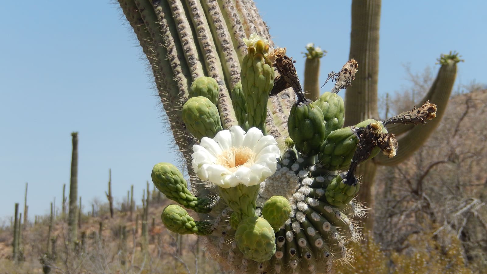
The NPS gives the flowering season as late April through June, with white flowers in May and June giving way to bright-red fruit that the Tohono O'odham have harvested for generations. The flowers open at night and are worked by a mix of nocturnal and daytime pollinators -- bats, bees and white-winged doves are all cited locally; the Red Hills and Rincon Mountain visitor centers can tell you what is actually active during your visit. The bloom is one of the genuine wildlife and botanical events of the Sonoran Desert calendar. Two woodpecker species do the excavating -- the Gila woodpecker and the gilded flicker -- boring into the fleshy column to form nesting chambers, which dry and harden into "boots." Those cavities are then reused by elf owls (among the world's smallest owls, up from Mexico for the summer), cactus wrens, purple martins, kestrels, and other cavity nesters.
The saguaro grows only in the Sonoran Desert, and the Sonoran Desert extends only into southern Arizona and northwestern Mexico. This is the only place on Earth this species grows in the wild. The density of saguaros in and around Tucson -- particularly in both districts of the national park -- represents some of the largest concentrations of the plant anywhere in its range.
Fees and Passes
Saguaro National Park charges a standard NPS vehicle fee for entry. The East and West districts have separate entry stations, but the National Park Service states that the standard entrance pass is good for seven days and includes both the Tucson Mountain District (West) and the Rincon Mountain District (East) -- you do not pay a second time to visit the other side of the city. One practical trap: the park does not accept cash at any purchase location, only credit and debit cards. Verify the current fee amount at nps.gov/sagu before your trip; NPS fees change periodically. A per-person fee applies for pedestrians and cyclists at a lower rate than the vehicle fee.
The America the Beautiful annual pass (also called the National Parks and Federal Recreational Lands Pass) covers the entry fee at both Saguaro districts. If you plan to visit multiple national parks or NPS sites in the same trip or year, the annual pass typically pays for itself within a few entries. The pass is available at either Saguaro entrance station, at other NPS sites, or via recreation.gov. Senior, military, and access passes are also available -- verify current eligibility and pricing at nps.gov/planyourvisit/passes.htm.
Both districts have visitor centers with exhibits, ranger staff for questions, and current trail condition information. The Rincon Mountain Visitor Center (East) is accessible from Old Spanish Trail. The Red Hills Visitor Center (West) is on Kinney Road near the Arizona-Sonora Desert Museum. Visitor center hours vary seasonally -- verify opening times before building your day around ranger assistance or picnic area access.
When to Go and What the Heat Means
October through April is the prime season for Saguaro National Park, but do not read "prime season" as "cool." National Weather Service normals for Tucson put the average high at 86 degrees Fahrenheit in October and 83 in April -- shoulder-month hiking still needs an early start and a full water carry. The genuinely mild window is December through February, when normal highs sit in the mid-60s. Mornings are cool across the whole season. Early spring (February and March, normal high 76) brings the possibility of wildflowers in the lower desert, and by late April the saguaros begin their bloom cycle. Winter and spring light -- long shadows, warm tones, clear air -- is also when saguaro photography is at its best.
Summer in Saguaro is a genuine physical risk. The National Weather Service puts Tucson's normal high at 101 degrees Fahrenheit in June, 100 in July and 99 in August, with an all-time record of 117; NWS calls extreme heat "by far the number-one, weather-related killer in Arizona." The low elevation of most accessible trails means there is no natural escape from heat inside the park's lower zones, and there are no water sources on most routes.
The park's own hiking-safety guidance is the standard to plan against, and it is more specific than most visitors expect. On a hot, dry summer day, the NPS says you should be drinking one quart of water per hour of hiking; in winter, take at least two quarts for the day. Bring electrolyte replacement -- sports drinks or salty snacks -- because water alone is not enough. Drink before you feel thirsty; the humidity is low enough that you dehydrate without the usual warning signs. Avoid 10 AM to 4 PM entirely in summer, the hottest part of the day, and start early in the morning or close to sunset instead. If you are camping in the backcountry, the NPS minimum is one gallon of water per person per day, more in the low country in summer, and all surface water must be treated. Leave your itinerary with someone before you go.
The monsoon is the second hazard, and it arrives earlier than most guides say. The National Weather Service defines the Arizona monsoon as June 15 through September 30; the NPS flags flash flooding at Saguaro from July through September. Afternoon thunderstorms build over the mountains and move across the desert, and the park's instruction is to avoid hiking in canyons and washes -- dry riverbeds -- whenever thunderstorms are occurring anywhere nearby. If you are already out and water is running, do not cross a flooded stream; wait until the flow subsides. Lightning is the paired risk on this park's best routes: NWS notes it can strike up to 10 miles from the parent storm, so if you hear thunder you are close enough to be hit. Get off hilltops, ridges and flat open ground -- which is to say, off Tanque Verde Ridge and off the Wasson Peak ridgeline. Note that the NWS stopped recommending the old "lightning crouch" in 2008 because it "doesn't provide a significant level of protection"; there is no safe position outdoors. The only real answer is a substantial building or a hard-topped vehicle, reached before the storm arrives, which on a ridge route means turning around early rather than improvising.
Three wildlife hazards are worth knowing before your first desert hike, all per NPS guidance. Rattlesnakes: never put your hands or feet into a place you cannot see; if bitten, stay calm, restrain movement, and get medical help immediately. Africanized honey bees are established here -- if a colony attacks, run, and keep running, since bees typically break off a quarter to a half mile from the hive. Mountain lions: do not hike or jog alone, keep children close and in sight, and if you meet one, do not run. Stand and face it, make eye contact, and make yourself look as large as you can. Cell coverage is unreliable across much of both districts, so do not treat a phone as your safety plan. Emergencies: 911.
October is when comfortable hiking conditions return. The monsoon's secondary benefit is that the annual plants green up and wildflowers appear again in late summer and early fall, giving the desert a second life before the main season begins.