Flagstaff residents have a particular relationship with Jerome that visitors don't. It is not a road trip for them — it is an afternoon. The 57-mile drive on AZ-89A takes about 60 to 70 minutes, passes through Oak Creek Canyon (one of Arizona's three genuinely great scenic drives), and deposits you in a copper mining ghost town that operates on a completely different calendar than Flagstaff's pine-forest college-town energy.
Flagstaff is 6,910 feet of elevation, ponderosa pine, NAU students, ski season at Arizona Snowbowl on the San Francisco Peaks, and serious winters that shut down roads. Jerome is 5,066 feet, copper-era Victorian buildings on a cliffside, 450 permanent residents, a winery owned by the vocalist of Tool, and a paranormal reputation that Travel Channel has documented multiple times. The drive between them is Arizona compressed into a single hour.
This is the story of what that drive feels like and why it works as an escape. For the mile-by-mile route details, fuel stop locations, and seasonal road condition notes, see the Flagstaff to Jerome route logistics page. This piece covers the experience, not the checklist.
📌 Full route logistics: Flagstaff to Jerome driving guide
Mile markers, fuel stop locations (Sedona is the last reliable option before Jerome — 23 miles ahead), parking at Hull Avenue (85 spaces, fills by 11 AM on weekends), seasonal AZ-89A road conditions through Oak Creek Canyon, and alternate routes when the canyon is closed. Everything practical is on that page. This post is about what the drive means, not how to execute it.
Act One: Leaving at 7,000 Feet
The drive south from Flagstaff on AZ-89A begins in the ponderosa pine forest that covers the San Francisco Peaks volcanic plateau. At 6,910 feet, Flagstaff is one of the highest-elevation cities of its size in the contiguous United States. The surrounding forest is genuine subalpine: Ponderosa and Engelmann spruce, elk in the meadows east of town along US-180, snowpack from November through March, and a low-angle winter sun that barely clears the tree line.
You leave all of this within 8 miles of downtown Flagstaff. AZ-89A drops off the plateau edge at the Mogollon Rim — the same escarpment that defines Arizona's topographic split between the high country north and the desert south. The descent from the Rim begins at the Oak Creek Canyon overlook, elevation approximately 6,600 feet, where AZ-89A cuts into the canyon head.
The overlook pullout (capacity: 30 vehicles, often full by 10 AM on weekends) is worth stopping at on a first drive. You are looking down 1,200 feet into Oak Creek Canyon, carved into Coconino Sandstone — a creamy buff formation laid down in Permian-period sand dunes approximately 270 million years ago. The canyon walls you see here are the same geological layer that forms the Kaibab Plateau above the Grand Canyon, just exposed at a different elevation by a different river system.
Act Two: The Canyon Descent
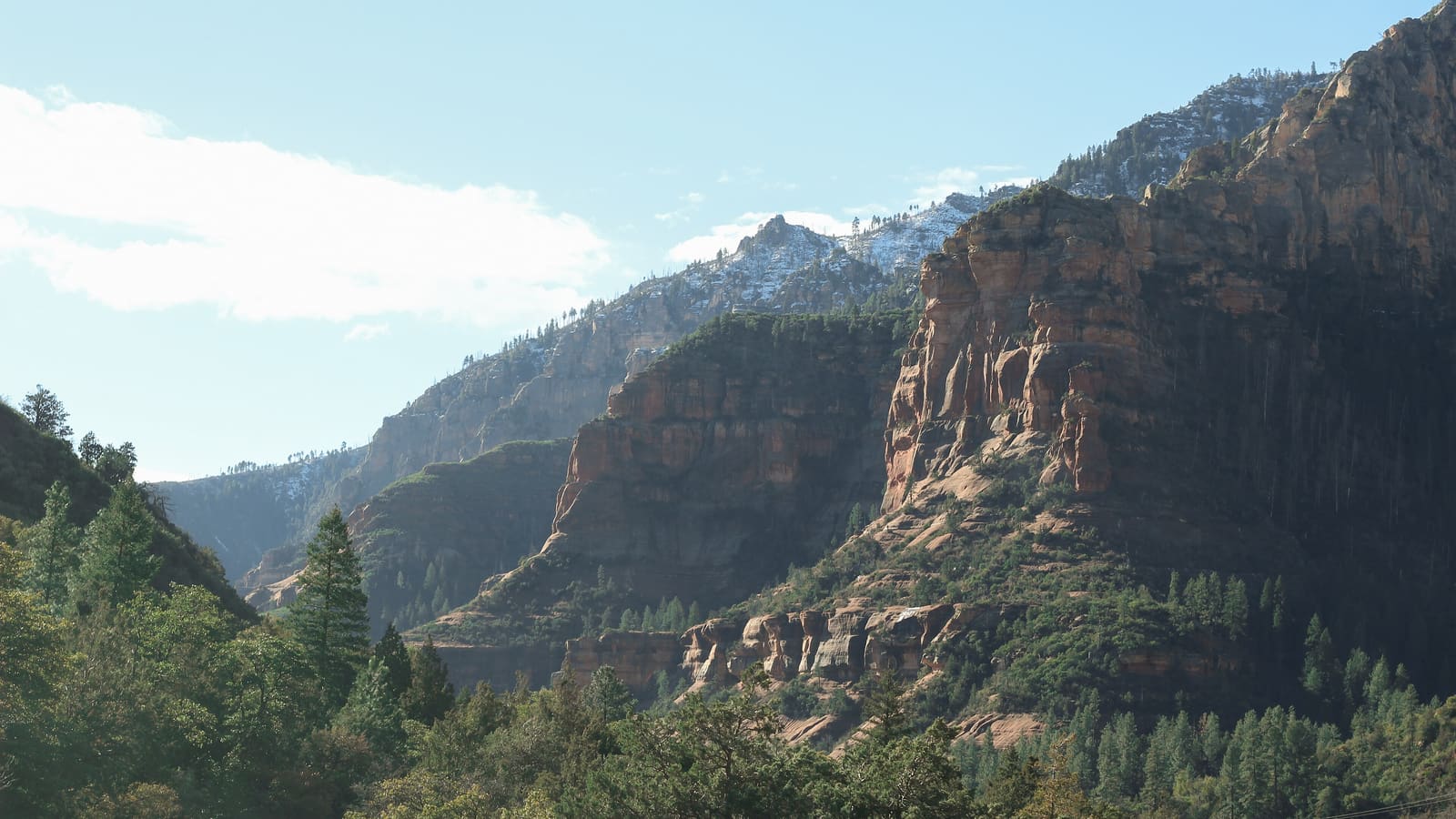
The 16-mile drive through Oak Creek Canyon is the centerpiece of the Flagstaff-to-Jerome route. It descends approximately 2,500 feet from canyon rim to Sedona's valley floor, passing through four geological formations in sequence from top to bottom:
- Kaibab Limestone — white, marine fossils, canyon rim at roughly 6,600 feet
- Coconino Sandstone — buff and cream, cross-bedded Permian dunes, the cliff face that defines the canyon walls
- Hermit Shale — red-brown, mid-canyon color band visible from AZ-89A
- Supai Formation — deep red, ancient river deposits, canyon floor approaching Sedona
Slide Rock State Park at 6871 N. AZ-89A is the main pause point in the canyon. Natural sandstone water slides in Oak Creek, open daily at 8 AM, $10 to $20 vehicle fee depending on season and advance reservation status. On summer Saturdays, the park parking lot (approximately 150 vehicles) fills to capacity by 10 AM and closes to new entries — arrive at 8 AM or plan a weekday visit. Fall foliage in late October, when the canyon maple and Arizona sycamore turn, makes this one of Arizona's best seasonal drives by any measure.
Below Slide Rock, the canyon widens and the red Sedona formations begin replacing the white Coconino Sandstone on the walls. The Schnebly Hill formation — the specific red-and-orange sandstone that gives Sedona its defining color — starts appearing about 3 miles before the town boundary. This visual transition from oak forest canyon to red rock country happens in less than a mile of road and is worth slowing down for if there is no traffic behind you.
Act Three: Through Sedona
The drive through Sedona on AZ-89A is the honest obstacle between Flagstaff and Jerome. Sedona's commercial district — the stretch from the North Sedona junction through Uptown to the Y intersection where AZ-89A splits from SR-179 — has become one of Arizona's most congested road segments on weekend mornings between 10 AM and 2 PM.
Sedona sits at 4,350 feet. By the time you reach it from Flagstaff's 6,910 feet, you have already descended 2,560 feet through Oak Creek Canyon. The remaining descent to Cottonwood at 3,314 feet and the re-ascent to Jerome at 5,066 feet still lie ahead. Sedona's traffic is often the only place the Flagstaff-to-Jerome trip takes noticeably longer than expected.
On weekday mornings before 10 AM, Sedona traffic is manageable. On Saturday between 10 AM and noon, the Uptown stretch can add 20 to 30 minutes. The partial bypass: from the north end of Sedona on AZ-89A, take Jordan Road west for 0.8 miles to the Dry Creek Road junction, rejoining AZ-89A and skipping the worst of the Uptown intersections. This saves no distance but avoids the main traffic choke point.
Alternatively, work Sedona into the plan. The last fuel stop before Jerome is at the Safeway plaza on AZ-89A in West Sedona, 23 miles ahead of Jerome and not reliably available after. Coffee Pot Restaurant at 2050 AZ-89A (101 omelet options, a 30-minute wait on weekday mornings) is worth pulling into — eat, let the early Sedona traffic clear, and continue to Jerome with a full tank and no midday hunger problem.
Act Four: The Verde Valley and the Switchback Climb
South of Sedona, AZ-89A continues through red rock formations before emerging onto the Verde Valley floor near Cottonwood at 3,314 feet. This is the low point of the entire drive — you have descended 3,597 feet from Flagstaff and will now climb 1,752 feet back up to Jerome in 8 miles.
The Verde Valley section is often described dismissively as the "boring" part of the Flagstaff-to-Jerome route. This is wrong. The Verde River riparian corridor — a green cottonwood tree band against buff desert hillsides, with Mingus Mountain's roughly 7,800-foot peak rising above Clarkdale — has a different beauty than Oak Creek Canyon: wider, quieter, and agricultural rather than geological. The Verde Valley is also Arizona's primary wine-producing region. The vineyards you pass near Page Springs Road are working farms producing grapes for Caduceus Cellars, Page Springs Cellars, and a dozen other labels that have made this appellation nationally recognized.
The switchback climb to Jerome starts near the AZ-89A and AZ-89 junction northeast of Cottonwood. Eleven documented switchbacks in 3 miles gain the bulk of the 1,752-foot elevation change. If you have not yet understood why Jerome exists where it exists, this climb makes it clear: Cleopatra Hill holds the United Verde copper deposit that made Jerome one of the wealthiest cities per capita in the United States in the 1910s. The road climbs because the ore was up here, and the ore was worth the road.
Why This Feels Like an Escape (The Flagstaff Perspective)
Flagstaff in summer is a university town with Grand Canyon tourist traffic, summer session students, and the compressed energy of a mountain city in its busiest season. Flagstaff in winter is ski season — serious cold, real snowpack, a distinctly different register from the rest of Arizona. Both versions of Flagstaff are good. Neither one is Jerome.
Jerome has none of Flagstaff's seasonal density. Its 450 permanent residents are artists, gallery owners, wine bar operators, and people who chose the isolation consciously. The Spirit Room at the Connor Hotel on Main Street is a genuine live music bar with a 30-year history, not a tourist performance — live music runs Thursday through Sunday until midnight or later. Caduceus Cellars at 158 Main St is a real winery making serious small-production red wines. The Jerome Grand Hotel at 200 Hill St is genuinely the 1926 United Verde Copper Company Hospital, not a themed attraction.
The result is a place that operates on a slower rhythm than either Flagstaff or Sedona. When you arrive in Jerome after 60 minutes from Flagstaff, you have not driven far by Arizona standards. But you have left Flagstaff's register entirely — the university energy, the ski resort pressure, the Grand Canyon corridor volume. That is the escape. It takes one hour and does not require a long weekend.
The Day Trip Sequence From Flagstaff
Flagstaff visitors have one natural advantage over Phoenix visitors doing Jerome: they are already at elevation and acclimated. Jerome's 5,066 feet is 1,844 feet below Flagstaff, not above it — there is no altitude adjustment, no slowing down, no headache on the first afternoon. Here is how to structure the day:
- Depart Flagstaff 8:00 AM. AZ-89A south, pick up the canyon at the Mogollon Rim overlook. Canyon overlook stop: 10 minutes. Slide Rock State Park optional (weekday or arrive at 8 AM on weekends).
- Arrive Jerome 9:30 to 10 AM. Park at Hull Avenue lot (85 spaces, free, open until midnight). Jerome State Historic Park at 100 Douglas Rd opens at 8:30 AM — best before-crowds window.
- 10:30 AM: Main Street walk. Caduceus Cellars at 158 Main St opens at 11 AM on weekends, noon on weekdays. Gold King Mine at 1000 Perkinsville Rd opens at 9 AM daily ($12 adults, $8 kids, live donkeys and 50-plus vintage vehicles).
- Noon: Lunch at Haunted Hamburger at 26 Main St ($12-$20, no reservations, weekday waits are manageable) or The Asylum at 200 Hill St in the Jerome Grand Hotel ($25-$45, reservations required).
- 2 to 4 PM: Afternoon at leisure — gallery walk, Caduceus Cellars, Jerome Grand Hotel self-guided history.
- Return Flagstaff: Via I-17 north from Cottonwood for 1 hour 10 minutes efficient; via AZ-89A back through Sedona and Oak Creek Canyon for the scenic repeat with different afternoon light.
Book Jerome Tours and Ghost Experiences via Viator
Jerome ghost tours start at 10 PM when day-trippers are gone ($20-$25 per person, 90 minutes, book 2-plus weeks ahead on weekends). Verde Valley wine tours departing from Flagstaff are also available — they handle the driving, parking, and tasting room logistics. Browse available tours and book with instant confirmation on Viator.
Browse Jerome Tours on Viator Affiliate link — we may earn a commission at no cost to you.The Route Flagstaff Locals Actually Take
Ask a Flagstaff local who does the Jerome drive regularly whether they take AZ-89A through Oak Creek Canyon or I-17 south to Cottonwood, and they will almost uniformly say the canyon. The I-17 route via Exit 287 to AZ-260 west adds approximately 15 miles and saves no meaningful time while bypassing the only genuinely great scenic section of the drive.
The exception: if you are doing Jerome as an evening trip departing after 3 PM, the I-17 route avoids the late-afternoon Oak Creek Canyon traffic (which can be heavy with day-trippers returning to Flagstaff). In that case, take I-17 south to AZ-260 west to Cottonwood, drive up the switchbacks to Jerome for the golden-hour light and evening atmosphere, and return via I-17 after the Spirit Room. The round trip on this routing is about 2 hours 20 minutes of driving for a 4 to 5-hour Jerome evening.