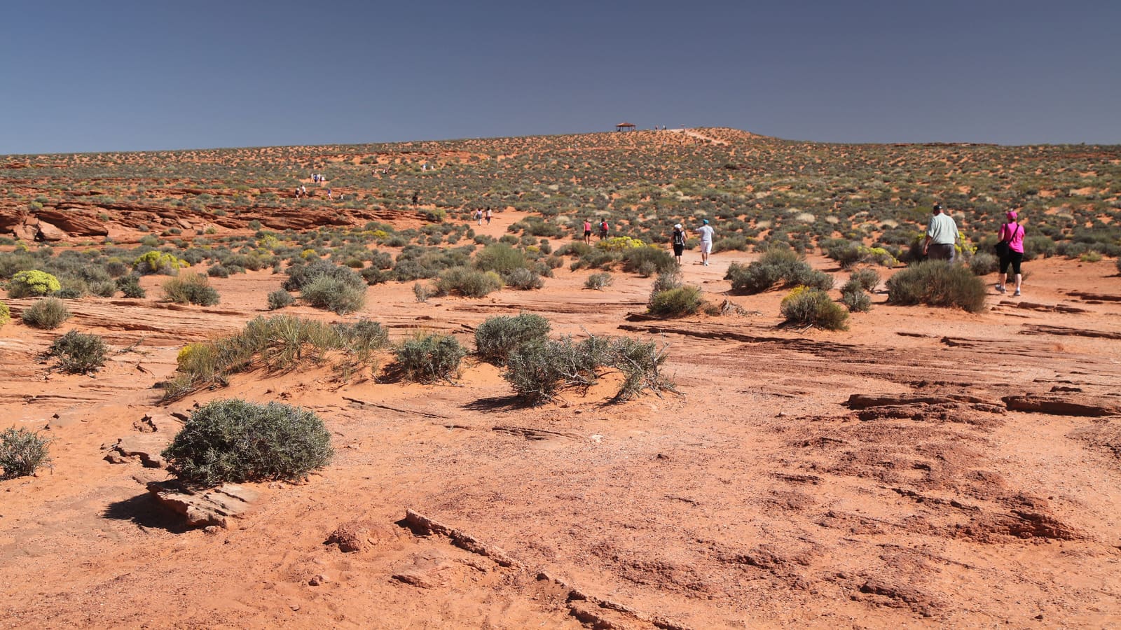
Horseshoe Bend Rim Walk
The Horseshoe Bend trail runs from a paid parking lot on US-89, about 5 miles south of the Carl Hayden Visitor Center, out to the canyon rim overlooking the Colorado River's bend. The National Park Service lists the hike at 1.5 miles round trip on a hardened path, roughly 20 minutes each way. The overlook and that stretch of river are inside Glen Canyon National Recreation Area, but the parking lot is run by the City of Page and charges its own fee -- National Park Service passes do not cover it.
The path is relatively flat and packed, and the National Park Service rates it accessible under the Americans with Disabilities Act -- it takes wheelchairs, strollers, and leashed dogs. Shade is very limited: there are two shade structures along the length of the trail, but none at the overlook itself, so do not count on getting out of the sun once you reach the rim. The NPS advises avoiding the hike during the hottest part of the day. It is the most heavily trafficked trail on this list, so expect company, particularly in the hour after sunrise and before sunset when the light is best. At a comfortable pace, most hikers cover the round trip in under an hour, not counting time spent at the rim.
One thing to understand before you go: there are railings at the edge of the overlook's viewing platform, but not along the trail. The National Park Service warns that much of the rim remains exposed to a 1,000-foot drop, so watch your footing and keep track of children and pets the whole time you are near the edge -- do not assume the whole rim is fenced.
This is the trail most first-time visitors to Page choose, largely because of the view rather than the hiking itself -- treat it as a short, exposed walk to a dramatic overlook rather than a wilderness hike.
Hanging Garden Trail
The Hanging Garden Trail is a shorter route inside Glen Canyon National Recreation Area, managed by the National Park Service, named for a spring-fed colony of plants clinging to a sandstone alcove at the end of the route -- an unusual sight in an otherwise dry landscape. The National Park Service lists it at 1.5 miles round trip. The turn-off is about a quarter mile east of the Glen Canyon Bridge on US-89 -- the opposite side of the bridge from the Carl Hayden Visitor Center -- with trailhead parking roughly 500 yards off the highway. It draws far fewer visitors than Horseshoe Bend, which makes it a reasonable choice if you want a quieter outing without driving far from town.
Like most trails in the area, the surface is a mix of slickrock and sandy sections, and shade is minimal to none. The trail is mostly flat until the last stretch, where you climb the side of a hill to reach the alcove, and footing on slickrock can be uneven, so supportive footwear is worth having even though the trail is not long. Trailhead access and current trail condition are worth confirming with the National Park Service at Glen Canyon National Recreation Area before you go, since signage and parking at lesser-known trailheads around Page can change.
Page Rimview Trail
The Page Rimview Trail -- the City of Page refers to it as the Rim Trail -- is an eight-mile paved multi-use path that circles Manson Mesa, the mesa the town of Page sits on, offering views out toward Lake Powell and the surrounding desert. Unlike Horseshoe Bend or Waterholes Canyon, it is accessible directly from several points around town, which makes it a practical option if you want a walk or short hike without driving anywhere.
Because it connects to multiple access points around town, you can treat it as a flexible out-and-back of whatever length suits your group rather than committing to the full loop. As with the other trails on this list, shade is limited. Being paved and multi-use, it is shared with cyclists and other non-motorized traffic, so stay aware of your surroundings. Confirm current trail conditions and access points with the City of Page Parks and Trails department.
Waterholes Canyon (Permit-Dependent)
Waterholes Canyon is a slot canyon a short distance south of Page, on Navajo Nation land within the Le Chee Chapter, just off US-89 near milepost 542. It has a reputation as a quieter, less-visited alternative to Antelope Canyon. Access is split: Navajo Nation Parks and Recreation requires a backcountry permit for the lower section of East Waterholes, sold through the Lake Powell Navajo Tribal Park visitor center, while the upper section of East Waterholes is accessible by guided tour only. Policies around independent access have shifted over time.
Given how often access rules for Navajo-permitted slot canyons change, do not assume you can simply walk in -- confirm current permit requirements, fees, and whether a guide is mandatory directly with Navajo Nation Parks and Recreation or a licensed operator before planning a trip around this canyon, and sign in and out as the permit requires. Slot canyons in this region are also subject to flash flood risk during monsoon season, which the National Weather Service defines as June 15 through September 30 -- a wider window than many visitors assume. A slot canyon can flood even when the sky above you is clear, because a storm miles upstream can send water through with little warning. Check the forecast and any flash flood watches or warnings the morning of your hike, and do not enter a slot canyon if storms are in the area.
Heat, Water, and General Cautions
Every trail covered here shares the same core hazard: heat and sun exposure rather than elevation gain or technical terrain. None of these routes have reliable shade for a meaningful portion of their length, and none have water available along the trail. Carry more water than the distance alone would suggest, especially from late spring through early fall when daytime temperatures regularly climb into a range that makes dehydration a real risk even on short hikes.
Early morning starts reduce heat exposure and, for Horseshoe Bend in particular, also tend to mean better light and lighter crowds. Sun protection -- a hat, sunscreen, and sunglasses -- is worth treating as mandatory gear rather than an afterthought given the exposure on all of these trails.
Cell service can be inconsistent at some trailheads and along parts of these routes. Let someone know your plan before you head out, and download offline maps in advance if you are relying on a phone for navigation.