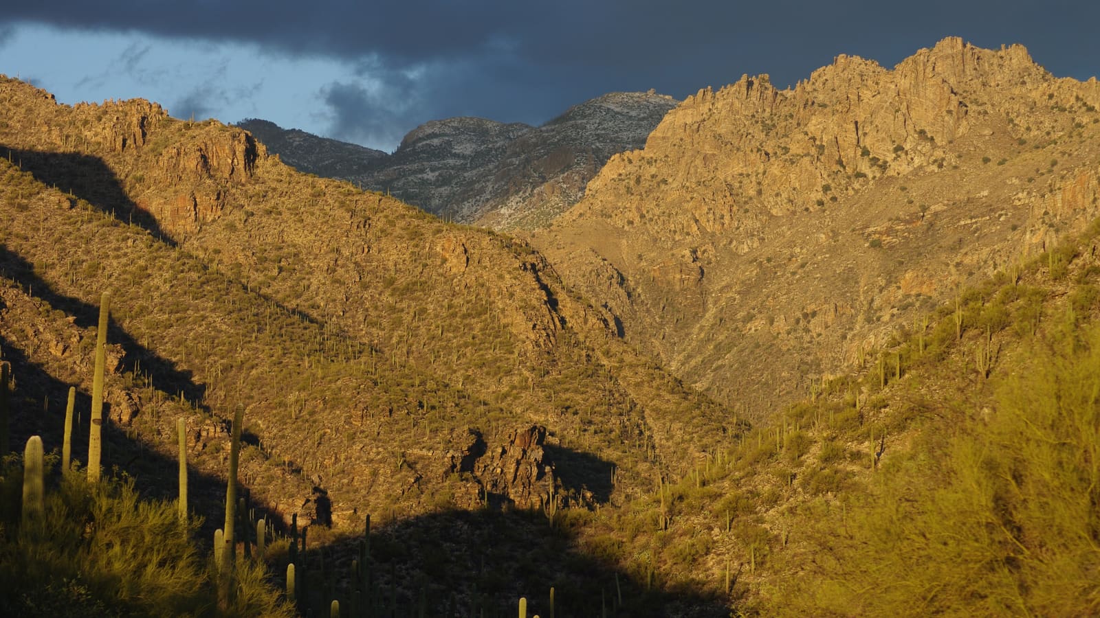
What Sabino Canyon Is
Sabino Canyon Recreation Area sits at the edge of Tucson in the foothills of the Santa Catalina Mountains, managed by the Coronado National Forest. The canyon is carved by Sabino Creek, which drains from the higher elevations of the Santa Catalinas, and the combination of perennial or near-perennial water and canyon topography creates a riparian corridor that stands out sharply from the surrounding Sonoran Desert. Cottonwoods, sycamores, and other water-dependent vegetation line the creek in a way that is uncommon in the open desert, giving the canyon a shaded, cooler microclimate relative to much of the rest of the Tucson basin.
The recreation area includes both Sabino Canyon proper and the adjacent Bear Canyon, each with its own road or trail corridor and set of access points. Sabino Canyon is the more developed and heavily visited of the two, with the paved shuttle road and a wider range of trailheads, while Bear Canyon tends to see fewer visitors and leans more toward hikers heading for its namesake trail and the seasonal waterfall it is known for when conditions allow.
The Shuttle System
Private vehicles are not permitted on the paved road that runs up Sabino Canyon, which is instead served by the Sabino Canyon Crawler -- an open-air electric shuttle, still called "the tram" by most locals after the diesel vehicles it replaced. The Sabino route is a one-hour round trip with nine stops, covering about 3.7 miles of paved road, and each shuttle seats up to 48 passengers. A separate Bear Canyon route with three stops serves the Bear Canyon Overlook Picnic Area and the Seven Falls trailhead. When the creek is running high, the operator switches to a shortened high-water tour rather than the full route. This arrangement keeps the canyon corridor quieter and more walkable than it would be with regular vehicle traffic, and the narration on the shuttle typically covers some of the canyon's natural and human history, though the specific content can vary by driver and by season.
Most visitors use the shuttle to reach a stop of interest, get off, walk a trail or a stretch along the creek, and either walk back down or catch a later shuttle. This makes Sabino Canyon flexible for a wide range of visitors -- it can be a short, low-effort outing centered on the lower stops, or the access point for a considerably longer hike into the surrounding forest for visitors who want more distance and elevation gain. Shuttle departures are hourly, with the first at 9:00 AM and the last leaving at 4:00 PM, and the visitor center and shuttle desk run 8:00 AM to 4:30 PM -- but confirm current hours, frequency and fares with the concessioner at sabinocanyoncrawler.com before visiting, since departure frequency is seasonal. Trail, creek and closure information comes from the Coronado National Forest.
Popular Walks and Trails
The lower stretches of Sabino Canyon, closest to the visitor center, include shorter walking options that stay near the creek and are accessible without significant elevation gain -- a reasonable choice for visitors with limited time or mobility, or anyone who simply wants to experience the riparian setting without a long hike. Nine stone bridges cross Sabino Creek along the canyon road, built out of native granite by Depression-era relief crews -- the road was begun with Federal Emergency Relief Administration funds in the fall of 1934, and Works Progress Administration money completed the nine bridges and the Sabino dam in 1935. The walk along or near the creek at these lower stops is one of the more reliably shaded options in the Tucson area during the warmer months.
For visitors seeking more distance, trails branch off from various shuttle stops into the surrounding Coronado National Forest, ranging from moderate day hikes to longer routes that connect toward the higher terrain of the Santa Catalinas. The Bear Canyon corridor's trail toward Seven Falls is the frequently cited longer option, and it is longer than most visitors expect: the Forest Service puts it at approximately 8.5 miles round trip from the Sabino Canyon Visitor Center, with the Bear Canyon shuttle cutting roughly 4 miles off that. Plan against the 8.5-mile figure unless you hold a shuttle ticket -- that route runs daily in winter but only on weekends in summer. It crosses the stream repeatedly, so expect wet feet when water is running. The falls themselves depend heavily on recent rainfall and can be reduced to a trickle or dry in drought conditions; check current water conditions with the Coronado National Forest before planning a hike specifically around seeing them.
The Desert Riparian Setting
What distinguishes Sabino Canyon from much of the rest of the Tucson-area landscape is the riparian corridor itself -- a band of water-dependent vegetation and habitat that follows Sabino Creek through otherwise dry Sonoran Desert terrain. This kind of desert riparian environment supports a different and often denser range of wildlife than the surrounding desert slopes, including a variety of bird species that rely on the shade and water. Early morning is generally the best window for wildlife viewing, when animals are more active and temperatures are more comfortable.
The desert slopes rising above the creek corridor remain classic Sonoran Desert terrain, with saguaro cacti and other characteristic desert vegetation visible from the canyon road and most trails. The contrast between the shaded creek corridor and the exposed, saguaro-covered slopes above it is part of what makes the canyon visually distinctive -- within a short walk you move between two quite different desert microenvironments.
Best Time of Day and Year
Early morning is generally the best time to visit Sabino Canyon, particularly from roughly April through October, when Tucson-area temperatures climb quickly once the sun is up. The exposed sections of trail away from the creek can get hot well before midday during the warmer months, and starting early also tends to mean better wildlife activity and lighter crowds. In the cooler months, roughly November through March, timing is more flexible and midday visits are generally comfortable.
Weekends and holidays bring heavier visitation, particularly at the lower, more accessible stops near the visitor center. A weekday visit, or an early weekend start, generally means an easier experience with the shuttle and less competition for parking near the entrance. Water levels in Sabino Creek also vary by season -- late winter and spring tend to show more water, while the driest parts of the year can leave stretches of the creek reduced or dry.
Practical Notes
A Coronado National Forest recreation fee applies for parking at the Sabino Canyon entrance -- $8 per vehicle per day or $10 per vehicle per week, satisfied by an Interagency (America the Beautiful) pass, including the Annual, Senior, Access and Military versions, or by a $40 Coronado National Forest annual pass. Shuttle fares are separate and are not included in that fee. Confirm current amounts with the Forest Service rather than relying on an older figure, since fees and passes are updated periodically. Bring water regardless of how short a visit you plan; shade along the creek does not eliminate the need for hydration in desert heat, and not every stretch of trail is shaded.
Sturdy footwear is worth wearing even for the shorter walks, since trail surfaces vary and can be uneven near the creek crossings. If a longer hike into the surrounding forest is the goal, treat it like any other desert hike -- carry more water than seems necessary, check the forecast, and let someone know your plan, since conditions in the backcountry sections beyond the shuttle road can change quickly with weather.
Safety in the Canyon: Water, Heat, and Storms
The same water that makes Sabino Canyon beautiful is the thing to respect most. It is a drainage that funnels runoff out of the Santa Catalina high country, and the National Weather Service defines the Arizona monsoon as June 15 through September 30 -- the season when afternoon storms build over the mountains and send water down washes and creeks. The National Park Service guidance for this terrain applies directly here: avoid hiking in canyons and washes when thunderstorms are occurring anywhere nearby, even if the sky above you is clear, and do not cross a flooded stream -- wait until the flow subsides. The risk is amplified by the 2020 Bighorn Fire, a lightning-caused fire that burned through the Santa Catalinas including the Pusch Ridge Wilderness and affected more than two-thirds of the area's trail system; burned ground sheds water instead of absorbing it, which means faster runoff and debris in the drainages below.
Driving deserves the same caution as walking. NWS Tucson's instruction is blunt -- "never ever drive into a flooded roadway," and never drive around barricades -- because it takes only about one to two feet of water to float most vehicles, including SUVs. Turn around, don't drown.
Heat is the other constant. NWS normal highs for Tucson are 101 degrees Fahrenheit in June, 100 in July and 99 in August, and NWS states that extreme heat is "by far the number-one, weather-related killer in Arizona." Shade along the creek does not change the arithmetic on the exposed sections. The NPS standard for desert hiking nearby is one quart of water per hour of hiking on a hot summer day, two quarts for a winter day, plus electrolytes -- sports drinks or salty snacks -- because water alone is not enough. Avoid being out from 10 AM to 4 PM in summer. Do not drink untreated creek water.
Lightning is the paired monsoon hazard, and it matters on the open canyon slopes above the creek. NWS notes lightning may strike up to 10 miles from the parent storm, so if you can hear thunder you are already within range. There is no safe place outdoors: the NWS stopped recommending the old "lightning crouch" in 2008 because it "doesn't provide a significant level of protection." Get to a substantial building or a hard-topped vehicle, and wait 30 minutes after the last thunder before heading back out. On wildlife, the NPS guidance for the surrounding desert holds: never put hands or feet where you cannot see, because rattlesnakes shelter in shaded gaps; if Africanized honey bees attack, run and keep running, since they typically break off a quarter to a half mile from the hive; and if you meet a mountain lion, do not run -- stand and face it, make eye contact, and make yourself look as large as you can. Emergencies: 911.