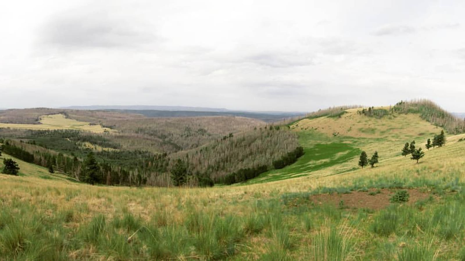
Escudilla Mountain and the Escudilla Wilderness
Escudilla Mountain rises to 10,912 feet in the Apache-Sitgreaves National Forest's Alpine Ranger District, making it Arizona's third-highest summit, behind Humphreys Peak near Flagstaff and Mount Baldy in the White Mountains. Its bowl-shaped ridgeline is visible from a wide arc of the surrounding high country, and the mountain gives its name to the 5,200-acre Escudilla Wilderness, which Congress designated in the Arizona Wilderness Act of 1984. The wilderness encompasses the upper reaches of the mountain -- mixed conifer forest giving way to aspen groves and, near the summit, open subalpine grassland.
As federally designated wilderness, the standard rules apply: no motor vehicles, motorized equipment, or mechanized transport, including mountain bikes. Camping, hiking, and hunting are the primary permitted uses, and well-behaved dogs are allowed. The nearest town is Alpine, roughly 8,000 feet in elevation itself, which makes a practical staging point before you head up onto the mountain.
Aldo Leopold's "Escudilla" and the Last Grizzly
Escudilla's other claim to fame has nothing to do with elevation rankings. Conservationist Aldo Leopold, who worked as a young Forest Service ranger in this part of Arizona in the early 1900s, later wrote an essay titled "Escudilla," collected in his 1949 book A Sand County Almanac. The essay describes a grizzly bear known locally as Bigfoot, whose tracks around the mountain were, in Leopold's telling, part of what made Escudilla Escudilla. When the bear began killing cattle, a government trapper was sent to eliminate the threat, and after about a month's effort, he did.
Leopold used the episode to reflect on what a landscape loses when its apex predator is removed -- writing that the mountain "still hangs on the horizon, but when you see it, you no longer think of the bear. It's only a mountain now." The essay is widely read today as an early, plainly stated argument for what Leopold would go on to call a land ethic, and it is one of the reasons Escudilla is known well beyond Arizona's borders. There is no dedicated bear-viewing site or marker tied to the story today -- it lives in the essay itself, and in the mountain you're looking at while you read it.
The Escudilla Trail and the Fire Lookout
Escudilla National Recreation Trail #308 is the main route up the mountain, a maintained trail of about three miles that climbs from the Terry Flat Loop Road toward the summit and the site of the historic fire lookout. It is a genuinely high-elevation hike -- budget more time than the mileage alone suggests, and treat afternoon monsoon storms with the same caution you would on any exposed White Mountains summit.
The lookout itself has a real history: built in 1933, the 54-foot tower with its 14-by-14-foot live-in cab was, by some accounts, the tallest fire lookout tower in Arizona. It was severely damaged in the 2011 Wallow Fire and has been reported closed to all public entry since, due to safety concerns with the fire-weakened structure. That closure has held for years in trail reports, but conditions and forest orders change, so do not plan a trip around climbing the tower itself -- confirm current status with the Alpine Ranger District before you go, and treat the summit hike as the goal rather than the structure.
The Wallow Fire and Forest Recovery
The Wallow Fire started on May 29, 2011, and by the time it was contained in early July had burned roughly 538,000 acres across the Apache-Sitgreaves National Forest in Arizona and into New Mexico -- widely reported as one of the largest wildfires in Arizona history. The Escudilla Wilderness was severely affected, and the burn scar is still visible on parts of the mountain today.
Recovery has been real but uneven. Native grasses and dense stands of young aspen have come back among the burned conifer trunks in places, which is its own kind of scenery -- particularly striking during fall color season. Other routes have fared worse: Government Trail #119, a secondary access route into the wilderness, has been reported in poor condition since the fire. Check current trail reports before choosing a route, since post-fire deadfall and erosion can make an old map unreliable.
Visiting: Access, Rules and Timing
The usual jumping-off point is the town of Alpine, with the Terry Flat Loop Road providing forest-road access toward the trailhead. As with the rest of the high White Mountains, plan around elevation and weather rather than the calendar alone: snow can linger into late spring at this altitude, and summer brings the same monsoon thunderstorm pattern that affects Mount Baldy and the rest of the high country, with afternoon storms building through June 15 to September 30 by the National Weather Service's definition of the season. Start early, watch the sky, and get off exposed ridgeline before storms arrive.
Because this is designated wilderness, leave the mountain bike and any motorized gear at the trailhead, pack out what you pack in, and give the still-recovering burned sections of forest the same respect you would any regrowing landscape. Confirm current forest road and trail conditions with the Alpine Ranger District before you commit to a specific route, particularly anything involving Government Trail #119 or the lookout tower itself.