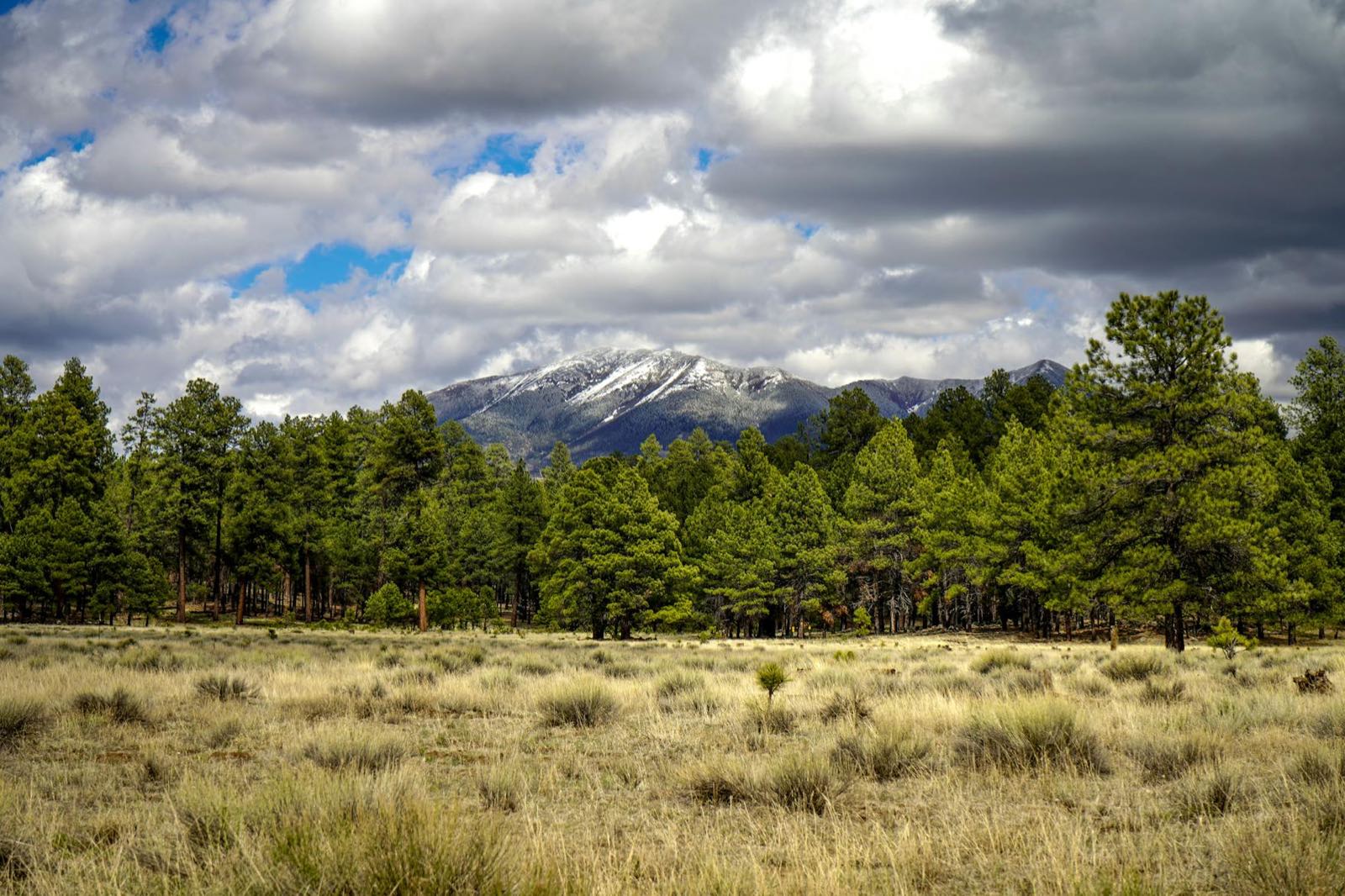
The White Mountains offer cool-forest hiking the Arizona desert simply can't match — Ponderosa pine giving way to spruce, fir, and aspen at higher elevations, mountain meadows, and the state's second-highest peak. Three trail zones anchor most visits: the everyday Pinetop-Lakeside Trail System, the more demanding Mount Baldy and West Fork trails toward Greer, and the Rim-edge hikes strung along the Mogollon Rim escarpment.
This guide breaks down each zone, what to expect, and the safety and access notes specific to hiking in this range — including the respectful handling of trails that border White Mountain Apache tribal land. For lodging and the rest of the trip, see our White Mountains travel guide, and for the village nearest Mount Baldy, see our Greer guide.
Altitude, Weather & the Mount Baldy Summit Closure
Trails here range from roughly 7,000 feet in the Pinetop-Lakeside system to well over 10,000 feet approaching the Mount Baldy Wilderness boundary. If you're arriving from lower elevation, expect to feel the altitude and pace yourself accordingly. Summer monsoon storms (July–September) bring afternoon lightning to exposed terrain — start early and be off high, open ground by early afternoon. The true summit of Mount Baldy sits on White Mountain Apache tribal land and is closed to non-tribal access; trails lead to the wilderness boundary, not the top, and that closure should be respected.
The White Mountains Trail System (Pinetop-Lakeside)
Centered on Pinetop-Lakeside, this is a connected network of looping, multi-use trails through Ponderosa pine forest, built for hikers, mountain bikers, and equestrians alike. Rather than a single named trail, it's a system of segments that can be combined into short loops for a casual morning walk or linked into longer half-day routes for a more ambitious outing — the flexibility is the point. It's the trail resource most visitors staying in the cabin country actually use day to day, precisely because it doesn't require driving out to a single trailhead.
Good for: a range of fitness levels, families, and anyone based in Pinetop-Lakeside who wants trail access without a long drive. [Verify current trailhead locations, mileage of specific loop segments, and any seasonal closures with the Forest Service before your visit.]
Mount Baldy & the West Fork Trails
For the big day, Mount Baldy — Arizona's second-highest peak — is the marquee hiking objective in the range. The West Baldy and East Baldy trails, both accessed from near Greer, climb through spruce-fir forest and open alpine meadow toward the mountain's upper reaches. As covered above, the actual summit lies on White Mountain Apache tribal land and is closed to non-tribal hikers out of respect for its sacred status; the public trail system takes you to the wilderness boundary, and that's the honest turnaround point, not the peak itself.
These are demanding routes by White Mountains standards — real elevation gain, high-altitude exertion, and exposure to fast-changing mountain weather. They reward hikers with fitness and some altitude tolerance more than casual walkers. [Verify current trail distances, elevation gain figures, and any permit or access requirements directly with the Forest Service or the White Mountain Apache Tribe before attempting either trail.]
Mogollon Rim-Edge Hikes
The Mogollon Rim is the great forested escarpment that separates Arizona's low desert from the high pine country, and it's the geological backbone of the entire White Mountains region. Trails and forest roads along and near the Rim's edge within the Apache-Sitgreaves National Forests offer sweeping views off the plateau, generally reached via the Rim Road (Forest Road 300) corridor. These hikes pair naturally with a broader scenic drive along the Rim — see our scenic drives guide for the road-trip version of this same terrain, and our lakes and fishing guide for the Rim lakes several of these trails pass near.
When to Hike the White Mountains
Late spring–summer (May–September) is the most reliable window overall, since higher trails toward Mount Baldy can hold snow into late spring in a heavy winter. Summer draws the cool-escape crowd, with afternoon monsoon thunderstorms a real consideration from July into September — start early on anything exposed.
Fall (late September–October) brings aspen color at higher elevations, especially toward Greer and the approach to Mount Baldy, and it's a favorite window for hikers who also want fall foliage.
Winter (December–March) can still offer hiking at lower elevations in the Pinetop-Lakeside Trail System, though snow and ice are a real factor — see our skiing guide for how the same terrain converts to Nordic skiing and snowshoeing when conditions allow.
Guided Hikes & Outdoor Tours in the White Mountains
Guided hiking experiences and other outdoor adventures across the high country — hand-picked from Viator. Affiliate disclosure.
Browse White Mountains ToursWe earn a small commission if you book — at no extra cost to you.
More White Mountains Guides
Greer, Arizona
The alpine village and trailhead access point for the Mount Baldy trails.
Alpine VillageScenic Drives
The Rim Road and the approach drives that pair with the Rim-edge hikes covered here.
Road TripLakes & Fishing
The Rim and high-plateau lakes several of these trails pass near.
Trout FishingSkiing & Snow
The same trail terrain in winter — Sunrise Park and Nordic/snowshoe options.
WinterFrequently Asked Questions
What is the White Mountains Trail System?
It's a network of looping, multi-use trails centered on Pinetop-Lakeside, built for hikers, mountain bikers, and equestrians through Ponderosa pine forest. Rather than one single trail, it's a connected system of loops and segments that can be combined into short walks or longer half-day outings, which makes it the everyday hiking resource for visitors staying in the Pinetop-Lakeside area rather than a single bucket-list destination hike.
Can you hike to the summit of Mount Baldy?
No — not to the true summit. Mount Baldy's actual peak lies on White Mountain Apache tribal land and is closed to non-tribal access out of respect for its sacred status. The West Baldy and East Baldy trails, both accessed from the Greer area, climb through spruce-fir forest and alpine meadow to the Mount Baldy Wilderness boundary, which is as far as the marked, public trail system goes. Respect the closure rather than pushing past posted boundary markers.
Are the White Mountains trails good for beginners?
Yes, in the Pinetop-Lakeside Trail System especially — it includes shorter, gentler loop segments suitable for casual hikers and families alongside longer connected routes for more ambitious days. The West Fork and West/East Baldy trails toward Mount Baldy are more demanding, with real elevation gain and higher-altitude exertion, and are better suited to hikers with some fitness and altitude tolerance.
What is the Mogollon Rim, and are there hikes along it?
The Mogollon Rim is the long forested escarpment that separates Arizona's low desert from the high pine country, running across the state and forming the geological backbone of the White Mountains region. Several trails and forest roads trace or approach the Rim's edge within the Apache-Sitgreaves National Forests, offering long views off the plateau; these Rim-edge hikes are generally reached via the Rim Road (Forest Road 300) corridor covered in our scenic drives guide.
When is the best season for hiking in the White Mountains?
Late spring through fall (roughly May through October) is the most reliable window, since higher-elevation trails toward Mount Baldy can hold snow into late spring in a heavy winter. Summer is popular for the cool temperatures relative to the desert, though afternoon monsoon thunderstorms in July and August mean starting early and being off exposed, higher terrain by early afternoon. Fall brings aspen color at higher elevations, particularly toward Greer and Mount Baldy. Winter hiking is possible at lower elevations but requires checking current snow conditions.