Where the Dunes Are and How They Relate to Yuma
The Imperial Sand Dunes, sometimes called the Algodones Dunes and known informally as Glamis, lie west of Yuma, just across the state line in Imperial County, California. Per the BLM, the dune field runs northwest to southeast for more than 40 miles, from near Niland down to the Mexican border by Winterhaven, in a band averaging about five miles wide. Interstate 8 crosses the southern end of that band -- the Buttercup area, and the part nearest Yuma -- while Highway 78 crosses it further north at Glamis. While it's a different state, it's close enough to Yuma to function as a straightforward day trip for visitors already based in the area. Because exact drive times depend on which access point or staging area you're headed to, check a current map and route before you leave rather than relying on a single fixed mileage figure.
The dunes are managed by the Bureau of Land Management, which is the authoritative source for current access points, fees, closures, and area designations. Because rules and open-area boundaries can change seasonally, always check the BLM's official page for the dunes before planning your specific route or activity.
California's Largest Dune System
The Bureau of Land Management calls the Imperial Sand Dunes the largest mass of sand dunes in California, and describes the wider Algodones system as one of the largest dune complexes in North America -- worth stating precisely, because "North America's largest" is a claim you'll see repeated online that the managing agency itself does not make. By BLM's figures the dunes were built from windblown sands of ancient Lake Cahuilla, run more than 40 miles from near Niland southeast to the Mexican border, average about five miles wide, and often rise 300 feet above the desert floor. Constant wind reshapes the dune faces over time, which is part of what gives the landscape its dramatic, sculpted look -- ridgelines and slopes that shift gradually from season to season.
Because the dune field is so large, different sections serve very different purposes -- some are designated for OHV recreation, others are set aside as wilderness with no motorized access at all. Knowing which zone you're in matters both for legal compliance and for the kind of experience you're looking for, whether that's engine noise and steep-face riding or quiet, undisturbed dune scenery.
OHV and Off-Roading Culture
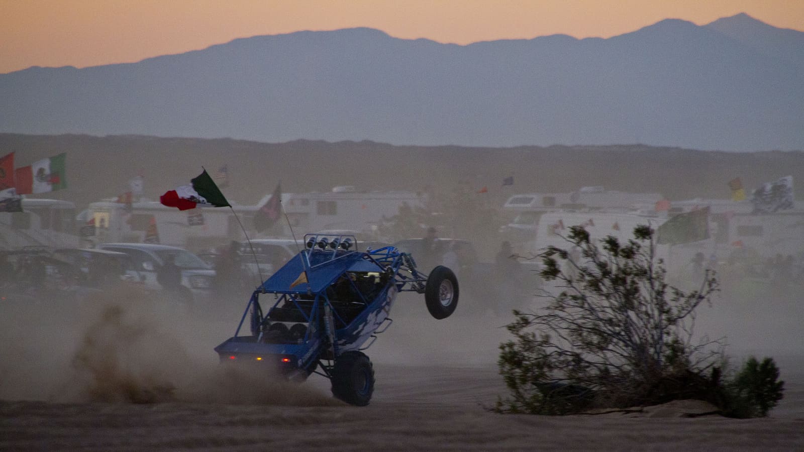
The dunes are one of the best-known off-highway vehicle destinations in the country, and the Glamis nickname is closely tied to that reputation among the OHV community. Riders bring dune buggies, ATVs, and dirt bikes to the designated open riding areas, and the terrain -- steep dune faces, soft sand, blind crests -- rewards experience and appropriate safety gear. Riding here is a genuinely different skill set from pavement or trail riding, and first-timers should expect a learning curve.
Permits, vehicle registration, and safety equipment requirements are set and enforced by the BLM, and staging areas fill heavily around major holiday weekends, most notably the long weekends in late fall and winter when the OHV community turns out in large numbers. If you're planning a riding trip, confirm current permit requirements, fees, and open-area maps directly with the BLM well before you go, since these details are updated periodically and vary by season.
The BLM's safety rules here are mandatory, not advisory. Every vehicle in the Imperial Sand Dunes Recreation Area -- including two-wheeled motorcycles -- must fly a safety whip: a securely mounted mast carrying a 6-by-12-inch red or orange flag, with the mast tip reaching 8 feet above the ground. That flag is what makes you visible over a blind dune crest, which is the single most dangerous feature of this terrain. Every person who operates or rides an ATV or recreational off-highway vehicle on California public lands must wear an approved safety helmet, regardless of age. A recreation permit is required and must be displayed in the windshield of your primary street-legal vehicle, date side out, on arrival. Confirm the current version of all of this with the BLM before you tow anything to the dunes.
A Famous Film Location
Beyond recreation, the dunes carry a long-running reputation in the film industry, and the BLM itself documents the headline example: Return of the Jedi filmed at Buttercup Valley, in the southern dunes nearest Yuma, in 1982, staging Jabba's sail barge and the Sarlacc pit there. The BLM also names Stargate, The Scorpion King, and Flight of the Phoenix among the productions shot at Buttercup, drawn by the same qualities that make the location visually striking for visitors -- scale, texture, and an almost lunar quality to the terrain under the right light.
Beyond that BLM-documented list, specific claims about which scenes were filmed exactly where are not always consistently recorded, and film history for a remote desert location like this can be more folklore than formal record in places. Treat the film-location reputation as a genuine and well-established part of the dunes' identity, but verify any production or scene claim the BLM doesn't name against a reliable film-history source before repeating it as fact.
Seasonal Timing: Avoid the Summer Heat
The same seasonal pattern that governs a Yuma trip applies to the dunes, and arguably more so, since open sand offers essentially no shade or shelter. Roughly November through March lines up with Yuma's own comfortable winter window and is the practical season for both casual sightseeing and OHV riding. Cooler air temperatures during these months make extended time outdoors reasonable, and this is also when the OHV community is most active at the dunes.
Summer, roughly June through September, is a different story entirely. Sand surface temperatures in direct sun can run significantly hotter than the already extreme regional air temperature, and midday exposure on open dunes during this stretch is a genuine safety concern, not just a discomfort. If a summer visit is unavoidable, limit activity to the earliest morning hours, bring more water than you think you'll need, and treat any midday plans on open sand as something to reschedule rather than push through. Know the National Weather Service's warning signs while you're out there: heavy sweating, cool clammy skin, weakness, dizziness, or nausea signal heat exhaustion and mean stopping and cooling down; confusion, slurred speech, hot dry skin, or loss of consciousness signal heat stroke, which is a medical emergency -- call 911 immediately.
Planning a Visit
There are essentially no services on the dunes themselves, so plan to arrive with full fuel, water, and supplies, and let someone know your general itinerary if you're heading into a remote section. Cell coverage can be inconsistent in parts of the dune field, which is worth factoring into any safety plan, especially for solo visitors or those riding at dusk. Whether you're there for a quiet sightseeing walk or a full day of OHV riding, checking the BLM's current access, fee, and closure information before you leave Yuma is the single most useful step you can take.