Where the Park Sits and Why It's Different from Sabino Canyon
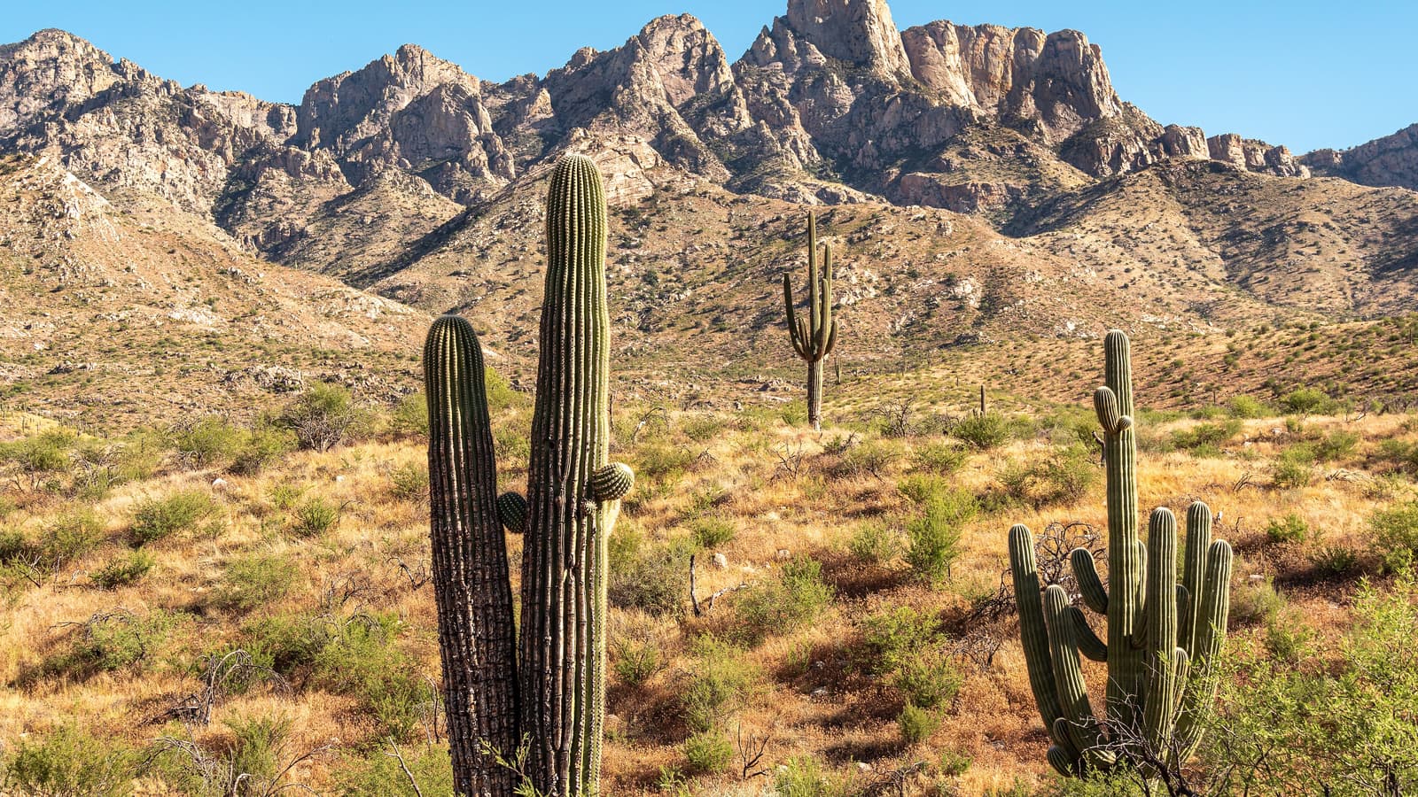
Catalina State Park sits on the north side of the Tucson metro area, at the base of the Santa Catalina Mountains near Oro Valley, which puts it on a different flank of the range than Sabino Canyon and gives it a distinct set of trails and terrain. Where Sabino Canyon centers on a shaded riparian canyon with a shuttle, Catalina State Park is a broader desert-foothills landscape with a more traditional state-park layout, including a visitor area, campground, and trailhead network.
It is a state park rather than a national forest or national park unit, which means it is managed by Arizona State Parks and follows their fee structure, hours, and rules rather than federal ones -- worth knowing since the specifics can differ from the nearby Coronado National Forest land it borders.
Romero Canyon Trail and the Pools
The Romero Canyon Trail is the park's best-known route, climbing from the desert floor up into the canyon toward Romero Pools, a series of natural rock basins that many hikers treat as a turnaround point rather than continuing the trail's full length into the higher Santa Catalina backcountry. Arizona State Parks rates the trail overall as difficult, with roughly 3,300 feet of elevation gain over its 7.2 miles, and is specific about the Romero Pools hike: from the Main Trailhead you cross Sutherland Wash and walk an easy mile to the Montrose Pools overlook, after which the next 1.8 miles to Romero Pools are difficult -- a steep, rocky, uneven climb through the Pusch Ridge Wilderness gaining about 1,000 feet. Budget at least 5.6 miles and four hours round trip. This is not a moderate nature walk, and it should not be started late on a warm day.
Whether the pools actually hold water depends heavily on recent rain and snowmelt, and levels can swing a great deal by season and by year -- generally fuller after winter storms or the summer monsoon, and prone to running low during extended dry stretches. Do not plan a trip specifically around swimming without checking recent conditions first.
The Canyon Loop and Birding Trail
The Canyon Loop Trail is a 2.3-mile loop that gives a good introduction to the park's desert-foothills scenery without the sustained climb of Romero Canyon, making it a reasonable choice for visitors short on time. Arizona State Parks rates it moderate and notes it includes sections with stairs and steep hills, so "shorter" is not the same as "flat." It is technically formed from parts of the Romero Canyon Trail, the Sutherland Trail and a connector, and it is a popular morning outing that still delivers real mountain views.
The Birding Trail is a 1.0-mile loop from the Main Trailhead running along the edges of the park's riparian areas, where desert birdlife concentrates, particularly near water. Arizona State Parks also rates this one moderate rather than easy, so treat it as a gentle walk rather than a guaranteed stroller route. It suits visitors who want a short outing, families, or anyone there to look and listen for birds rather than log trail miles. If you want the park's genuinely easy options, the Bridle Trail (1.4 miles), the Nature Trail (1.0 mile) and the Romero Ruins Interpretive Trail (0.8 miles) are the three Arizona State Parks rates easy.
One rule applies to all the trails heading up into the Pusch Ridge Wilderness, and it surprises visitors with dogs: dogs and bicycles are not allowed beyond the Forest Service gate roughly one mile from the trailhead, inside the Bighorn Sheep Management Area. From January 1 through April 30, traveling more than 400 feet off a designated Forest Service trail is also prohibited, for bighorn lambing season.
Camping at Catalina State Park
The park operates a developed campground -- Arizona State Parks lists 120 campsites with electric and water hookups, suitable for tents and RVs -- and its direct trailhead access makes it a popular base for multi-day hikers and equestrian visitors who want more than a single day in the Santa Catalina foothills. Facilities and site types are set by Arizona State Parks and can change, so check current offerings before booking; individual buildings also close for renovation from time to time.
Reservations, especially for the cooler months when demand is highest, are generally worth making well ahead of your trip rather than assuming a same-day site will be available. The Arizona State Parks reservation system is the authoritative source for current availability and fees.
Fees, Hours, and Practical Planning
Catalina State Park charges a day-use entrance fee typical of Arizona State Parks facilities, and the fee should not be treated as fixed here -- Arizona State Parks sets and periodically adjusts it, so verify the current amount on their official site shortly before your visit. Hours are more generous than the sunset-closing pattern common at other parks: Arizona State Parks lists day use as 5:00 a.m. to 10:00 p.m. daily, with the visitor center and park store open 8:00 a.m. to 5:00 p.m. That early opening is what makes a genuine pre-dawn summer start possible here.
A rental car is the practical way to reach the park from central Tucson, and there is a paved parking area near the main trailheads. The park covers about 5,500 acres at an elevation near 3,000 feet. Bring more water than you think you need, since shade is limited on most of the desert-facing trail sections.
Flooding, Fire Scar, and Heat: The Real Hazards
This is the part of a Catalina State Park visit most guides leave out, and it comes from the park itself. Arizona State Parks warns that areas of the park look different since the Bighorn Fire, and that the burned areas "host hazards such as fallen rocks, trees, debris, and potential flash flooding." The Bighorn Fire was a lightning-caused fire that started June 5, 2020 and burned through the Santa Catalinas including the Pusch Ridge Wilderness, affecting more than two-thirds of the area's trail system. Burned slopes shed water rather than absorbing it, so the drainages below them run harder and faster than they used to.
The consequence is specific and worth planning around: Arizona State Parks states that "roads near campsites may face flash flooding, which could prohibit campers from leaving the park until flooding subsides," and instructs visitors "do not attempt to drive through flooded roads." If you are camping here during the monsoon, build in the possibility that you cannot leave on your intended morning. The National Weather Service defines the Arizona monsoon as June 15 through September 30, and NWS Tucson's driving guidance is unambiguous -- "never ever drive into a flooded roadway," never drive around barricades, and it takes only about one to two feet of water to float most vehicles, including SUVs. Turn around, don't drown.
On the trails, the water crossings are the same story on a smaller scale. Arizona State Parks notes that winter rains from December to March and the summer monsoon from June to September "may create seasonal water crossings on the trail" -- and the Romero Canyon Trail begins by crossing Sutherland Wash. Do not cross a flooded wash or stream; wait for the flow to drop. Lightning is the paired monsoon risk on these exposed foothill slopes: NWS notes lightning may strike up to 10 miles from the parent storm, so thunder means you are within range. There is no safe place outdoors -- NWS dropped the old "lightning crouch" recommendation in 2008 because it "doesn't provide a significant level of protection" -- so the answer is a substantial building or hard-topped vehicle, and 30 minutes after the last thunder before you go back out. Plan a summer climb to be off the high ground by early afternoon.
Heat is the year-round baseline. NWS normal highs for Tucson are 101 degrees Fahrenheit in June, 100 in July and 99 in August, and even the shoulder months are warm -- 86 in October, 83 in April. NWS states that extreme heat is "by far the number-one, weather-related killer in Arizona." The NPS standard for desert hiking in this region is one quart of water per hour of hiking on a hot summer day, two quarts for a winter day, plus electrolyte replacement such as sports drinks or salty snacks, and avoiding the 10 AM to 4 PM window entirely in summer. The park's 5:00 a.m. opening exists precisely so you can beat that. On wildlife: never place hands or feet where you cannot see, since rattlesnakes shelter in shaded gaps in rock; if Africanized honey bees attack, run and keep running, as they typically break off a quarter to a half mile from the hive; and if you encounter a mountain lion, do not run -- stand and face it, make eye contact, and make yourself look as large as possible. Bighorn sheep also range above the park, which is the reason for the dog and off-trail restrictions. Emergencies: 911.
Best Time of Year to Visit
Cooler months generally offer the most comfortable conditions for the longer climbs like Romero Canyon, and they also tend to be when the pools are more likely to hold water following winter precipitation. Spring can bring wildflowers to the lower desert sections, adding another reason to time a visit outside the hottest stretch of summer.
If a summer visit is unavoidable, an early start is the single biggest factor in making the trails tolerable -- and the park's 5:00 a.m. opening means you can genuinely be on trail before dawn. The shorter Canyon Loop or Birding Trail are far more forgiving than a full Romero Canyon push in the heat, and the NPS guidance for this region is to stay off exposed desert trails entirely between 10 AM and 4 PM in summer.