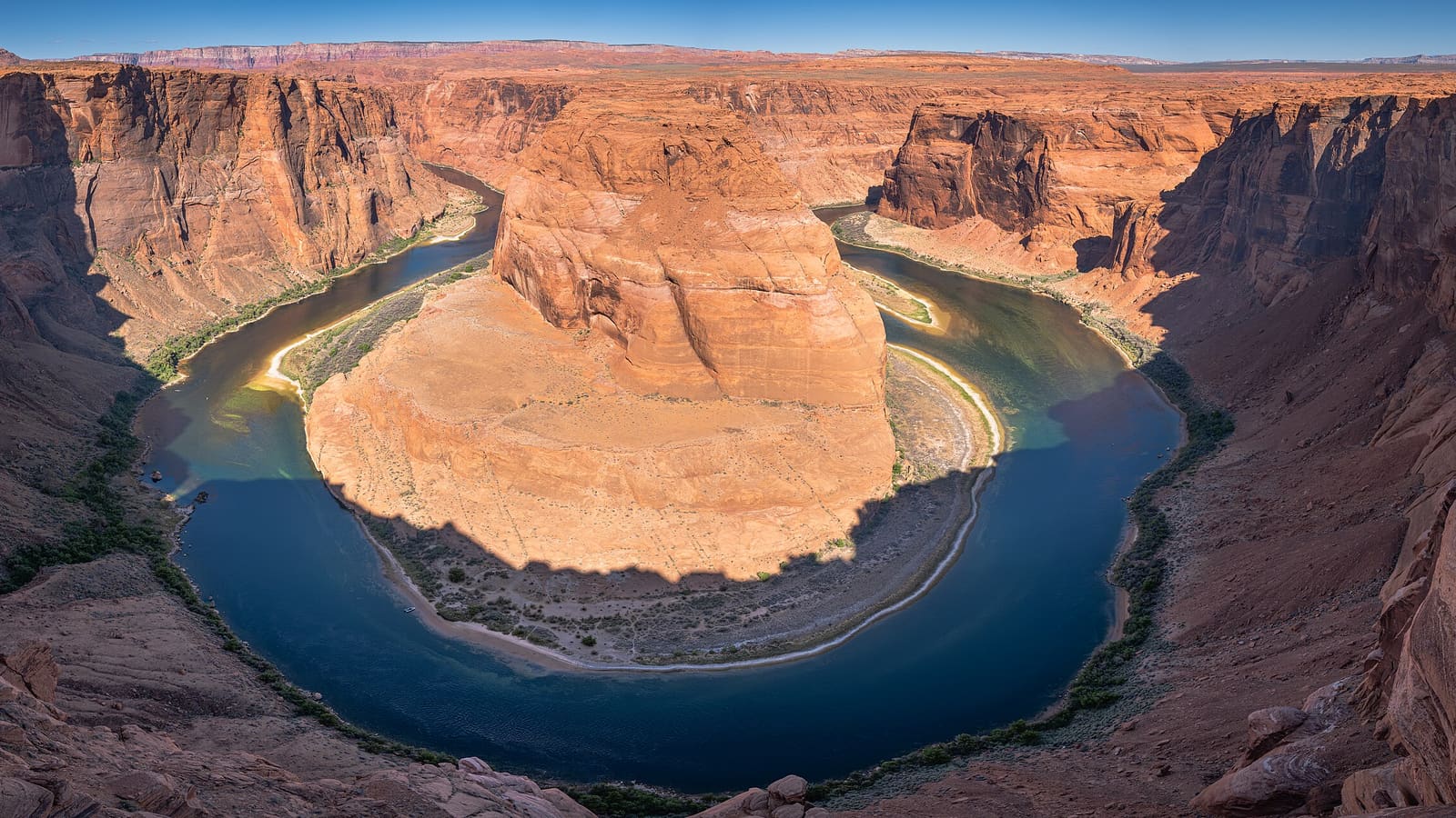
Two Ways to See Horseshoe Bend That Aren't the Overlook
Horseshoe Bend is best known from a single vantage point: the rim overlook off US-89 near Page, reached by a short trail from a paid parking lot. That's the land-based view almost every photo of the bend shows. It isn't the only way to see it, though -- the same sweep of the Colorado River can also be reached from below, on the water, or from above, in the air, and both approaches show the canyon from angles the overlook can't.
If you specifically want the classic overlook hike -- the 1.5-mile trail, the parking logistics, the standard rim photo -- Page's full guide to Horseshoe Bend covers that in detail. This page covers the other two ways to see it: kayak and raft trips that pass beneath the bend, and scenic flights that pass over it.
One geography note worth getting right before you book anything: Horseshoe Bend sits on the Colorado River downstream of Glen Canyon Dam, not on the Lake Powell reservoir itself. The dam separates the two -- Lake Powell is the reservoir upstream of the dam, and the river below it, including the stretch at the bend, is a different body of moving water entirely. A houseboat based on Lake Powell can't motor down to Horseshoe Bend; getting there by water means a river trip that launches near the dam, not a lake cruise.
Kayak and Raft Trips Below the Dam
The stretch of the Colorado River between Glen Canyon Dam and Lees Ferry, roughly 15 miles of flatwater, is a popular half-day or full-day paddling and rafting route, and it passes directly beneath Horseshoe Bend partway through. Several outfitters based in Page run guided kayak and raft trips on this stretch. Self-guided paddling generally isn't permitted here, since access below the dam is controlled, so a booked trip with a licensed operator is the standard way to do it rather than showing up with your own kayak.
Trips typically launch near the base of the dam and float downstream with the current, which is gentle here since this is flatwater rather than the whitewater found further down the canyon. Under the bend itself, the sandstone walls rise on both sides and the famous horseshoe curve of the river is visible from underneath rather than from above -- a genuinely different perspective than the overlook photo everyone has seen.
One detail worth knowing before you book: the water released from the bottom of Glen Canyon Dam runs cold year-round, generally somewhere in the mid-40s to low-50s Fahrenheit regardless of the air temperature above, because it's drawn from deep in the reservoir rather than off the surface. Outfitters plan around this, but it's a good reason to follow the gear guidance below rather than assuming a hot Arizona day above the water tells you anything about the water itself.
Scenic Flights Over the Bend
For a view from directly above rather than from the water, scenic flights departing from Page's small municipal airfield fly over both Lake Powell and Horseshoe Bend, typically as part of a longer route that also covers Rainbow Bridge, Antelope Canyon's slot formations from the air, and stretches of the reservoir's side canyons. Horseshoe Bend's tight, near-360-degree meander is one of the more recognizable shapes from the air, and it reads very differently as a full aerial loop than as a single rim photo.
Flight length and route vary by operator, and availability depends heavily on weather and wind -- small aircraft and helicopter tours out of Page are more weather-sensitive than a ground-based trip, so build some flexibility into your schedule if a flight is the priority rather than a backup activity. Morning and late-afternoon flights generally get requested first for the light, so book ahead if you want a specific time of day.
We don't have verified, current pricing or specific operator names to publish here -- rates, routes, and availability change from season to season, so check current Page-area scenic flight operators directly before you plan around one.
Best Light for Water and Air Photography
Light behaves differently from the water than from the rim. From a kayak or raft at river level, the canyon walls tower overhead, and direct overhead midday sun tends to flatten them much the way it flattens the view from above -- mornings and late afternoons bring more raking light and shadow definition on the sandstone. Because guided river trips run on the outfitter's schedule rather than yours, you may not get to pick your exact time slot, but morning departures generally avoid both the heat and the flattest light.
From the air, timing matters just as much, since the classic aerial shot of the bend's full curve depends on shadow and contrast to show its shape clearly. Early morning and late-afternoon flights tend to produce more dramatic images than a midday flight, for the same reason golden hour works well from the ground -- a low sun angle brings out texture in the rock that overhead light erases.
If you're set on a specific look, mention it when booking either a river trip or a flight. Smaller operators can sometimes accommodate a preferred time of day even if they don't advertise fixed photography-focused departures. For a broader look at framing and timing across the region, see our Lake Powell photography guide.
What to Bring on the Water or in the Air
For a river trip, the water itself is cold even in summer, so a warm layer for your top half is worth packing even on a hot day -- spray off the flatwater and wind on an open raft or kayak can chill you quickly. A dry bag for phones and cameras is close to essential; equipment drops off boats and rafts are one of the most common things guides mention. Sun protection still matters at river level despite the shade of the canyon walls in places, so a hat that won't blow off and a way to secure sunglasses are both worth having. Guided outfitters generally supply life jackets and required safety gear, but confirm what's included and what to bring yourself when you book.
For a scenic flight, dress for a cool cabin, since small aircraft and helicopters are often air-conditioned or simply cold at altitude regardless of ground temperature. Bring a camera or phone with a wide-angle option if photography is the point of the flight -- window glare can be an issue, so a polarizing filter or a lens hood held close to the glass helps on sunnier days.
If you plan to combine either trip with more time in the area, our best time to visit Lake Powell guide covers how the seasons affect water temperatures, flight conditions, and the rest of a Page-area itinerary.