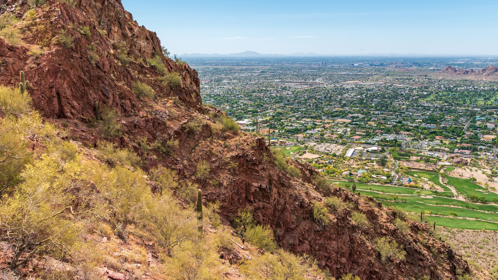
Where Camelback Mountain Sits
Camelback Mountain rises out of Phoenix's Camelback East area, roughly between the Camelback Corridor and Old Town Scottsdale, and its silhouette-a hump-and-head shape said to resemble a kneeling camel-is one of the most recognizable landmarks in the Valley. Unlike many desert peaks that sit well outside the city, Camelback is surrounded by dense residential and resort development, which is part of why it draws such heavy foot traffic: it is one of the few true summit hikes you can reach in minutes from central Phoenix hotels.
The mountain is protected as a City of Phoenix park, and both maintained routes to the top are genuine hikes with real elevation gain and exposed rock sections-this is not a casual stroll despite its short mileage. Treat it with the same respect you would give a longer wilderness trail, particularly around heat and hydration.
Echo Canyon Trail
Echo Canyon, on the mountain's western side off McDonald Drive, is the shorter and more popular of the two summit routes. It covers 1.14 miles one way with about 1,400 feet of elevation gain, packing a serious climb into a short distance. The trail includes hand-over-hand rock scrambling sections with metal handrails bolted into the rock at the steepest points, and loose, uneven footing is common throughout.
Because Echo Canyon is the more direct line up the mountain, it tends to be the busier of the two trails, especially on weekend mornings and around sunset. The scrambling sections can bottleneck when the trail is crowded, so budget extra time if you're visiting during a peak weekend. This route is not recommended for hikers with a fear of heights or exposure, since several sections put you close to real drop-offs with only handholds for security.
Cholla Trail
Cholla Trail climbs the mountain's eastern side, starting from a trailhead off Invergordon Road, and runs a bit longer than Echo Canyon-1.5 miles one way-with comparable overall elevation gain (about 1,420 feet) spread over a slightly longer approach. Many hikers find Cholla marginally less technical than Echo Canyon's steepest scramble sections, though it still involves genuine rock scrambling near the summit and should not be treated as an easier alternative in any meaningful sense.
Cholla's trailhead has historically had more limited and more contentious parking than Echo Canyon, with neighborhood streets nearby subject to posted restrictions, so check current City of Phoenix parks signage and any active trailhead-access rules before you go. Some hikers prefer Cholla specifically to avoid Echo Canyon's crowding, accepting the trade-off of a trickier parking search.
Difficulty and What to Expect
Both routes are rated Extremely Difficult by the City of Phoenix, and that rating holds up in practice: expect a sustained, aerobic climb with genuine scrambling, not a graded switchback trail. Trekking poles are not particularly useful here since you'll need both hands free for rock sections; sturdy hiking shoes with real grip matter more than anything else in your kit.
Round-trip time varies widely by fitness level, but most hikers should plan on a couple of hours minimum for either route, and considerably longer if you're taking photo breaks at the summit or moving cautiously through the scramble sections. Neither trail is appropriate for young children, hikers with mobility limitations, or anyone uncomfortable with real exposure to heights.
Parking: Plan Around It, Not Just the Hike
Parking is arguably the single biggest practical obstacle to hiking Camelback Mountain, particularly at Echo Canyon. The main trailhead lot fills early-often by late morning on weekdays, and can stay full all day on weekends during cooler months when hiking demand peaks-and once it's full, the City closes the entry gate to new arrivals rather than allowing unlimited roadside overflow parking. Arriving at first light is the most reliable way to guarantee a spot, and it also happens to be the safest time to climb.
Check the City of Phoenix parks website or current trailhead signage for up-to-date rules, since access policies, gate hours, and any reservation systems have changed over time and are worth confirming close to your visit date rather than relying on older trip reports.
Heat, Timing, and Safety
Phoenix heat turns Camelback from a strenuous hike into a genuine hazard for a large part of the year. There is minimal shade on either route, and the exposed rock surfaces radiate heat back at hikers on top of ambient air temperature. On days when the National Weather Service issues an Extreme Heat Warning, the City of Phoenix closes both Echo Canyon and Cholla Trails from 8 a.m. to 5 p.m. under its Trail Heat Safety Program-check current advisories before planning a summer visit, and strongly consider our Phoenix summer survival guide if you're visiting outside the cooler months.
Carry more water than you think you'll need-experienced local hikers often recommend at least double what a similar-distance hike elsewhere would require, given the heat and exertion. Start early, tell someone your plan, wear sun protection, and turn back if you're struggling; rescue calls on Camelback are common enough that Phoenix fire crews specifically train for this terrain.
Easier Alternatives: Bobby's Rock and Non-Summit Options
If a full summit climb isn't the goal, Bobby's Rock Trail-a short, Easy-rated loop accessed from the Echo Canyon Trailhead, about 0.2 miles with roughly 200 feet of elevation gain-circles a distinctive rock formation without the exposure and scrambling of the two main summit trails. It's a reasonable option for hikers who want mountain views and a real workout without committing to Echo Canyon or Cholla's harder sections.
You can also simply walk a short distance up either main trail and turn back once the terrain gets technical-there's no requirement to summit, and the lower sections of both routes still offer solid views back over the Valley. For a broader range of easier Valley hikes, our guide to Phoenix's best hikes covers options across a wider range of difficulty, and pairing a Camelback attempt with a visit to the Desert Botanical Garden makes for a full desert-focused day without demanding two strenuous hikes back to back.