What Glen Canyon National Recreation Area Actually Is
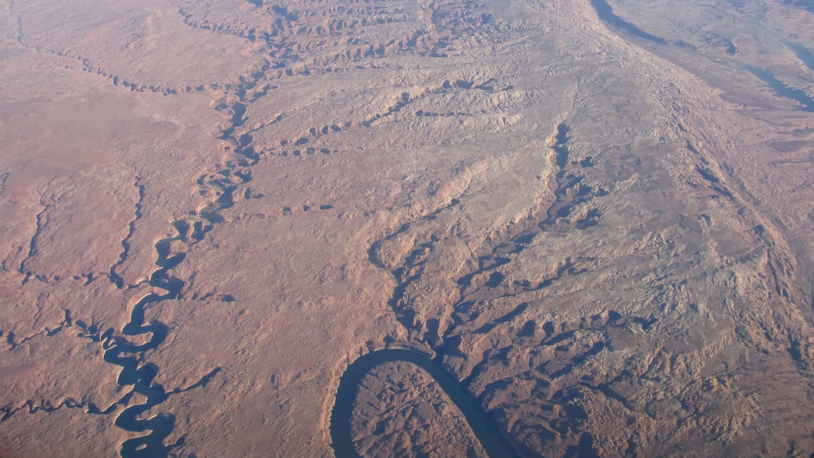
Glen Canyon National Recreation Area (GCNRA) is a unit of the National Park System managed by the National Park Service. Congress established it on October 27, 1972 to provide for public recreation on Lake Powell and the lands adjacent to it in Arizona and Utah, and it covers a much larger footprint than the water alone -- surrounding canyon country, backcountry roads, boat-in side canyons, and developed access points scattered across a long stretch of the Colorado River corridor.
Lake Powell is the reservoir inside the recreation area, not the name of the area itself. In everyday conversation the two names get used interchangeably, and for a first-time visitor that is usually fine -- but understanding the distinction matters once you start looking at maps, fee structures, and which agency manages what. The dam, the lake, Rainbow Bridge National Monument, and most of the developed marinas all sit inside GCNRA's boundary.
If your trip planning so far has centered on "the lake," treat this page as the zoomed-out map. Our guide to getting to Lake Powell and our Glen Canyon Dam visitor guide both drill into specific pieces of the area covered here at a higher level.
Scale and Geography: Two States, One Long Reservoir
GCNRA is genuinely large. The National Park Service puts it at 1.25 million acres across Arizona and Utah, of which Lake Powell itself is only about 13 percent. Shoreline and reservoir-mile figures are quoted at full pool (elevation 3,700 feet) and shift substantially with water levels, so treat any shoreline-mileage number you see as a full-pool maximum rather than what you will find on the day. The recreation area spans two states: the southern end, including the Wahweap and Page area, sits in Arizona, while Lake Powell extends north into Utah, where a separate cluster of access points and marinas exists.
That two-state span has practical consequences for planning. Arizona stays on Mountain Standard Time year-round while Utah observes daylight saving time, so depending on the season your Arizona and Utah stops within the same recreation area can be on different clocks. There is a third clock to watch: the NPS notes that the Navajo Nation within Arizona does switch to daylight saving time, which is exactly the trap that makes people late for an Antelope Canyon tour booked on tribal land. Driving between the southern and northern portions of the area is also a long trip on the ground, even though both ends belong to the same NRA -- the lake's shape and the region's canyon terrain mean there is no quick shortcut between them.
For most first-time visitors, one district is the practical center of the trip rather than the whole area at once. Deciding which end you are actually visiting -- and confirming which state and time zone that puts you in -- is one of the first planning steps worth nailing down.
The Main Access Districts
Wahweap, near Page, Arizona, is the largest and most developed district and the one most first-time visitors default to. It sits closest to Page's airport, lodging, and restaurants, and it hosts the area's biggest marina complex -- our marinas comparison breaks down how it stacks up against the other options.
Bullfrog and Halls Crossing sit up-lake in Utah, roughly facing each other across the water. They are linked by the Charles Hall Ferry, which carries State Route 276 across the lake in about a 25-minute crossing on a first-come, first-served basis with no reservations -- but do not build a route around it without checking first. The ferry cannot operate when the lake drops below 3,565 feet in elevation, and it has been out of service for long stretches in recent years for exactly that reason; UDOT posts the current status on its Lake Powell Ferry Crossing page. If it is not running, reaching the other side means a long drive around the lake instead. This district serves the northern half of the reservoir and is a meaningfully different logistical proposition than Wahweap -- fewer services nearby, longer drives from major airports, and a more remote feel that some houseboaters specifically seek out.
If you are towing a boat, treat launch access as the single thing most worth verifying before you drive. Lake Powell's elevation determines which ramps are usable, and at low levels individual ramps are restricted to smaller vessels, limited to paddlecraft, or closed outright -- at the extreme, the lake does not reach the Hite ramp at all. Which ramps are open changes through the season and from year to year, so check the NPS "Changing Lake Levels" page for the current ramp-by-ramp status rather than assuming the nearest marina to your campsite can put your boat in the water.
Lees Ferry sits downstream of Glen Canyon Dam, below the reservoir rather than on it. It is the launch point for Colorado River trips through the Grand Canyon and is also a distinct fishing access point on the river itself -- a different kind of visit than a lake trip, even though it falls within the same recreation area.
Entrance Fees and Passes
Glen Canyon National Recreation Area is managed by the National Park Service, and an entrance fee generally applies at its fee stations, with the America the Beautiful interagency annual pass accepted as an alternative to paying per visit. Because fee amounts, what they cover -- vehicle entry, boat launches, backcountry permits -- and how they are structured can all change, check current NPS Glen Canyon fee information directly before your trip rather than relying on a figure you saw elsewhere. One durable detail worth planning around: the park does not accept cash, and its entrance stations are credit/debit only.
Fee structures can also differ by district and by activity -- a vehicle entry fee is a different line item than a boat launch fee or a backcountry permit, and not every service inside the recreation area is necessarily covered by the same pass. If you are planning a multi-day visit that touches several of these (driving in, launching a boat, camping), verify what each piece actually requires ahead of time.
Note that fee and access rules inside GCNRA are separate from those at nearby attractions managed by other agencies or the City of Page -- the NPS states outright that America the Beautiful and Glen Canyon passes are not accepted for parking at Horseshoe Bend, because that lot is City of Page property. A tour booking at Antelope Canyon is likewise outside the federal fee system (more on that distinction below).
What's Inside, and What's Just Outside
Inside the recreation area's boundary: the reservoir itself, Glen Canyon Dam, and Rainbow Bridge National Monument, a separately designated national monument administered within GCNRA that ranks among the largest known natural bridges in the world. Reaching Rainbow Bridge means a boat trip or an approximately 14-mile hike around Navajo Mountain that requires a Navajo Nation permit. This is the piece of a Lake Powell trip most distorted by low water, so check the NPS Rainbow Bridge page before planning around it: concession-operated boat tours may run only on a limited schedule, the round trip by private boat runs about seven hours, there is currently no mid-lake marina for fuel or supplies, and at current lake levels the floating dock does not reach land -- the NPS advises that beaching your boat and walking through muck to the trail is at your own risk.
A common source of confusion for first-time visitors: Horseshoe Bend, which drew 831,631 recreation visits in 2024 by NPS count, sits on land under three different jurisdictions. Per the NPS, Horseshoe Bend itself and the Colorado River there are part of Glen Canyon National Recreation Area, but the parking lot is on City of Page land and the trail and overlook are on Navajo Nation land -- and the City of Page collects the parking fee (America the Beautiful passes do not apply to parking). It is close by and often visited on the same trip -- see our Horseshoe Bend guide for what that means in practice.
Antelope Canyon is a similar case -- it is operated by the Navajo Nation Parks and Recreation Department on Navajo Nation land, under its own tour and permit system entirely separate from GCNRA. Because it is not part of the National Park System, the NPS confirms that neither the America the Beautiful pass nor the Glen Canyon pass is accepted for admittance there. Treat "things near Lake Powell" as a mix of NPS land, city-managed sites, and tribal land, each with its own rules, rather than one single administrative area.
Connectivity, Fuel, and Planning a First Visit
Cell service is inconsistent across the recreation area, particularly once you are out on the water or away from Page and the main marina developments. Download maps, tour confirmations, and any reservation details before you leave reliable coverage, and do not assume you will be able to look something up once you are on the lake.
Fuel and services are concentrated at the developed districts -- Wahweap/Page and Bullfrog/Halls Crossing -- with long stretches of the surrounding landscape offering little in between. Fill up before heading into the more remote portions of the area, and confirm marina fuel dock hours and availability directly with the marina, since these can vary by season.
For a first visit, the practical sequence is: pick a district based on which end of the lake fits your route, confirm current NPS fee and pass information, and separate out any nearby attractions -- Horseshoe Bend, Antelope Canyon -- that are not actually inside the recreation area and run on their own rules. Our best time to visit guide covers how the seasons affect all of the above.