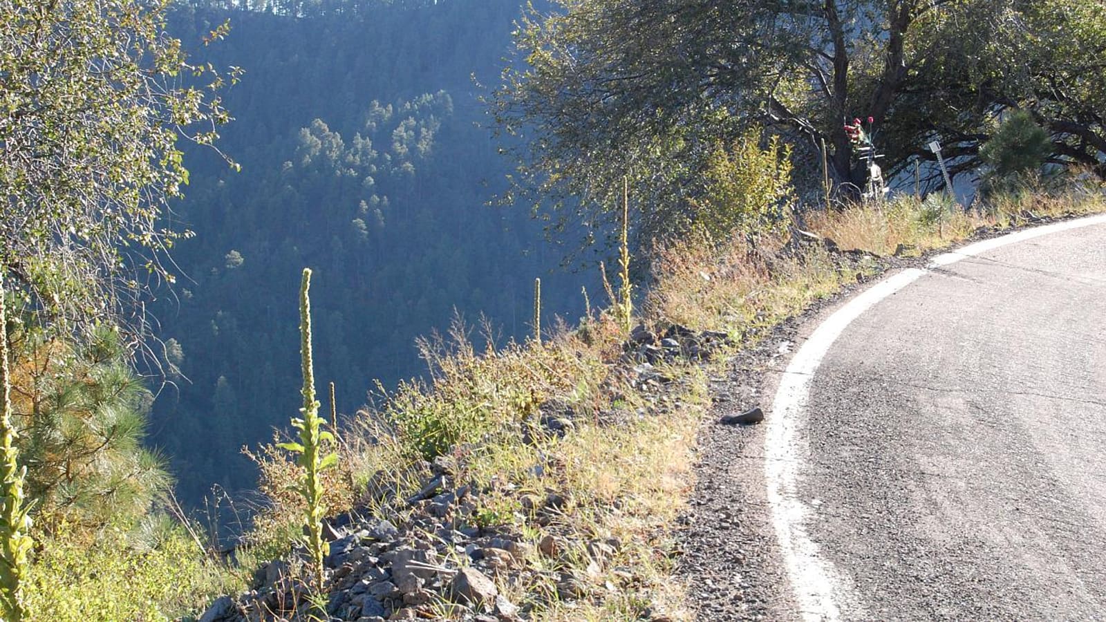
A curve on the Coronado Trail Scenic Byway in Arizona with a steep forested drop-off beside the road
Scenic Drives

Coronado Trail Scenic Byway (US-191): Driving Guide

The Coronado Trail follows US-191 south from the Alpine area through national forest and mountain curves. It is a drive that rewards patience and a full tank.

Last updated: 2026-10-06

Quick Verdict

The Coronado Trail Scenic Byway follows US-191 through the Apache-Sitgreaves National Forest, running from the White Mountains toward the copper-mining country around Clifton and Morenci. It is known for many tight curves and steep drop-offs, so it takes longer than the map suggests and is a poor fit for anyone in a hurry or for nervous passengers. Services are sparse, cell coverage can be spotty, and winter weather can affect the high sections. Check current conditions before you go, and read our general scenic drives guide for how this route compares with the rest.

What the Coronado Trail Is

The Coronado Trail Scenic Byway is the name given to a stretch of US-191 in eastern Arizona. It is named for Francisco Vasquez de Coronado, the Spanish explorer whose expedition passed through the region in 1540, though the paved highway is a modern route and not a replica of his path. Historians have long debated exactly where the expedition traveled, so treat the name as a nod to history rather than a literal map.

The byway runs through the Apache-Sitgreaves National Forest. Toward the north it connects with the Alpine area, Springerville, and the broader White Mountains; at the southern end it descends toward the mining towns of Clifton and Morenci.

What Makes It Different

Most White Mountains drives wander through gentle pine forest. This one is a mountain road in the full sense: a lot of curves, steep drop-offs in places, and long stretches without a gas station or shop. Many visitors find the road beautiful and slow in equal measure.

  • Go at the road's pace, not the speed limit's. Pull over where it is safe to let faster traffic by.
  • Check ahead about vehicle restrictions. Long vehicles and trailers can struggle on the tight curves, and some drivers avoid the byway for that reason.
  • Start with a full tank and plenty of water, and check what is open before you rely on any single stop.
  • Download directions in advance. Cell service is unreliable in the forest sections.

Meadows, Wildlife, and Seasons

Along the higher sections the road passes meadows and mixed forest, and the byway is often mentioned in connection with autumn color and wildlife. Elk, deer, and other animals are common in the region, which is another reason to drive carefully at dawn and dusk. Our wildlife viewing guide covers what lives in this part of the state, and the fall colors guide explains when and where color tends to peak.

Winter can bring snow and ice to the higher sections. Check current road conditions with the Arizona Department of Transportation and the national forest before you set out, and do not assume a road that was clear in the valley is clear at elevation.

Where It Fits in a Trip

The Coronado Trail is a full-day outing at the least, and many visitors treat it as the day they set aside for driving instead of hiking. Springerville and Eagar is a convenient northern base, and the 3-day itinerary shows how to work a long drive into a trip without wearing yourself out. Return the way you came or plan a loop with a driver you trust, and verify current road conditions for whichever route you pick.

Frequently Asked Questions

What is the Coronado Trail Scenic Byway? +
It is the scenic stretch of US-191 in eastern Arizona that runs through the Apache-Sitgreaves National Forest between the Alpine area and the Clifton and Morenci mining towns. It is named for the Coronado expedition of 1540.
Is the Coronado Trail a hard drive? +
It is a paved highway, but it is winding with steep drop-offs. Allow extra time, avoid rushing, and consider whether long vehicles or trailers are a good idea.
Are there services along the Coronado Trail? +
Services are limited between the towns, so start with a full tank and supplies, and check ahead about what is open. Cell coverage can be unreliable in the forest.
Is the Coronado Trail open in winter? +
Snow and ice can affect the higher sections. Check current Arizona Department of Transportation and national forest conditions before you leave.
When is the best time to drive it? +
Many visitors favor late spring through autumn, with fall color as a highlight. Conditions vary by year, so check current reports before choosing a date.

Planning Your Trip

Basing yourself in Pinetop-Lakeside or Show Low puts most of the White Mountains within an easy drive. Compare cabin and lodge deals or browse tours built around the high country through our partners below.

Check Cabin & Lodge Deals Browse White Mountains Tours

Keep Reading

White Mountains Scenic Drives →

The full set of high-country drives, side by side.

Alpine, Arizona Guide →

The mountain village at the northern end of the byway.

White Mountains Fall Colors →

Where and when autumn color tends to show up.

The Lowdown Guide earns a commission on qualifying bookings at no additional cost to you. Details such as prices, hours, distances, and access rules change — always verify with official sources before you go.